2.7 km away
Mount Sherman - Iowa Gulch
For a short-and-sweet 14er summit hike with only 2,150' of elevation gain, the West Slopes of 14,036' Mt. Sherman is a wonderful choice.
Difficult Hiking
- Distance
- 7 km
- Ascent
- 672 m
- Descent
- 672 m
While not "easy," Sherman is renowned as one of Colorado's easiest and most accessible 14ers.
Hiking Severe
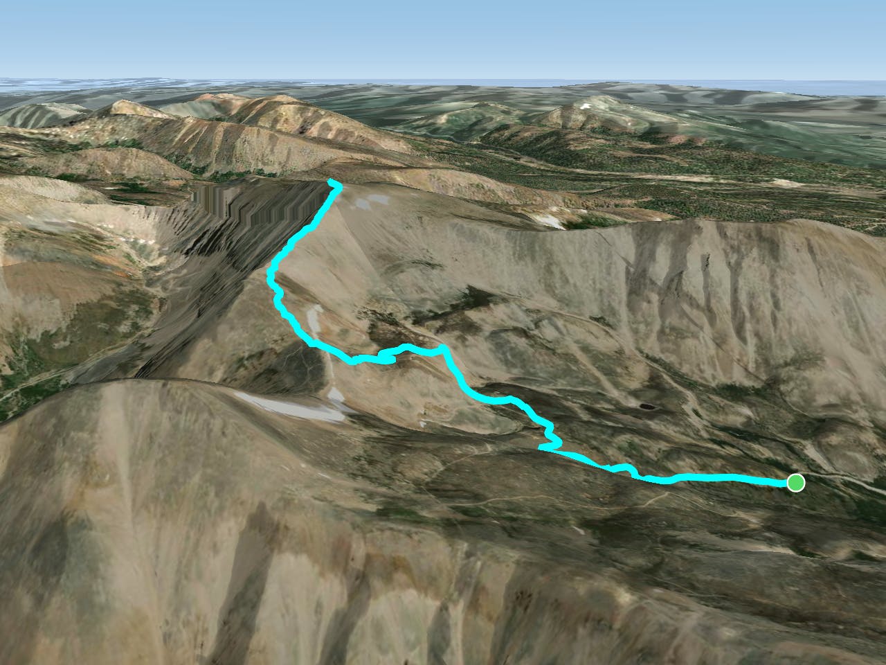
While there’s no such thing as an “easy” 14er, some 14ers are quantifiably easier than others. Mount Sherman is renowned as one of the best 14ers to climb for your first attempt at hiking above 14,000 feet. The standard route ascending the Southwest Ridge from the Fourmile Creek trailhead, mapped here, only gains 2,000 feet of elevation during a 5-mile roundtrip ascent. Compared to other mountains in Colorado that require 15 or more miles of hiking and over 5,000 feet of elevation gain, Sherman is, in some senses, child’s play. If you’re anything like me, this point is only driven home by the literal children passing you as you make your ascent up the mountain.
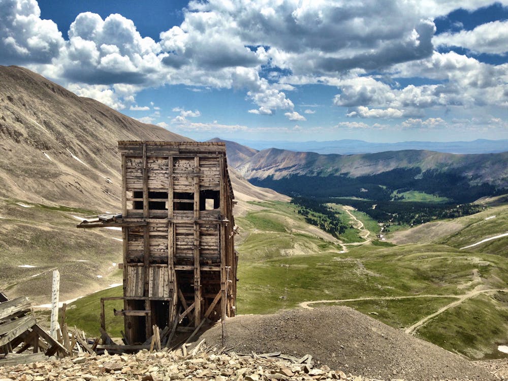
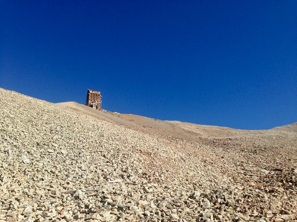

The climb begins at treeline, winding its way past historic mining relics. High up on the ridge, near 13,000 feet, you’ll reach a remarkably intact mine structure that rises several stories tall. Take a moment to appreciate the amount of effort that went into mining precious metals 13,000 feet above sea level, literally on top of a mountain!
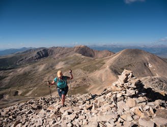
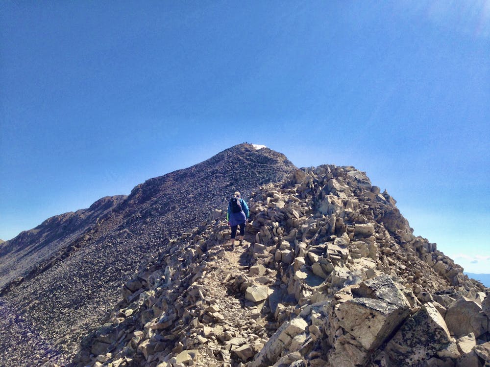
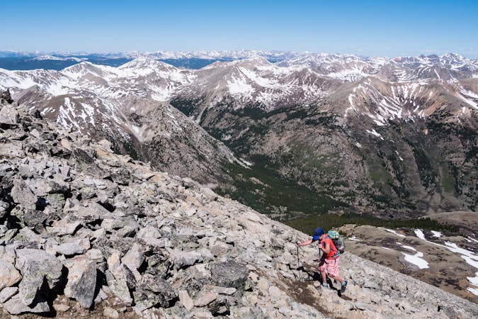
Once you gain the ridge, the climb gets progressively more strenuous and a bit more technical. The rest of the ascent follows the ridge to the summit, climbing along a scree-filled edge. While the ridge is never too narrow and the trail is never too technical, you may need to use a hand to stabilize yourself as you ascend through the loose scree.
After a few typical false summits, you’ll reach the “summit” of Sherman. Unfortunately, the “summit” is a bit disappointing—it resembles a 14,000-foot sports field more closely than it does a mountain summit. The broad plateau spreads out before you, in a way that many may find anticlimactic.
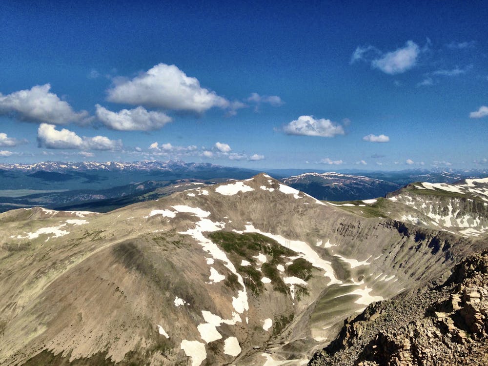
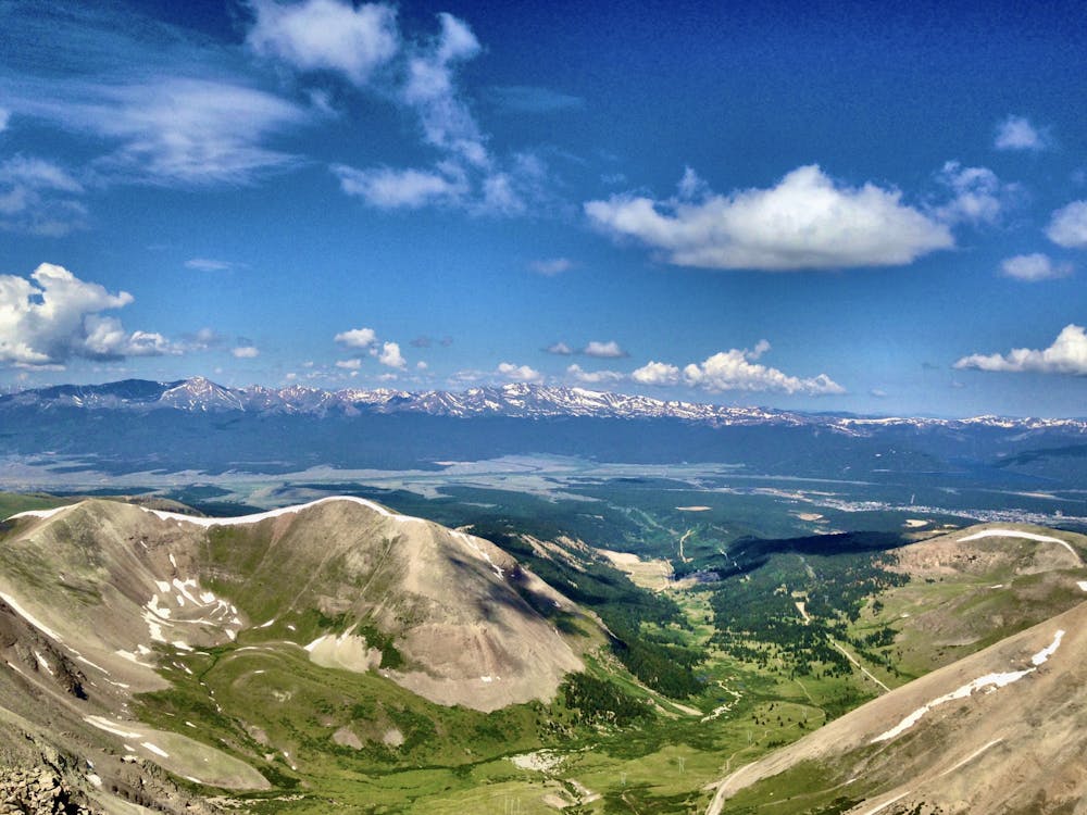
To take your mind off of the anticlimactic summit, turn around and soak in the views of the region. You’ll see the Mosquito Range running north and south from your position. Off to the west, the mighty Sawatch range creates the far horizon, home to the highest peaks in Colorado. In between, you’ll enjoy views of Leadville and the upper Arkansas Valley. Finally, to the east, the expansive South Park valley spreads out below you, a stunning expanse of flat land forming a 10,000-foot-high valley.
Once you’ve finished enjoying the view, retrace your steps back to the car.
Whatever you do, don’t let Sherman’s reputation as an easy 14er lull you into complacency. Thunderstorms filled with lightning still pose a very real threat to your continued existence, so be sure to summit early and get back to treeline by noon-ish.
Severe
Hiking challenging trails where simple scrambling, with the occasional use of the hands, is a distinct possibility. The trails are often filled with all manner of obstacles both small and large, and the hills are very steep. Obstacles and challenges are often unexpected and can be unpredictable.

The trail contains some obstacles such as outcroppings and rock which could cause injury.

Little chance of being seen or helped in case of an accident.
2.7 km away
For a short-and-sweet 14er summit hike with only 2,150' of elevation gain, the West Slopes of 14,036' Mt. Sherman is a wonderful choice.
Difficult Hiking
6.8 km away
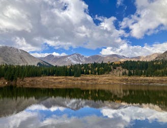
Hike to a little-visited alpine lake from a trailhead on a 4x4 road
Moderate Hiking
6 routes · Alpine Climbing · Hiking

46 routes · Alpine Climbing · Hiking