8.3 km away
Dillon Pinnacles
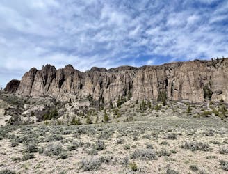
A beautiful jaunt through the sagebrush above the pristine waters of the Blue Mesa that's perfect for the entire family!
Easy Hiking
- Distance
- 6.2 km
- Ascent
- 151 m
- Descent
- 152 m
This moderate hike with beautiful views is one of the most popular in the Curecanti National Recreation Area.
Hiking Moderate

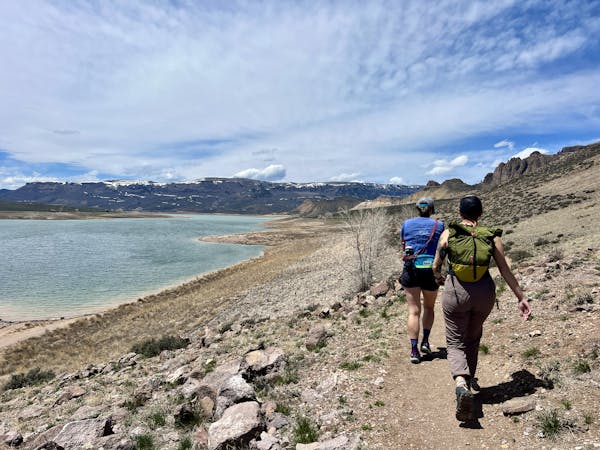
If you are looking for a hike that combines stunning views, cascading waterfalls, historic relics, and a boat ride option, look no further than the Pine Creek Trail in Curecanti National Recreation Area. This 2.4-mile out-and-back trail takes you from the rim of the upper Black Canyon to the shores of Morrow Point Reservoir, where you can explore the remnants of an old narrow gauge railroad that once ran through the canyon.
The trail starts with a steep descent of about 200 steps, which will test your knees and lungs on the way back up. But don't let that deter you from enjoying the beauty of Pine Creek as it tumbles over rocks and ledges on its way to join the Gunnison River. Along the trail, you will see interpretive signs that tell you about the geology, history, and wildlife of the area. You might even spot some bighorn sheep on the cliffs above.
Once you reach the reservoir, you can walk along the flat railroad bed and admire the towering walls of the canyon. You can also fish, picnic, or camp at designated sites along the shore. If you are feeling adventurous, you can bring a small hand-carried boat and paddle on the reservoir, or book a ranger-led boat tour that departs from the Pine Creek dock. The tour will take you deeper into the canyon and show you some hidden wonders.
The Pine Creek Trail is a moderately strenuous hike that is best done in spring or fall, when the temperatures are cooler.
Source: Curecanti National Recreation Area. https://www.nps.gov/cure/index.htm. Hiking - Curecanti National Recreation Area (U.S. National Park Service). https://www.nps.gov/cure/planyourvisit/hiking.htm. gjhikes.com: Pine Creek. https://www.gjhikes.com/2013/07/pine-creek.html.
Moderate
Hiking along trails with some uneven terrain and small hills. Small rocks and roots may be present.

The path is on completely flat land and potential injury is limited to falling over.

Away from help but easily accessed.
8.3 km away
A beautiful jaunt through the sagebrush above the pristine waters of the Blue Mesa that's perfect for the entire family!
Easy Hiking
11 routes · Hiking