3.7 km away
Mount Yale
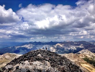
Buena Vista's backyard 14er offers a challenging climb with a rewarding summit view.
Extreme Hiking
- Distance
- 13 km
- Ascent
- 1.3 km
- Descent
- 1.3 km
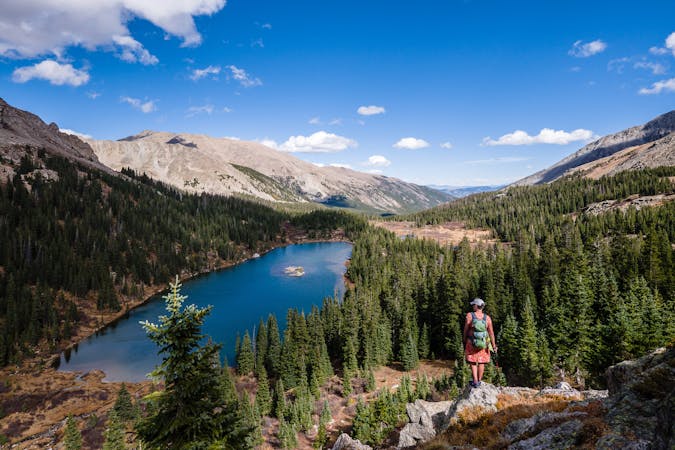
A popular 3-mile hike to a beautiful alpine lake.
Hiking Moderate

This local Buena Vista hike is popular for several good reasons: the trailhead is easily accessible via a paved road, the elevation gain is fairly mellow, and the views are spectacular.
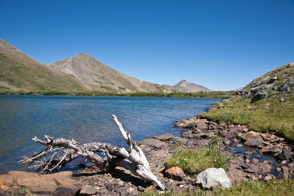
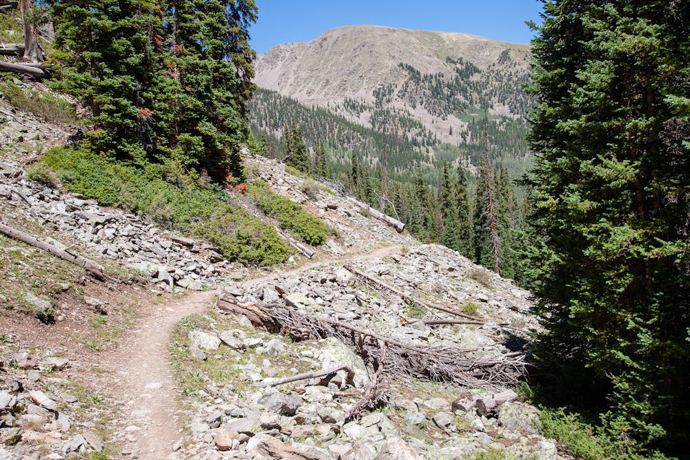
The first 2.5 miles travel across a talus field and through lovely woods, with periodic views of distant peaks opening up along the way. These early miles are relatively mellow, elevation-wise, making it a good choice for those who are new to mountain terrain. Taking time to enjoy the journey will help save energy for the final half-mile to the lake.
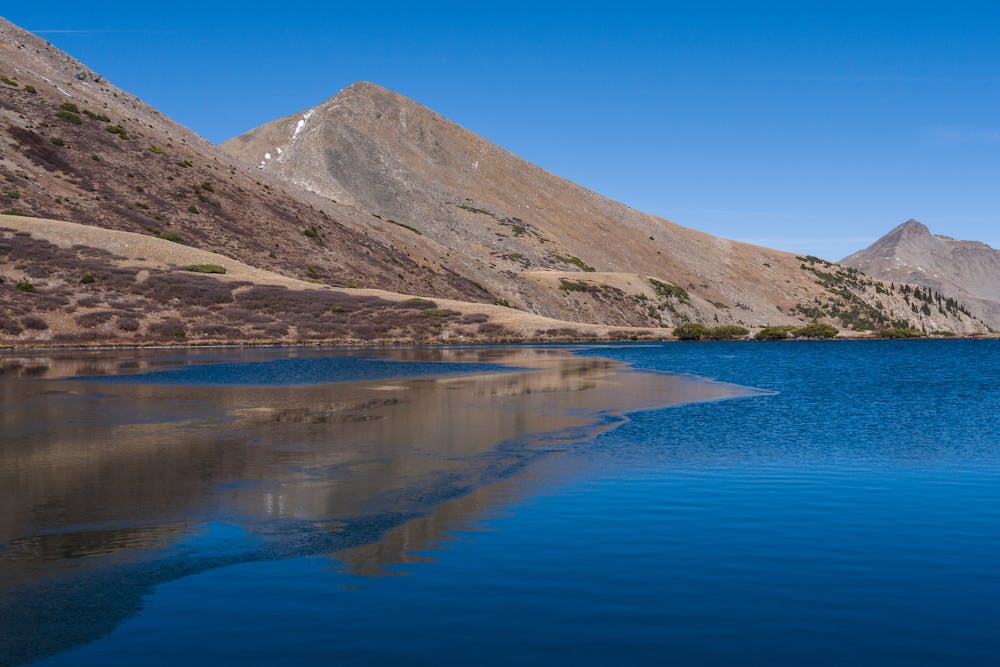
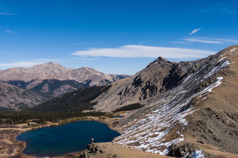
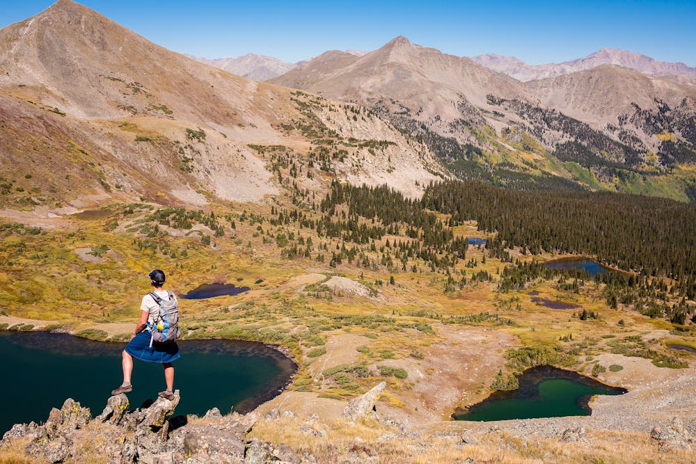
Once the terrain opens up, a small pond appears on the left. Though many hikers have stopped at this point, believing that they have arrived at their destination, keep going to find the much larger Ptarmigan Lake at about 12,100'. The trail meanders around the east side of the lake, providing numerous appealing lunch spots.
Ptarmigan Lake is also a destination for backpackers, so there may be tents located in spots around it. When selecting a campsite, remember to set up at least 100' from the water's edge.
Ptarmigan Lake has a Cutthroat Trout population, which makes it likely that there will be folks fishing. If flyfishing is your thing, pack a rod for the hike.
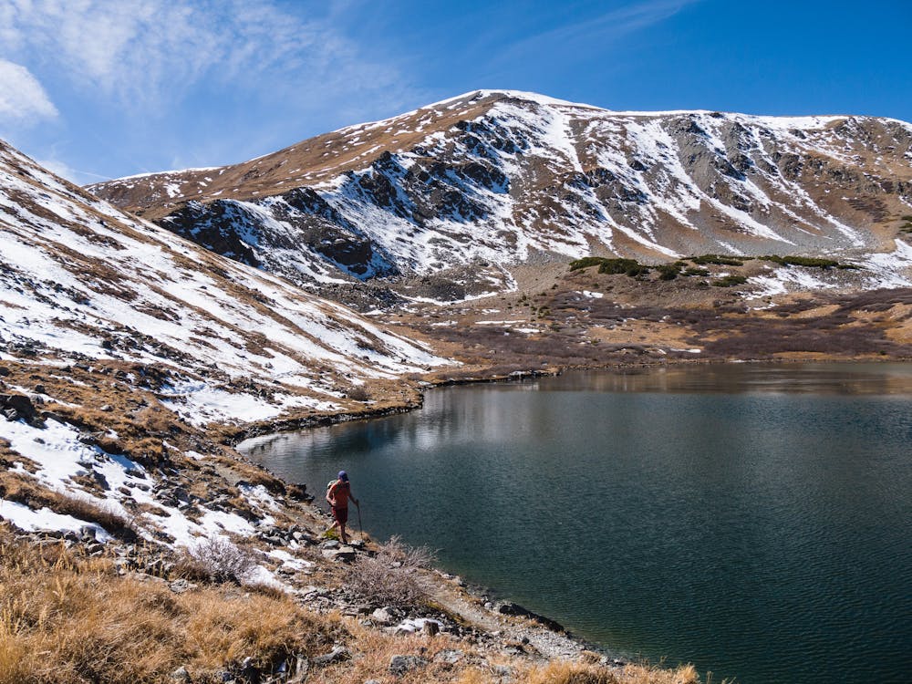
After relaxing and enjoying a good lunch, you may have enough energy to summit 13,218' Jones Mountain. Be sure to evaluate the weather before tackling the extra mile and 1,000' from the southwest end of the lake to Jones' summit. Early afternoon lightning makes the summit of a 13er a dangerous place to be!
If timing and conditions are good, the steep, untrailed mile to the summit rewards with a huge gain in views of surrounding peaks and Ptarmigan Lake down below.
Note that during the winter, the trailhead is NOT accessible except by snowmobile, fat bike, skis, or snowshoes. Cottonwood Pass closes at the Denny Creek trailhead and is groomed for winter recreational travel above that point.
Moderate
Hiking along trails with some uneven terrain and small hills. Small rocks and roots may be present.

The path is on completely flat land and potential injury is limited to falling over.
3.7 km away
Buena Vista's backyard 14er offers a challenging climb with a rewarding summit view.
Extreme Hiking
3.7 km away
Hike to an alpine lake deep in the Collegiate Peaks Wilderness.
Difficult Hiking

16 routes · Hiking
5 routes · Alpine Climbing · Hiking