1 m away
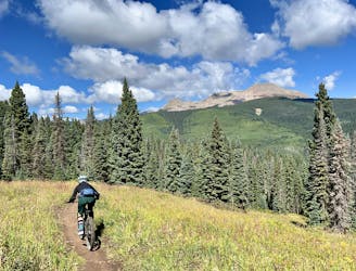
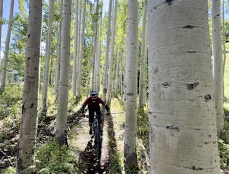
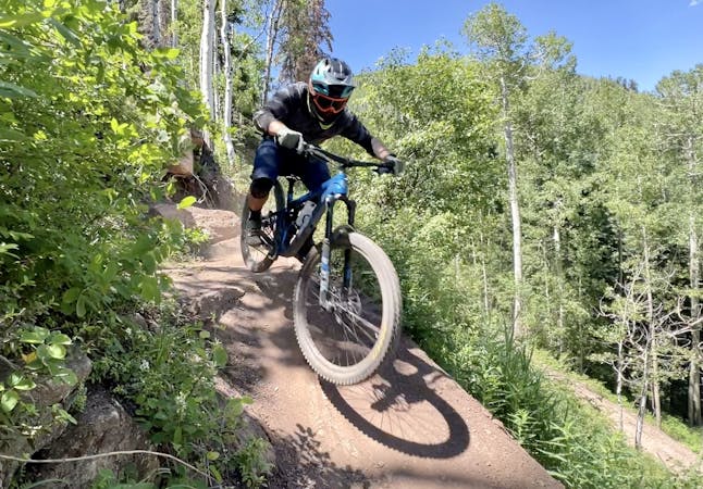
Stagecoach Loop
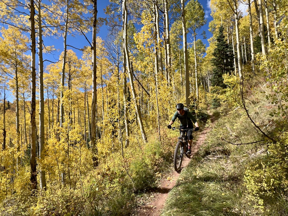
A fast, flowy track of dark black dirt through a gorgeous aspen grove.
Moderate Mountain Biking
- Distance
- 19 km
- Ascent
- 620 m
- Descent
- 620 m
A burly backcountry epic with some of the most beautiful views in the San Juans!
Mountain Biking Difficult

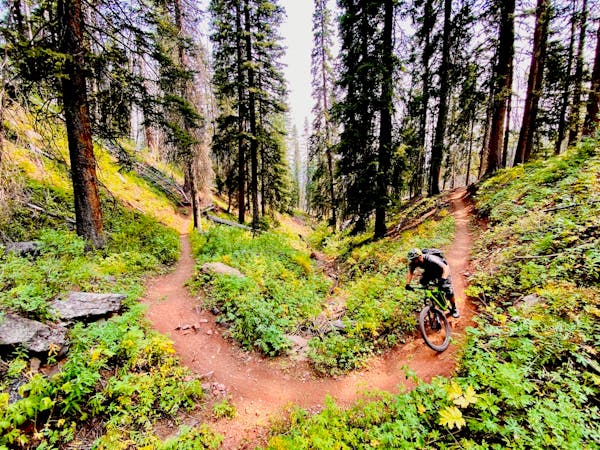
Many Durango locals think the Blackhawk Pass section of the Colorado Trail provides the most beautiful views of any portion of the bike-legal Colorado Trail in the San Juan Mountains. The entire stretch from Silverton to Durango is a certified IMBA Epic, but at 73 miles long, it's far from being a day ride. The loop mapped here is a day ride version of Blackhawk Pass... but it's still far from easy.
Other shorter sections of the nearby Colorado Trail can easily be shuttled, with drop offs at Molas Pass and Kennebec Pass. But Blackhawk Pass can't easily be shuttled unless you have a high clearance 4x4 vehicle. Even if you did, this section of singletrack is so remote that you'd spend hours driving around simply running the shuttle. Pedaling the loop shown here is much preferred.
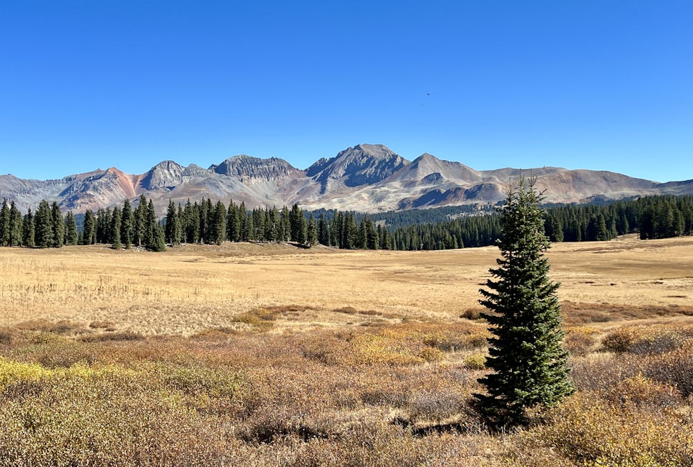
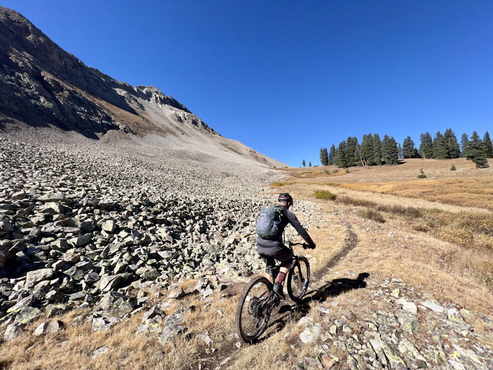
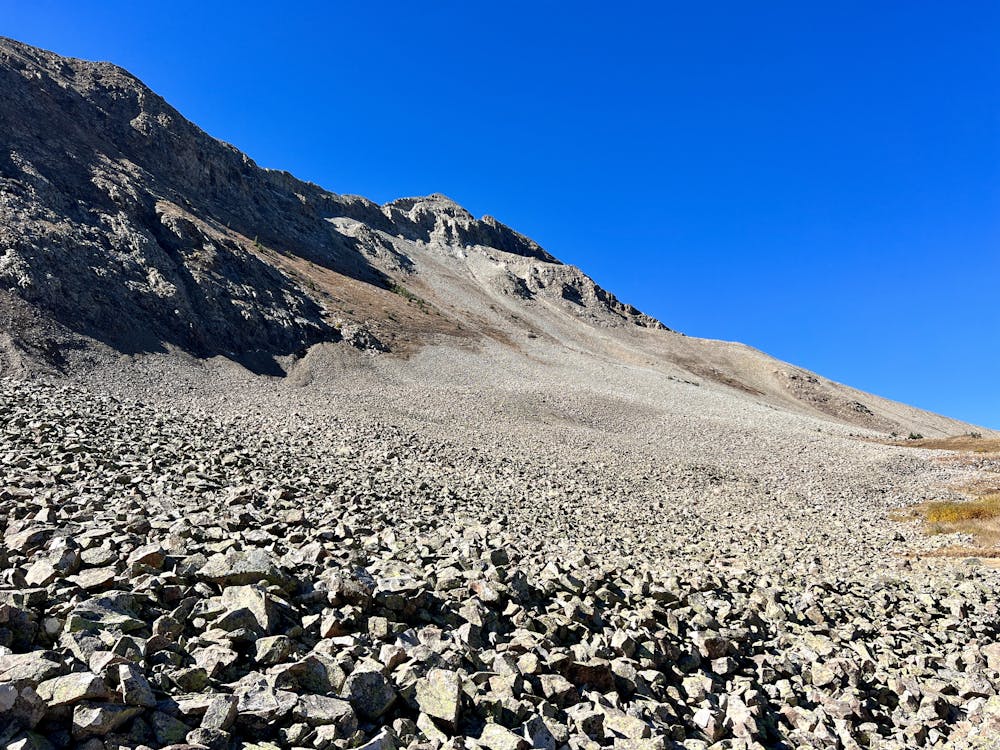
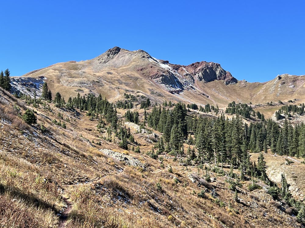
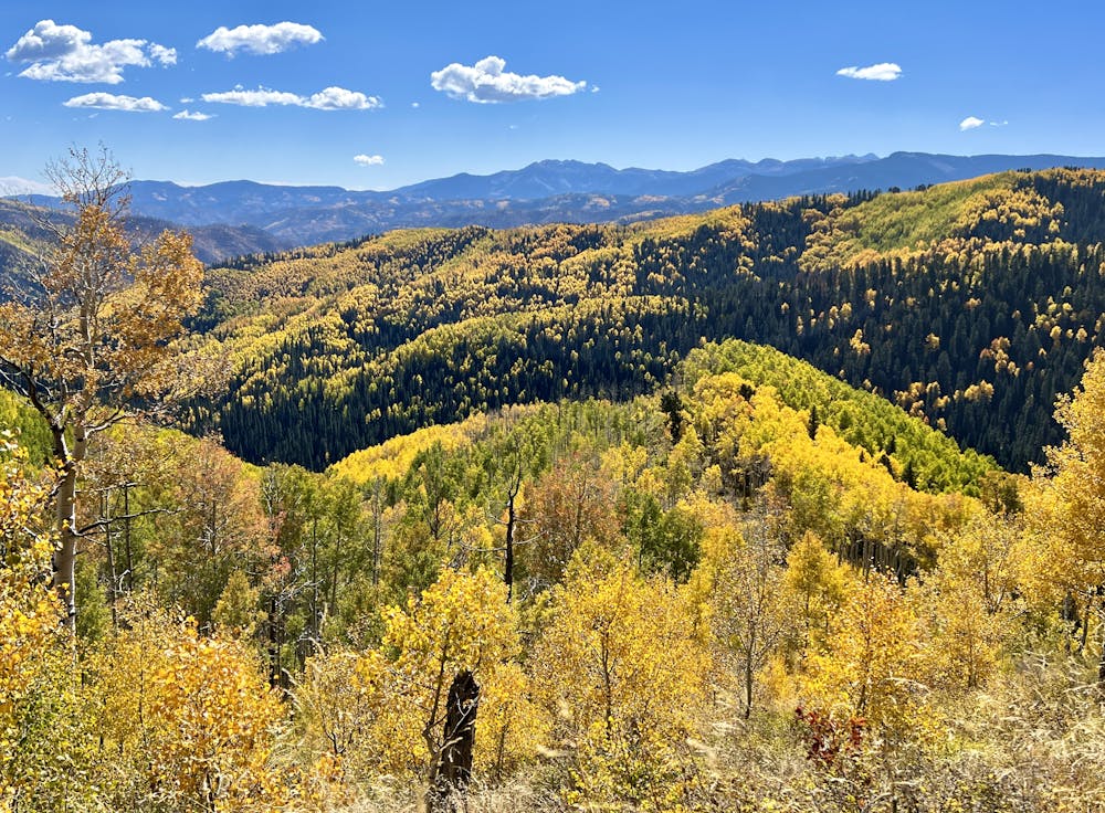
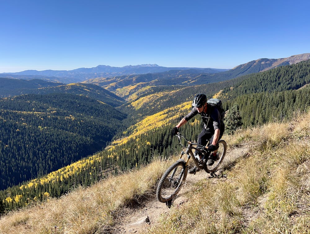
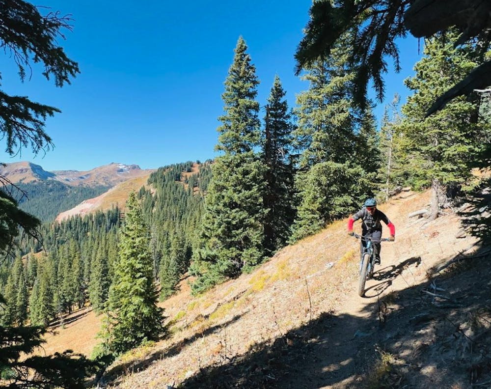
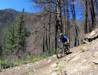
Even though Blackhawk is so renowned, the 4,600 feet of climbing over 25 miles will keep the masses away from this ride. After polishing off the long 4x4 road climb, the Colorado Trail continues rolling up and down a series of steeper climbs and fast descents. It's not uncommon to have the upper reaches of Blackhawk all to yourself while pedaling through spectacular alpine tundra, soaking in endless views in all directions. One particularly astonishing ible spot skirts around the bottom of a massive scree field at the base of Hermosa Peak.
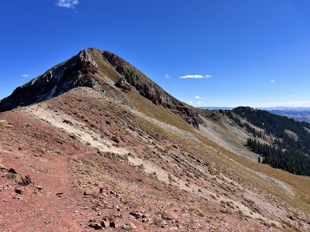
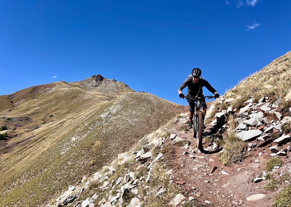
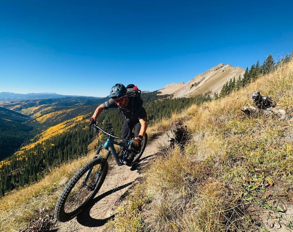
You'll have to do a lot of work to simply reach the bottom of the Blackhawk Pass climb, and once you get there, many riders will be forced to hike-a-bike at least portions of the steep uphill, which tops out at just over 12,000 feet.
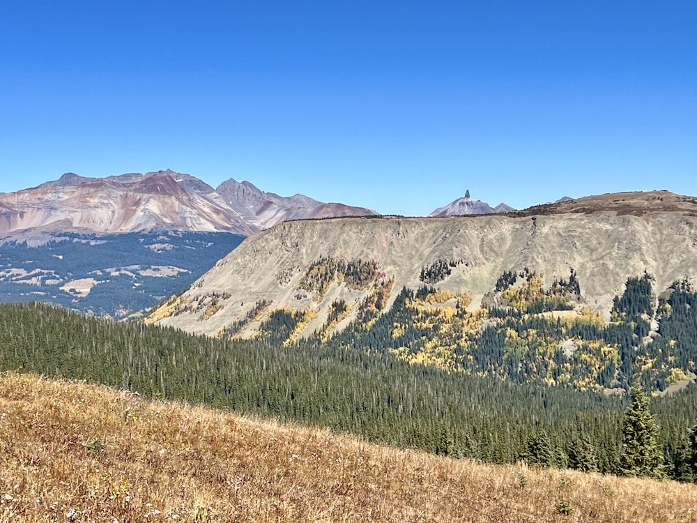
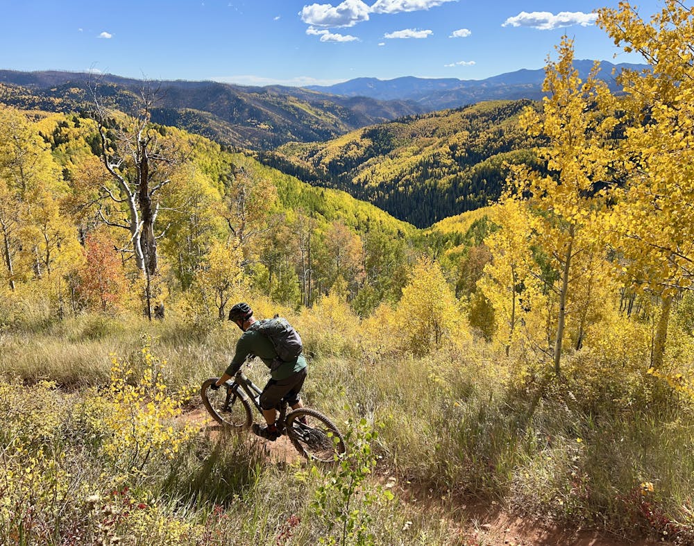
Once at the top of Blackhawk Pass, you'll have reached the high point of the ride, and it's (mostly) downhill from this point on! But before you drop into the never-ending descent, be sure to pause and take in the incredible views from this elevated saddle: the red dirt and rock cliffs forming a beautiful contrast with the green grasses, the mountain range unfurling into the distance.
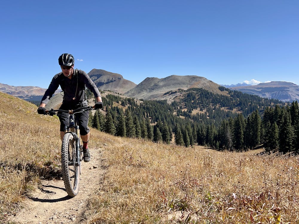
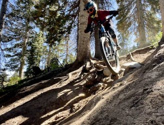
The downhill on both Blackhawk and, subsequently, the Stagecoach Trail is actually relatively smooth and non-technical. Sure, there are some rocks and roots along the way, but for a big high-country ride, this is a very technically achievable trail, making it a favorite of XC riders who have the legs for the big climbs but don't want too much gnar on the descents.
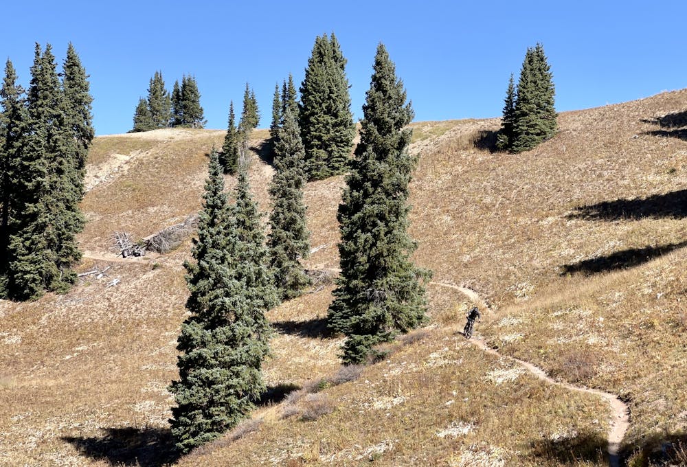
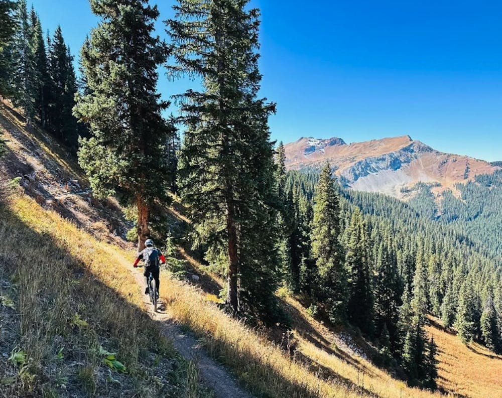
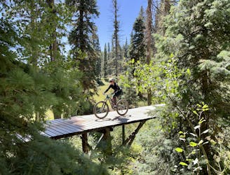
The trail rolls downhill for miles through swooping turns, high-speed sections, and beautiful benchcut singletrack winding through the forest. Then the route hits the Hotel Draw dirt road, but don't make the mistake of turning left down Hotel Draw! Instead, pedal uphill a short way to reach the Stagecoach Trail to continue the epic singletrack descending!
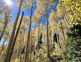
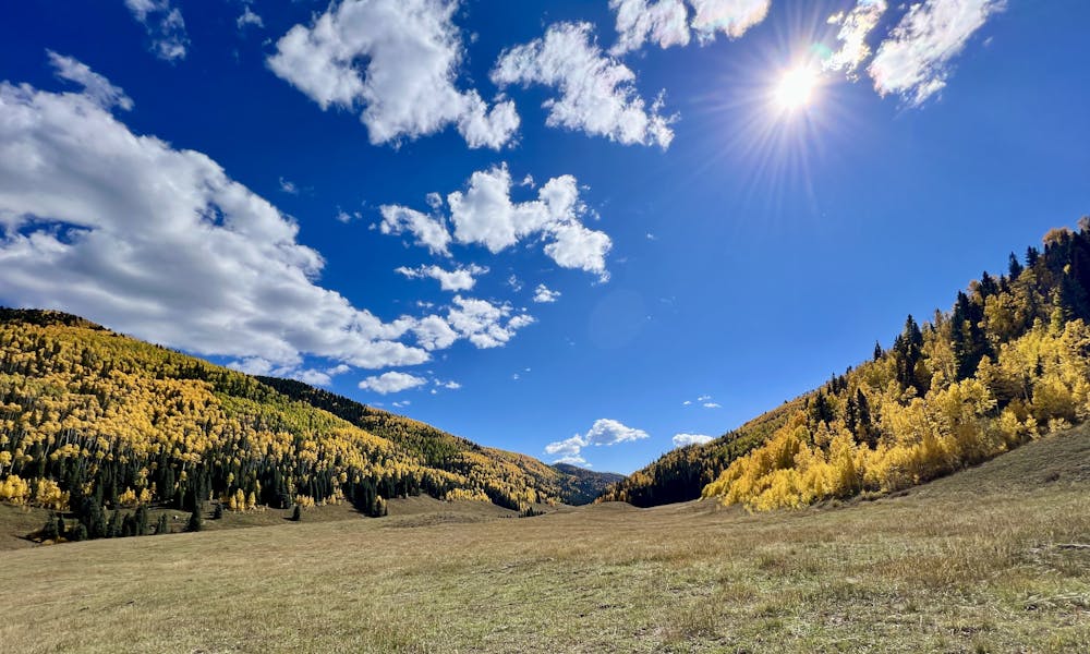
As noted above, Stagecoach is also very non-technical, aside from one optional rock roller line that can easily be bypassed. In the middle, there is also one rocky section with a few small ledges, but most of the trail consists of fast, flowing, dark black dirt through a towering aspen grove. The delightfully narrow trail follows an old road grade (presumably for a stagecoach line of some sort?), which includes some water bars that offer great jump opportunities. Even though you can see the width of the old road grade, the trail tread itself is beautiful, beautiful singletrack!
The aspen grove on Stagecoach adds a spectacular new aspect to this incredible ride, no matter the time of year that you experience it. In the summer, the whispering aspen leaves provide a magical sensory experience. But if you hit it during peak fall colors, you'll be transported to a mystical wonderland of golden leaves above, around, and below you. While it's tempting to just blast through this high speed descent, taking some time to stop and soak in the grandeur of the beautiful aspens is absolutely recommended.
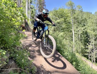
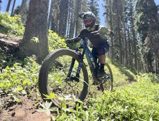
Difficult
Mostly stable trail tread with some variability featuring larger and more unavoidable obstacles that may include, but not be limited to: bigger stones, roots, steps, and narrow curves. Compared to lower intermediate, technical difficulty is more advanced and grades of slopes are steeper. Ideal for upper intermediate riders.

The trail contains some obstacles such as outcroppings and rock which could cause injury.

In the high mountains or remote conditions, all individuals must be completely autonomous in every situation.
1 m away
A fast, flowy track of dark black dirt through a gorgeous aspen grove.
Moderate Mountain Biking
4.3 km away
A sky-scraping stretch of trail, with incredible views from Indian Trail Ridge.
Difficult Mountain Biking
7.6 km away
A top-to-bottom beginner trail with two distinct sections.
Easy Mountain Biking
7.6 km away

One of the most technical lines in the bike park.
Extreme Mountain Biking
7.6 km away
Step into black diamond terrain at Purgatory.
Severe Mountain Biking
7.6 km away
A classic mountain bike ride through a gorgeous mountain valley.
Difficult Mountain Biking
7.6 km away
The best beginner flow trail lap at Purgatory.
Easy Mountain Biking
7.6 km away
The best top-to-bottom flow trail lap in the Purgatory Bike Park.
Difficult Mountain Biking
7.6 km away
A crowd pleaser run, combining a flow trail with a more natural singletrack finish.
Moderate Mountain Biking
7.6 km away
The steepest, most technical line on the mountain.
Extreme Mountain Biking

26 routes · Mountain Biking
8 routes · Mountain Biking
7 routes · Mountain Biking