1 m away
Blackhawk Pass -> Stagecoach Loop
A burly backcountry epic with some of the most beautiful views in the San Juans!
Difficult Mountain Biking
- Distance
- 40 km
- Ascent
- 1.4 km
- Descent
- 1.4 km
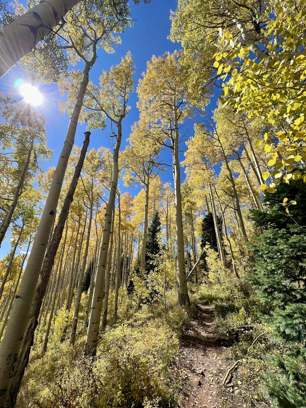
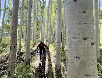
A fast, flowy track of dark black dirt through a gorgeous aspen grove.
Mountain Biking Moderate

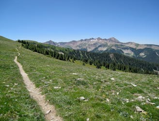
This loop of the Stagecoach Trail is a short but sweet backcountry ride, set many miles from the closest paved road. This isolated gem is well worth the drive to reach it!
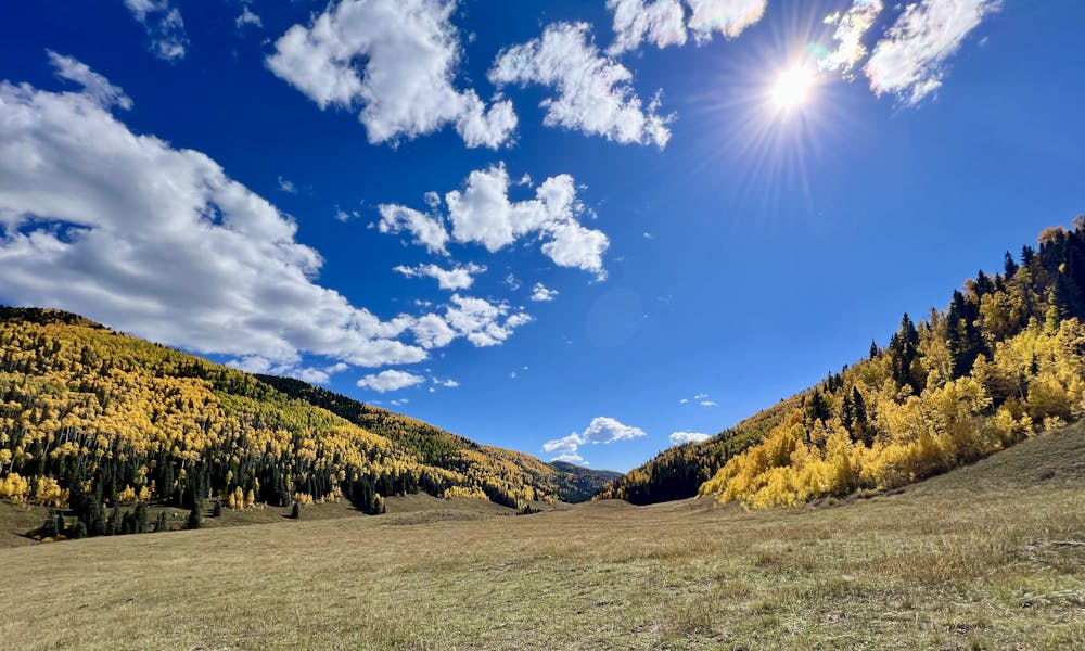
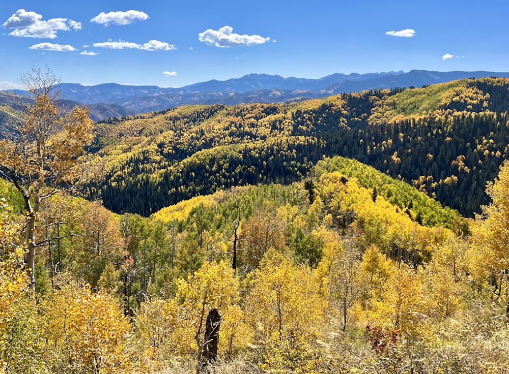
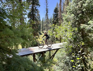
The climb to the top of the trail follows Bolam Pass before turning left onto Hotel Draw for the bulk of the climb. While the climb gains significant elevation (2,000 feet on this 11.6-mile ride), the well-graded road makes the climbing achievable, and the miles tick by surprisingly quickly. The incredible views of the surrounding mountains also help keep your mind off the work. Before you know it, you're at the top of the Stagecoach Trail and ready to descend.
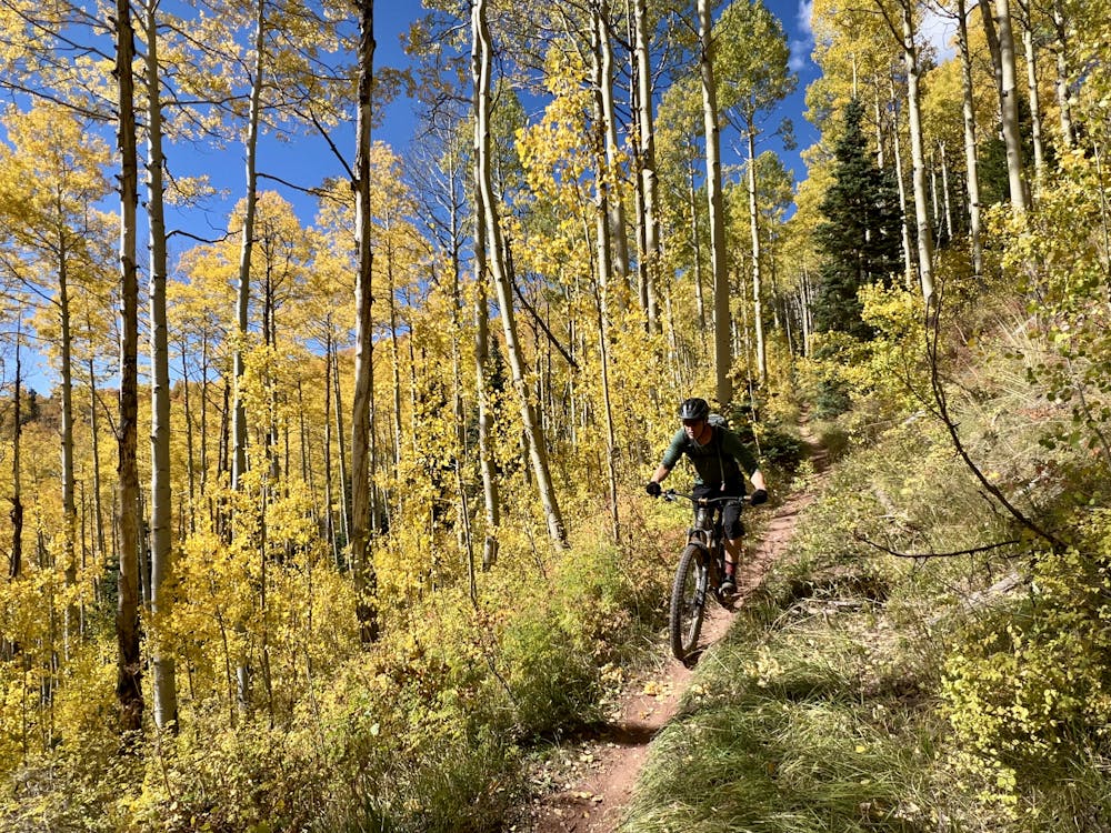
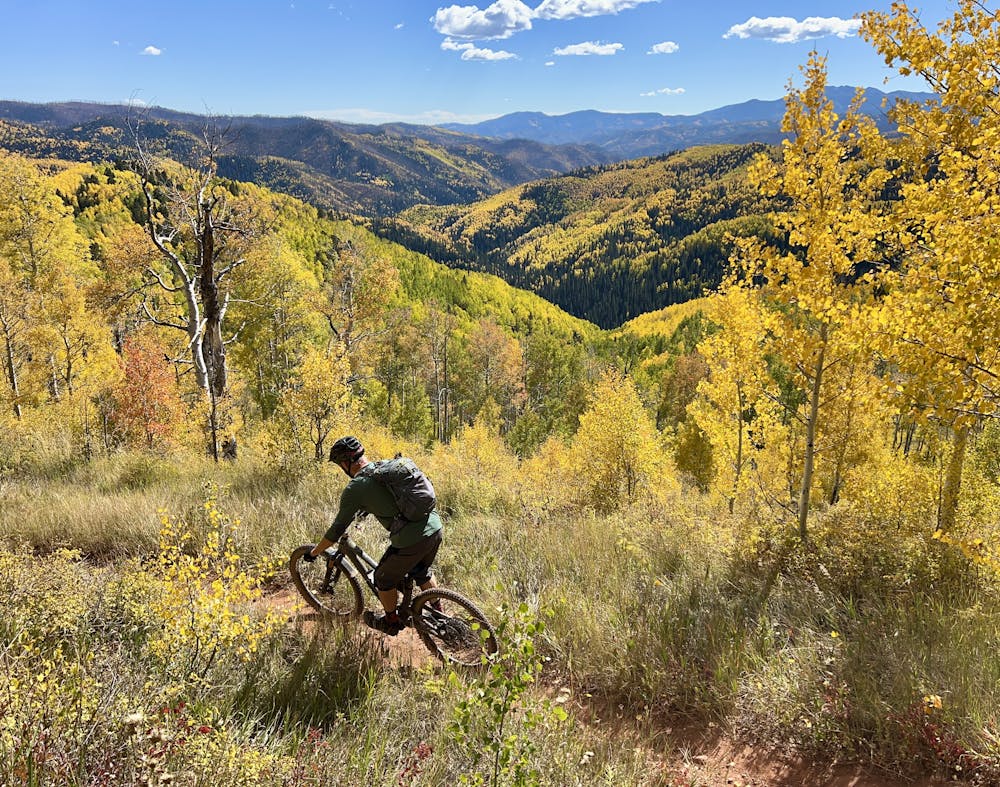
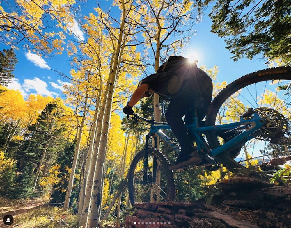
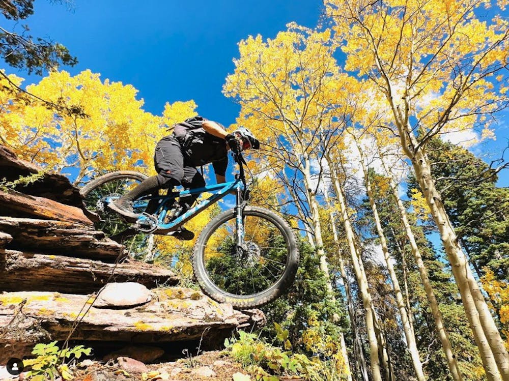
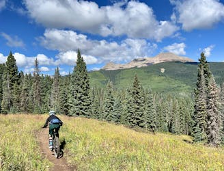
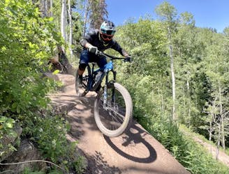
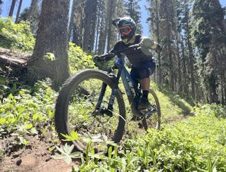
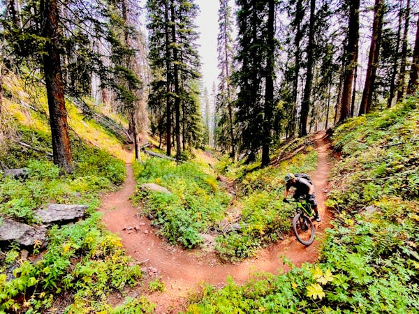
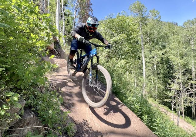
For being located this deep in the big mountains, Stagecoach is actually a fairly non-technical descent, aside from one optional rock roller line that can easily be bypassed. In the middle, there is also one rocky section with a few small ledges, but most of the trail consists of fast, flowing, dark black dirt through a towering aspen grove. The delightfully narrow trail follows an old road grade (presumably for a stagecoach line of some sort?), which includes some water bars that offer great jump opportunities. Even though you can see the width of the old road grade, the trail tread itself is beautiful, beautiful singletrack!
The aspen grove on Stagecoach is truly spectacular, no matter which time of year you get to experience it. In the summer, the whispering aspen leaves provide a magical sensory experience. But if you hit it during peak fall colors, you'll be transported to a mystical wonderland of golden leaves above, around, and below you. While it's tempting to just blast through this high speed descent, taking some time to stop and soak in the grandeur of the beautiful aspens is absolutely recommended.
Moderate
Mostly stable trail tread with some variability, with unavoidable obstacles 8in/20cm tall or less. Other obstacles such as rock gullies and steep sections may exist. Ideal for lower intermediate riders.

The trail contains some obstacles such as outcroppings and rock which could cause injury.

Little chance of being seen or helped in case of an accident.
1 m away
A burly backcountry epic with some of the most beautiful views in the San Juans!
Difficult Mountain Biking
4.3 km away
A sky-scraping stretch of trail, with incredible views from Indian Trail Ridge.
Difficult Mountain Biking
7.6 km away
A top-to-bottom beginner trail with two distinct sections.
Easy Mountain Biking
7.6 km away

One of the most technical lines in the bike park.
Extreme Mountain Biking
7.6 km away
Step into black diamond terrain at Purgatory.
Severe Mountain Biking
7.6 km away
A classic mountain bike ride through a gorgeous mountain valley.
Difficult Mountain Biking
7.6 km away
The best beginner flow trail lap at Purgatory.
Easy Mountain Biking
7.6 km away
The best top-to-bottom flow trail lap in the Purgatory Bike Park.
Difficult Mountain Biking
7.6 km away
A crowd pleaser run, combining a flow trail with a more natural singletrack finish.
Moderate Mountain Biking
7.6 km away
The steepest, most technical line on the mountain.
Extreme Mountain Biking

26 routes · Mountain Biking
8 routes · Mountain Biking
7 routes · Mountain Biking