1 m away
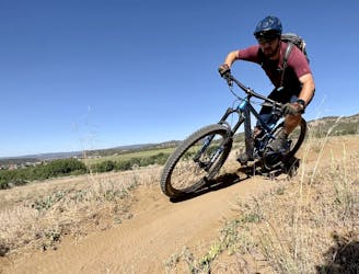
Grandview Ridge Loop
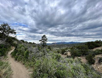
A beautiful cross country ride with a flowy finish.
Moderate Mountain Biking
- Distance
- 14 km
- Ascent
- 374 m
- Descent
- 374 m
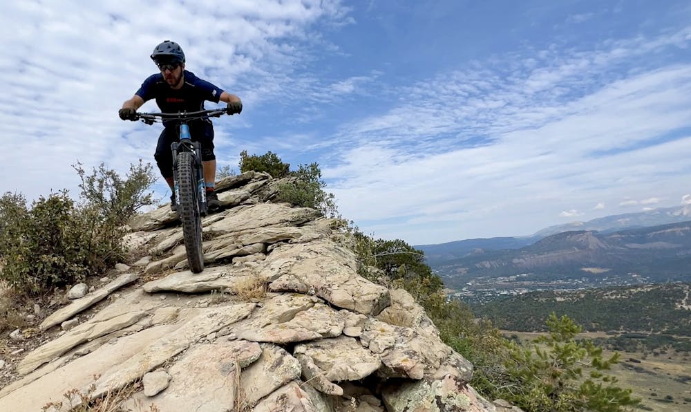
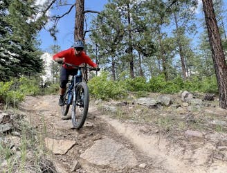
Tackle the rock chute on Pautskey Point, followed by a rip down Send It.
Mountain Biking Severe

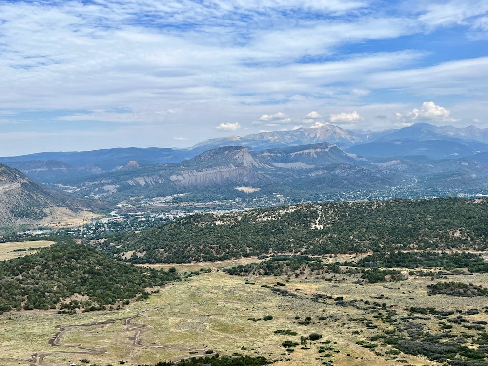
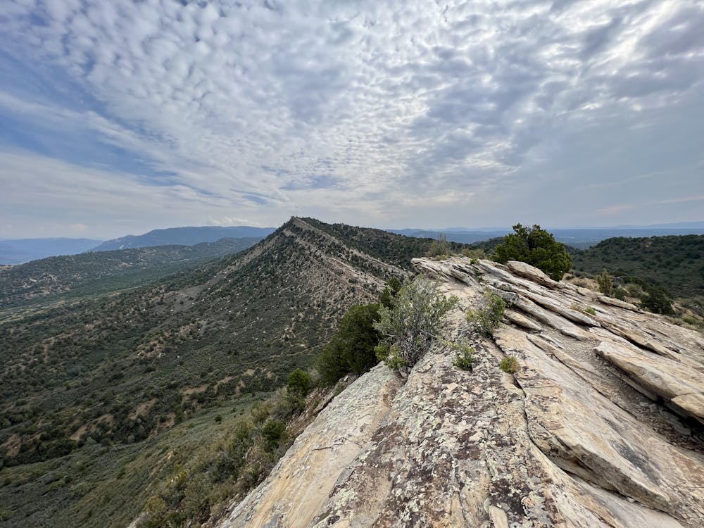
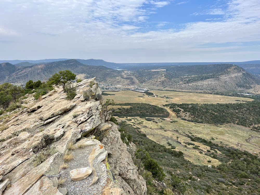
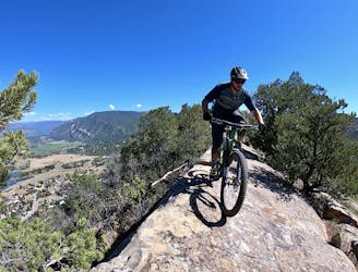
Pautskey Point is an easily identifiable ridge forming part of the skyline above the southern end of Durango. While it's tough to discern from downtown Durango due to Raider's Ridge sitting in between, this 7,698-foot upthrust spine of jagged rock offers panoramic 360-degree views of the region.
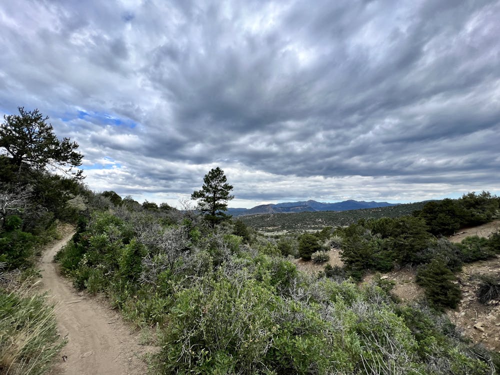
To get there, begin riding from the Horse Gulch trailhead, and then take a right onto the Telegraph Trail. Telegraph can be a bit of a grind at times, but as you get higher and higher up the trail, beautiful views slowly begin to open up, giving an indication of what you'll find at the top. While you'll gain elevation consistently, this section has nothing exceedingly technical.
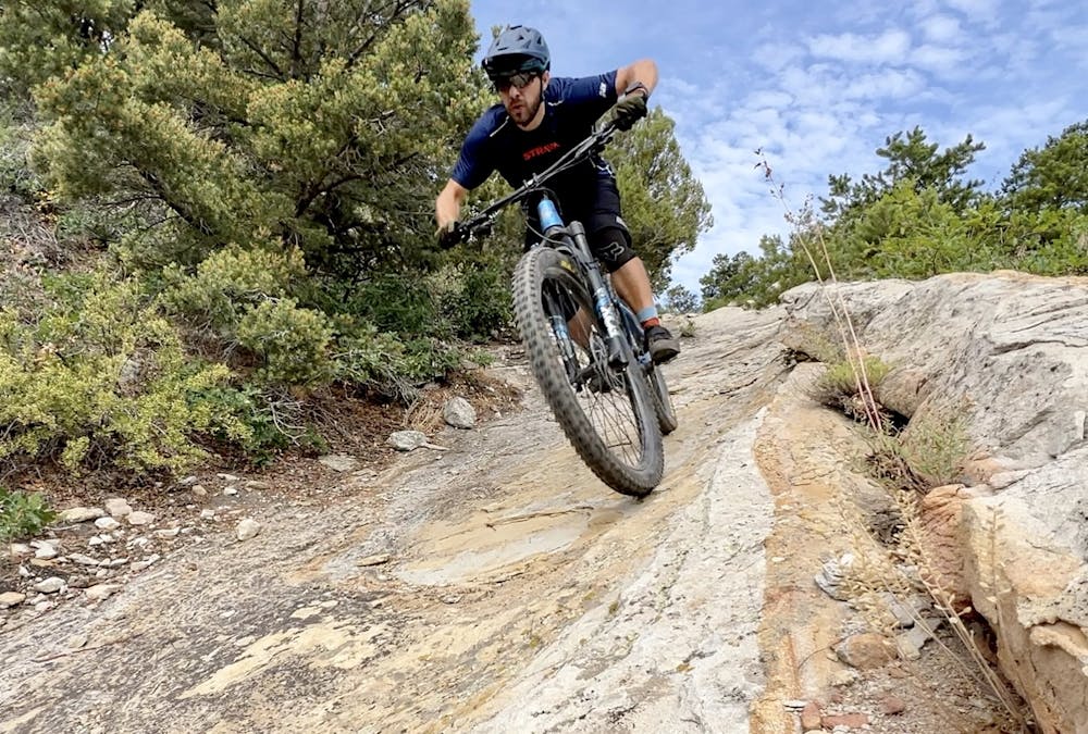
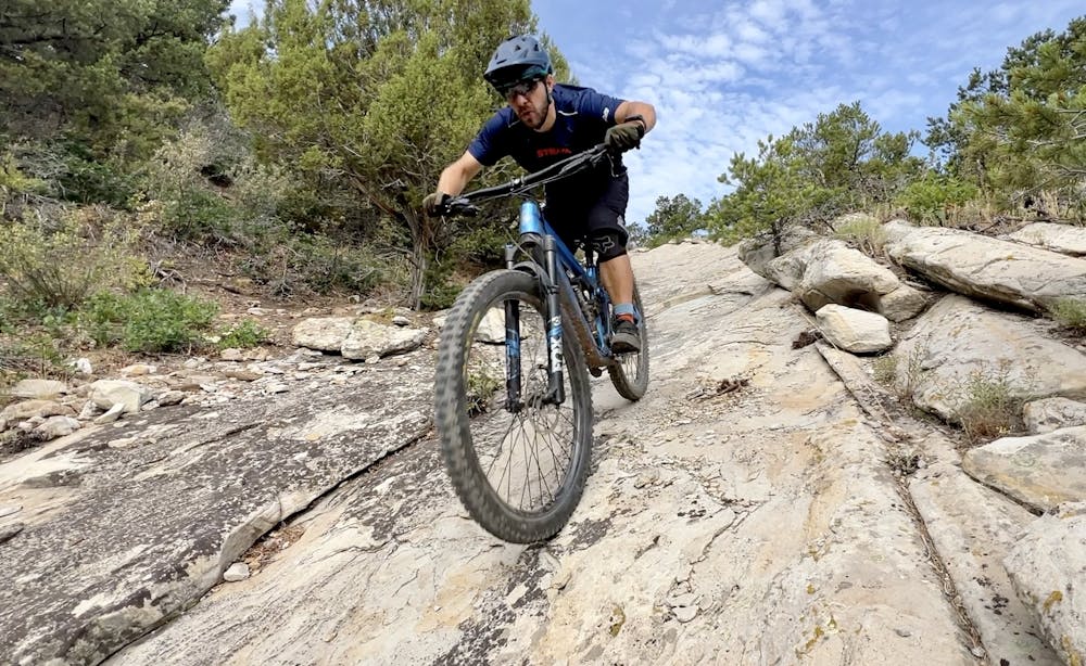
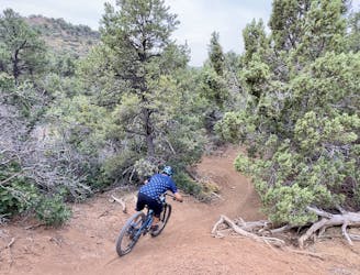
The final grunt to the summit is a fairly steep hike-a-bike up a rock slab chute that runs straight up the ridge. While it's a grunt on the way up, the ride back down this unique rock formation is an absolute riot!
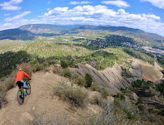
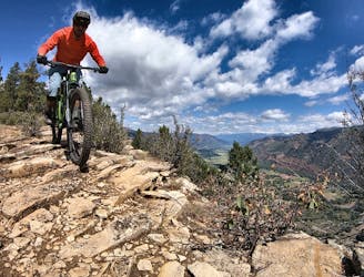
The final few feet of the climb follow a rocky ridge reminiscent of Raider's Ridge far below but with much more spectacular views! Head out as far as you'd like along this ridge, then stop to take in the stupendous views. You'll be able to glimpse downtown Durango peeking out from behind Raider's, but Perins Peak and the La Platas form an absolutely gorgeous skyline in the distance! Directly across the river, Smelter Mountain looms in front of you, with Nighthorse Reservoir visible beyond.
Once you are done enjoying the views, the fun part begins!
The beginning of the descent along the top of the spine can be fairly tricky depending on how far out you went, but once you reach the main trail, the descent gets much more straightforward. The rip down the rock chute is an absolute hoot—just be sure your brakes are up for the task!
While some online mapping platforms rate this trail a double black diamond, that's dramatically overstating its difficulty. On a global scale, this trail barely gets a single black rating, and the hardest part is negotiating a rocky turn before dropping into the top of the chute.
After finishing this awesome downhill romp, keep the fun flowing on the Send It trail. Send It is a fast descent that will encourage you to do exactly that, with several optional rock drops and kickers built into the trail tread. All of the air hits can be avoided if you so choose. Some parts of Send It are fairly exposed, but the riding is all straightforward. You'll enjoy a few entertaining rock gardens and some swoopy, fast turns as you drop toward the valley.
Finish the ride with some easier trails in the valley, then rip back down to the trailhead. Or, if you want more gnar, turn right and head up Raider's Ridge for more!
Severe
Widely variable, narrow trail tread with steeper grades and unavoidable obstacles of 15in/38cm tall or less. Obstacles may include unavoidable bridges 24in/61cm wide or less, large rocks, gravel, difficult root sections, and more. Ideal for advanced-level riders.

The trail contains some obstacles such as outcroppings and rock which could cause injury.
Away from help but easily accessed.
1 m away
A beautiful cross country ride with a flowy finish.
Moderate Mountain Biking
3 m away
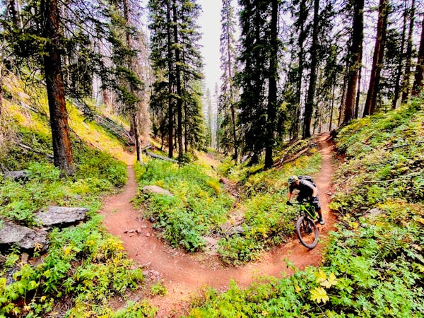
A superb XC ride from downtown Durango ending with a fast descent.
Difficult Mountain Biking
10 m away
Hands-down the most technical trail in Durango.
Extreme Mountain Biking
2.5 km away
Face extreme exposure on one of Durango's classic rides.
Extreme Mountain Biking
4.3 km away
Stunning views and a ripping descent, right in Durango.
Severe Mountain Biking
5.7 km away
The perfect beginner singletrack ride!
Easy Mountain Biking
9.1 km away
A quick loop on one of the better trail segments in the Log Chutes.
Difficult Mountain Biking
8 routes · Mountain Biking