3 m away
Telegraph -> Pautskey Point -> Send It Loop
Tackle the rock chute on Pautskey Point, followed by a rip down Send It.
Severe Mountain Biking
- Distance
- 9.6 km
- Ascent
- 368 m
- Descent
- 368 m
A superb XC ride from downtown Durango ending with a fast descent.
Mountain Biking Difficult

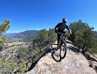
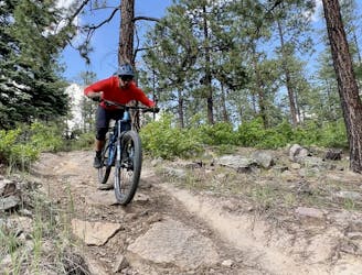
The Telegraph Trails provide beautiful cross country riding accessible directly from downtown Durango! While the route options are myriad, this loop is one of the best on offer.
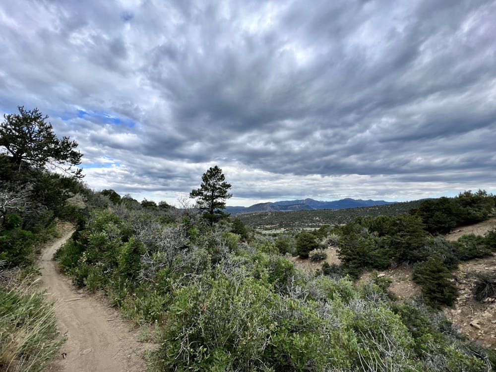
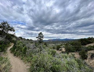
Begin riding from the Horse Gulch trailhead, and then take a right onto the Telegraph Trail. Telegraph can be a bit of a grind at times, but as you get higher and higher up the trail, beautiful views slowly begin to open up, giving an indication of what you'll find at the top. While you'll gain elevation consistently, this section has nothing exceedingly technical. The climb does finish with a short hike-a-bike (for most riders) to reach the saddle, but after that, it's blessedly rideable.
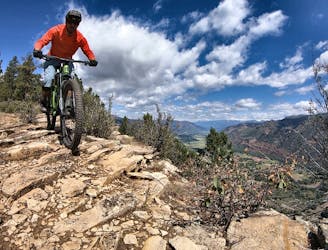
From the pass, you'll enjoy some fantastic sidehilling before dropping swiftly down Yellow Brick Road into the Sidewinder trail. But don't get too excited—this is billed as an XC ride, after all, and each descent here is followed by a climb.
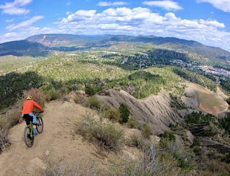
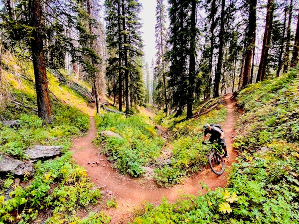
Upper Telegraph, Yellow Brick Road, and Sidewinder all provide swoopy buffed-out singletrack. The smooth, rolling trail tread is blissful to ride, but the difficulty will kick up a notch when you drop into Skull Rock.
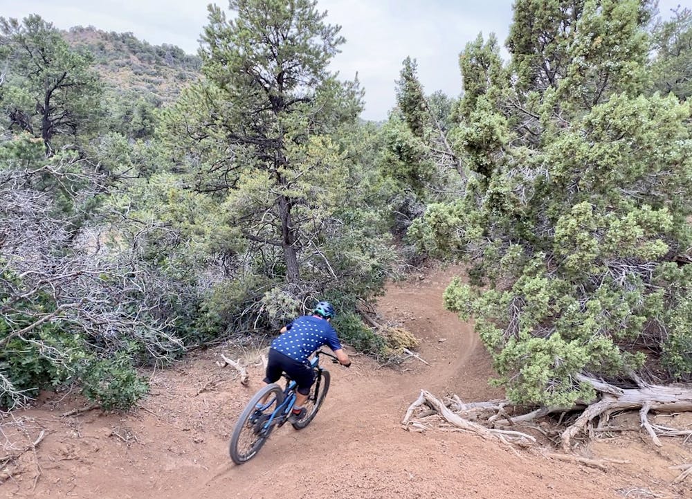
The initial steep descent into Skull Rock provides a taste of what's to come, although the black diamond rating assigned to this trail is definitely overstating its difficulty. There are a few fast, swoopy sections and a few fun rock features, but there are no truly challenging features on this trail. But that's not to say it isn't fun!
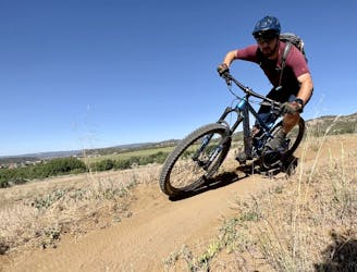
The final stretch of the descent on Big Canyon is aptly named, with the trail rolling through the bottom of a steep-sided canyon. At times, you're riding directly down the stream bed. The eons of water action have carved entertaining features, such as a rock wall ride in a corner of the canyon. This final section of trail is one of the true highlights of the ride, but like all good things, it soon comes to an end.
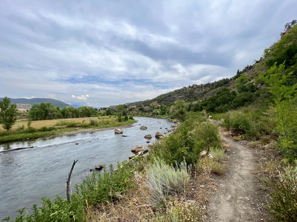
The ride connects along some pavement to reach the Railroad Trail, providing a beautiful pedal along the river to return. You'll have to connect along some more pavement on Sawmill Road to reach the next section of singletrack, but ultimately you'll complete the loop on trail.
Difficult
Mostly stable trail tread with some variability featuring larger and more unavoidable obstacles that may include, but not be limited to: bigger stones, roots, steps, and narrow curves. Compared to lower intermediate, technical difficulty is more advanced and grades of slopes are steeper. Ideal for upper intermediate riders.

The path is on completely flat land and potential injury is limited to falling over.

Away from help but easily accessed.
3 m away
Tackle the rock chute on Pautskey Point, followed by a rip down Send It.
Severe Mountain Biking
4 m away

A beautiful cross country ride with a flowy finish.
Moderate Mountain Biking
8 m away
Hands-down the most technical trail in Durango.
Extreme Mountain Biking
2.5 km away
Face extreme exposure on one of Durango's classic rides.
Extreme Mountain Biking
4.3 km away
Stunning views and a ripping descent, right in Durango.
Severe Mountain Biking
5.7 km away
The perfect beginner singletrack ride!
Easy Mountain Biking
9.1 km away
A quick loop on one of the better trail segments in the Log Chutes.
Difficult Mountain Biking
8 routes · Mountain Biking