1.1 km away
East Ridge 9
Nice long decent off Peak 9 Summit
Difficult Ski Touring
- Distance
- 1.6 km
- Ascent
- 0 m
- Descent
- 532 m
Another option near the summit of Peak 10
Ski Touring Difficult

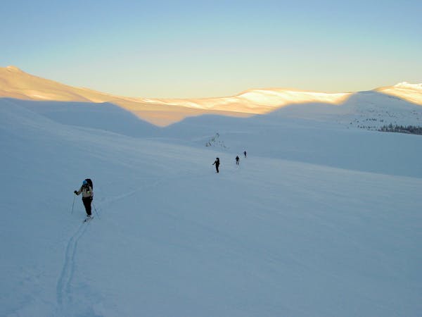
These options depend on coverage, snowfall history, and overall wind patterns. This option has more vertical than option 3, but coverage on option 3 may be better depending on the factors mentioned. Choose your route accordingly. If you are on the Summit of Peak 10, it will be difficult to make the right decision, so understand the further you travel down the ridge, the more vertical you will lose. The exit of this route will be just like the exit off of the Summit. Pay attention to scattered rocks throughout the run since it gets so much sun.
Difficult
Serious gradient of 30-38 degrees where a real risk of slipping exists.

As well as the slope itself, there are some obstacles (such as rock outcrops) which could aggravate injury.

In the high mountains or remote conditions, all individuals must be completely autonomous in every situation.
1.1 km away
Nice long decent off Peak 9 Summit
Difficult Ski Touring
1.7 km away
Hike Route that starts from the Backcountry Gate
Moderate Ski Touring
8.7 km away
The approach to a backcountry hut with an abundance of touring opportunities.
Easy Ski Touring
6 routes · Ski Touring