3.6 km away
Grays Peak - Lost Rat Couloir
Great route for beginner mountaineers—climb an easy 14er, ski a short couloir, and cruise through a fun gulley back to the trailhead.
Difficult Ski Touring
- Distance
- 9.9 km
- Ascent
- 928 m
- Descent
- 928 m
Ski a spectacular 3,000-foot line off the summit of one of Colorado's most popular 14ers.
Ski Touring Severe

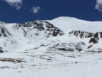
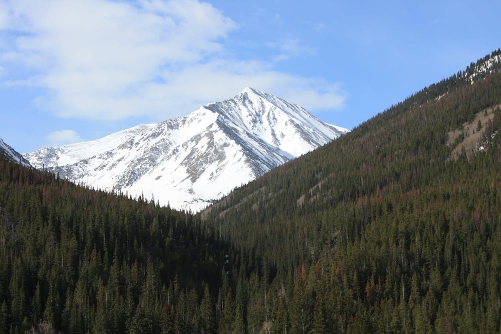
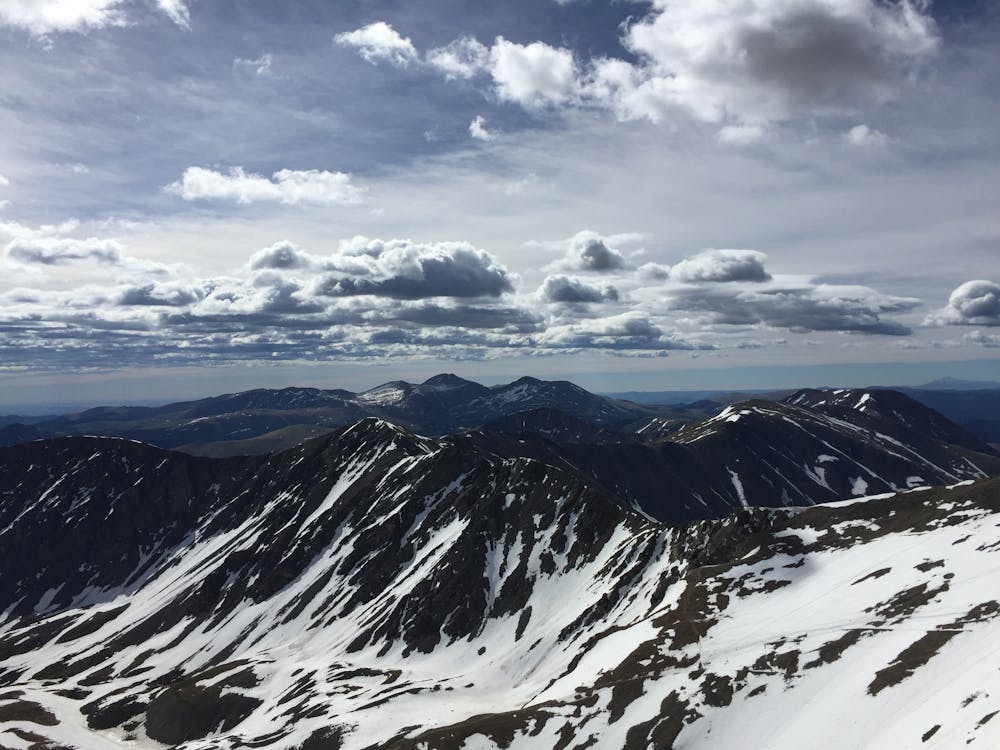
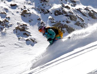
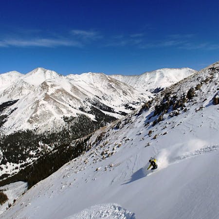
Emperor Couloir is the gnarly line on the north face of Torreys Peak that's begging to be skied! This spectacular route features one of the longest continuous lines in the state at 3,000 feet. There are almost no crowds on this line even though it is the most exciting ski route from the summit, it's visible from the highway, and is on one of the most popular 14ers in Colorado. It's only an hour from Denver and you can drive right to the base of the couloir! The opportunity to ski this type of line without a long approach is unique and makes this a hidden gem in Colorado for ski mountaineers.
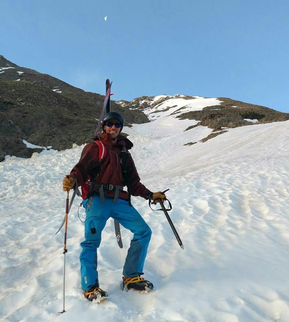
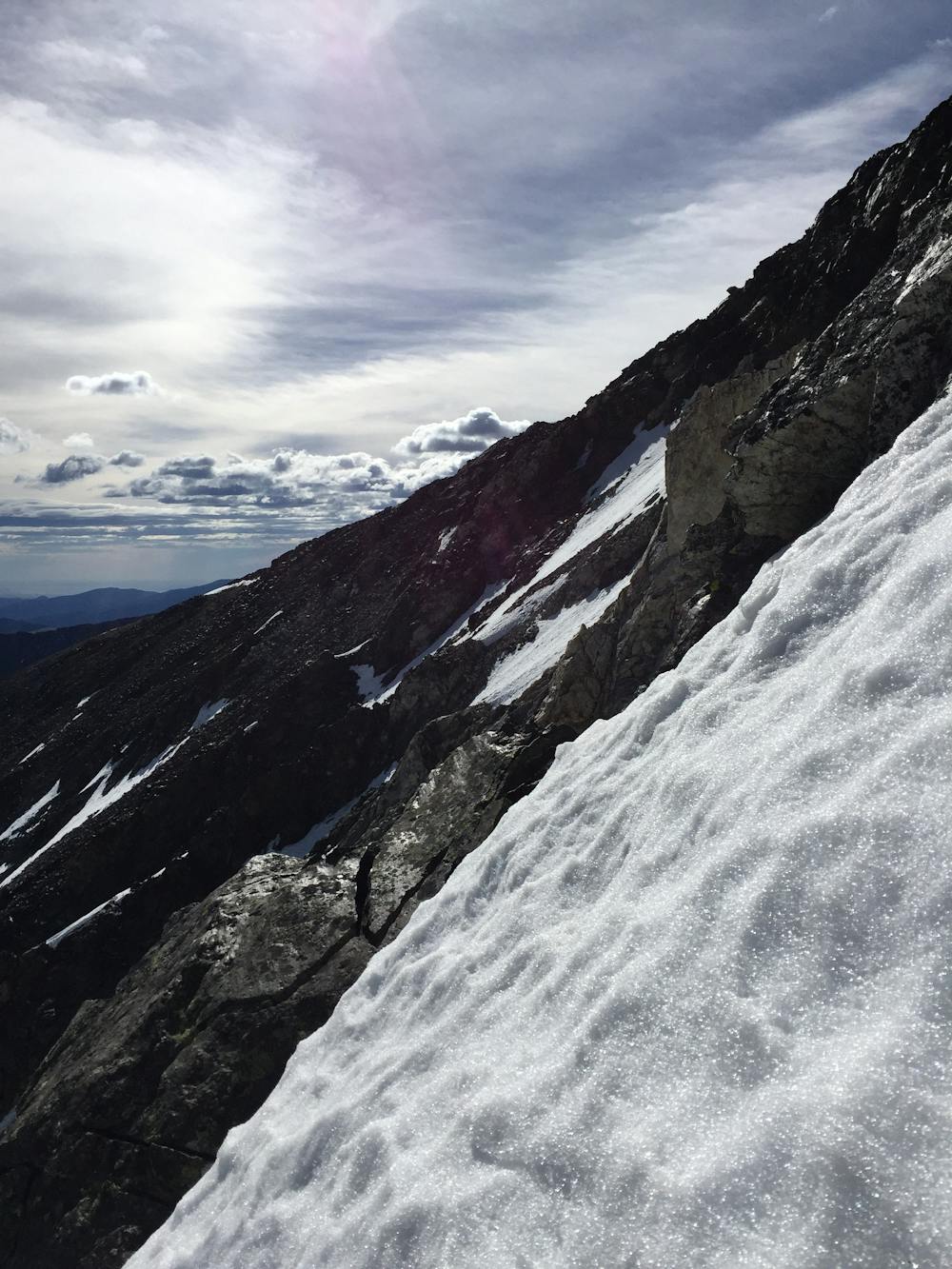
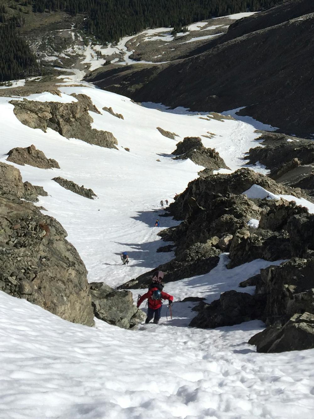
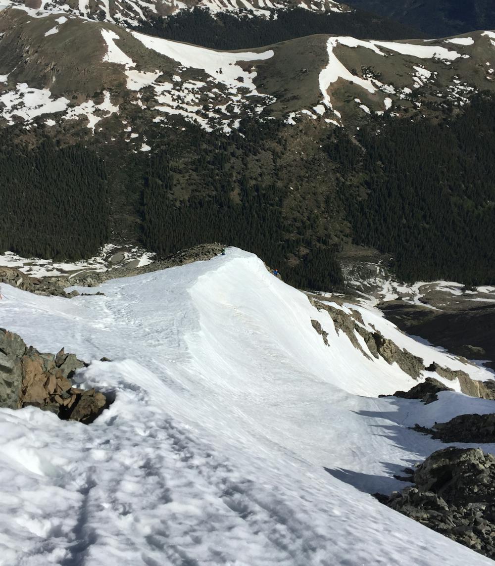
As you enter the couloir from the ridge you will be greeted by slope angles over 40 degrees—enough to get your heart pumping! The couloir isn’t particularly tight but the exposure of a 3,000-foot continuous line can be intimidating and exciting. Once you get past the rock bands that guard the upper section of the route, the slope angle mellows out and an open snowfield allows for some bigger turns.
The main route detailed on the map is the standard route and offers a line that will satisfy almost anyone. If you want an additional challenge there is an option to drop in skier’s right from the ridge, before the main line detailed in the GPX. This option culminates in a tight choke that is often rocky and will add a little spice to your run.
No highly technical moves are required on this route so someone with limited ski mountaineering skills could use this line to test their skills and knowledge.
This is a high altitude, north facing line so it holds snow late into the spring. People have died from avalanches in this area so it is highly recommended to wait until the snow has stabilized in the Spring before attempting this line. Climb it early and try to time the descent around mid-morning so you have sweet spring corn for your ski down. If your boots start to sink into the snow above the cuff it's time to turn around and get off the slope. Or, if you see snow pinwheels rolling down the slope, that is another sign that you are too late in the day and it's time to get off the slope.
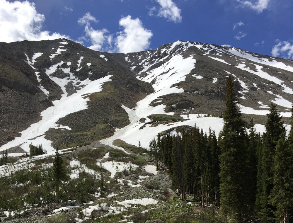
Getting to the base of the couloir requires driving up a fun 4x4 road with stream crossings and some narrow rocky sections. If you don't have a high clearance 4x4 you can park near the first stream crossing, but it will add about 4 miles of hiking/skinning round trip.
Severe
Steep skiing at 38-45 degrees. This requires very good technique and the risk of falling has serious consequences.

As well as the slope itself, there are some obstacles (such as rock outcrops) which could aggravate injury.

Little chance of being seen or helped in case of an accident.
3.6 km away
Great route for beginner mountaineers—climb an easy 14er, ski a short couloir, and cruise through a fun gulley back to the trailhead.
Difficult Ski Touring
8.3 km away
If avalanche conditions are safe this is a good powder stash near Keystone.
Moderate Ski Touring
7 routes · Ski Touring