9.8 km away
Green's Creek
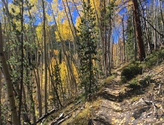
Run up a gorgeous mountain valley along a rushing stream.
Difficult Trail Running
- Distance
- 22 km
- Ascent
- 898 m
- Descent
- 898 m
The northbound FKT route of the Nolan's 14 in Colorado's Sawatch Range.
Trail Running Extreme

This is a popular trail running route which is generally considered to be extreme. It's an unknown remoteness, it features unknown exposure and is typically done in an unknown time of year. From a low point of 2.7 km to the maximum altitude of 4.4 km, the route covers 162 km, 13146 vertical metres of ascent and 13185 vertical metres of descent.
Nolan's 14 consists of climbing / hiking / running fourteen 14,000 foot mountains in Colorado's Sawatch Range in one foot-powered push of less than 60 hours. The exact route is open, but distance is about 90+ miles and elevation gain is around 44,000'.
Extreme
9.8 km away
Run up a gorgeous mountain valley along a rushing stream.
Difficult Trail Running