8 routes · Trail Running
Run the Continental Divide Trail through Rocky Mountain National Park.
Trail Running Difficult

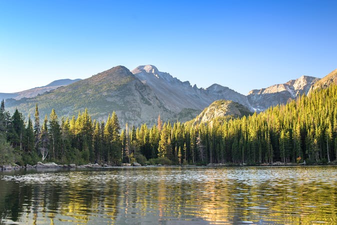
Starting from Grand Lake on the west side of the national park, this endurance loop connects two remote creek valleys with a section along the Continental Divide, way above the treeline with absolutely epic views. Aside from backpackers, these trails don’t get much traffic, making them especially good for running long and lonesome miles.
The run follows the Continental Divide Trail, which routes along Tonahutu Creek and North Inlet Trails. Begin at North Inlet trailhead near Grand Lake, where there’s ample parking in a dirt lot. The direction you take the loop is simply personal preference. It’s mapped here going counterclockwise, up North Inlet and down Tonahutu Creek. In this direction, the climb is a bit sharper, with a lot of elevation gain in a relatively short section of North Inlet. It then goes north along the Divide, meaning the sun will be mostly at your back.
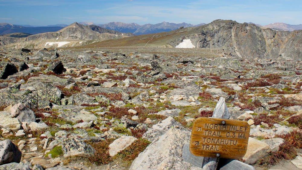
The first couple of miles on North Inlet are a friendly warm up on easy trail at the verge of broad meadows and fire-thinned forest. As the valley narrows, the trail traces the creek among more lush vegetation. It gradually steepens, then eventually climbs away from the creek on determined switchbacks. The trail punches above treeline and puts you steps away from the Continental Divide. This begins the breathtaking traverse across alpine tundra, at 12,000 feet elevation.
North Inlet meets Tonahutu Trail near the summit of Flattop Mountain, which is a popular hiking destination. Near this junction, you’ll peer off the precipitous east side of the range, over cliffs and glaciers. The trail trends downward from there, eventually re-entering the trees and dropping steeply to a creek. From there, it’s a long but relatively smooth run out through a patchwork of forest, meadows, and burned areas. The loop concludes at Tonahutu Creek trailhead, which is just a jaunt away from North Inlet trailhead along a dirt road.
Warning: Much of this area burned in 2020 during the East Troublesome Fire, and all trails were closed. They will likely reopen in 2021, but the extent of damage is unknown. Expect variable trail conditions and possibly reroutes.
Sources: http://www.metrotomountain.com/journal/mountains/tonahutu-creek-trail-guide960.php https://thehappypackers.com/north-inlet-tonohutu-creek-rocky-mountain-national-park/
Difficult

The trail contains some obstacles such as outcroppings and rock which could cause injury.

Little chance of being seen or helped in case of an accident.
8 routes · Trail Running