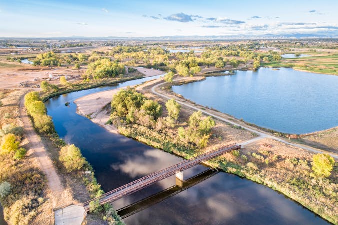
5.7 km away
Bear Creek Trail
A beautiful greenway path beginning near Morrison and running through Lakewood.
Easy Trail Running
- Distance
- 23 km
- Ascent
- 113 m
- Descent
- 277 m

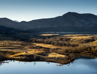
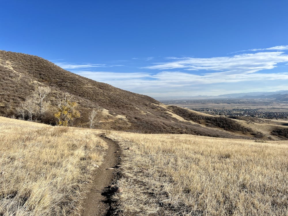
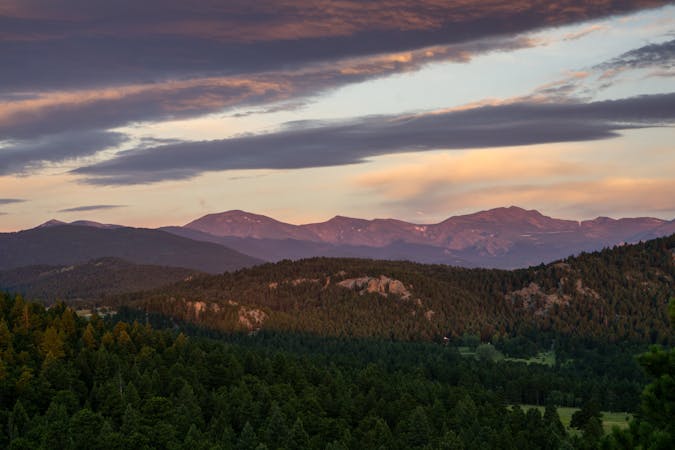
Green Mountain offers some of the best bang-for-your buck trail running near Denver. It’s close enough to the city for quick trips before or after work, and the scenery is top-notch. It’s a nearly treeless mountain of rolling grassland, with views to the Rocky Mountains and over the urban skyline. There are many trails and a range of difficulties to choose from. The fantastic loop mapped here climbs to the summit of Green Mountain via the Rooney Valley Trail and then follows the Green Mountain Trail back down to the trailhead.
The lower reaches of Rooney Valley are incredibly scenic, with beautiful, narrow singletrack rolling along the flanks of the mountain. The climb to the top of the follows a popular section of mountain biking trail—so expect downhill traffic. However, with just one extremely high-use bike section on this entire loop, that's a pretty fair trade-off for an excellent run!
Be sure to savor the views from the top of Green Mountain, but the views of downtown will continue as you work your way along the ridge and descend the southern end of the mountain. For being so close to Denver, Green Mountain is an absolutely spectacular resource for local residents!
The descent back down to the trailhead can be loose in spots, and as you approach the trailhead trail traffic will increase. If you're trying to open up your stride to make time down the mountain, be sure to remain alert for other trail users.
Sources: https://www.lakewood.org/Government/Departments/Community-Resources/Parks-Forestry-and-Open-Space/A-to-Z-Park-Listing/William-F.-Hayden-Park-on-Green-Mountain https://www.mobilemaplets.com/showplace/5644 https://www.youtube.com/watch?v=sq9xNZieRMs
Moderate

The path is on completely flat land and potential injury is limited to falling over.

Away from help but easily accessed.
5.7 km away
A beautiful greenway path beginning near Morrison and running through Lakewood.
Easy Trail Running
5.9 km away
A tough ascent to the highpoint over Red Rocks Amphitheater.
Severe Trail Running
9.5 km away
Challenging ascent of Lookout Mountain from its base in the town of Golden.
Difficult Trail Running
9.9 km away
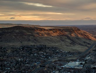
Climb to the panoramic top of North Table Mountain near Golden.
Moderate Trail Running
4 routes · Trail Running
21 routes · Trail Running