0 m away
Central Flatirons + Bear Canyon

Linking the central flatiron run to green summit and down bear canyon
Extreme Trail Running
- Distance
- 15 km
- Ascent
- 849 m
- Descent
- 849 m
One of the most famous trails in Boulder, leading to a natural arch via a rough, rocky ascent.
Trail Running Difficult

The trail to Royal Arch is one of the most popular in Boulder, thanks to its easy access and beautiful views. The run begins at the Bluebell trailhead on the edge of town, heading into the Flatirons to reach a natural stone arch—an eroded outcrop of the Fountain Formation. You'll also get to check out Tangen Spring and a small cave, adding a little extra exploration to the adventure.
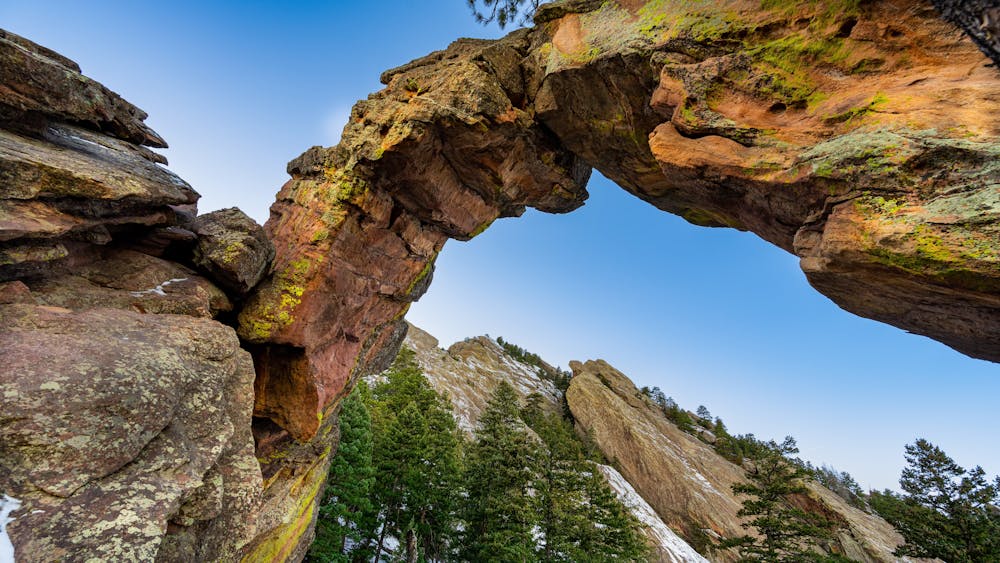
While the approach is easy, as the trail enters the Flatirons, it traverses some fairly challenging terrain, including loose rocks, tight switchbacks, and large steps. While popular, this is far from the easiest trail in Boulder. Come prepared for a bit of a challenge!
Sources: https://bouldercolorado.gov/trail/royal-arch https://www.outdoorproject.com/united-states/colorado/royal-arch-hike https://dayhikesneardenver.com/royal-arch-trail-hike-in-boulder-colorado/
Difficult

Some trail sections have exposed ledges or steep ascents/descents where falling could cause serious injury.

Away from help but easily accessed.
0 m away
Linking the central flatiron run to green summit and down bear canyon
Extreme Trail Running
873 m away
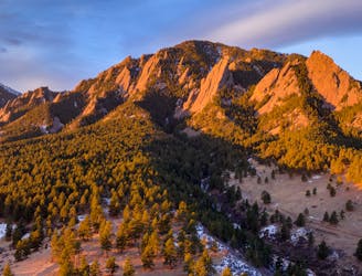
A loop to the top of Boulder's most iconic mountain.
Severe Trail Running
2.6 km away
A quintessential Boulder trail run.
Severe Trail Running