4.7 km away
Manoa Falls
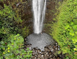
A mellow hike to a beautiful 100-foot-tall waterfall.
Moderate Hiking
- Distance
- 2.7 km
- Ascent
- 170 m
- Descent
- 170 m
Short jungle trail to pretty waterfall - sometimes muddy and slippy but a worthwhile mini adventure.
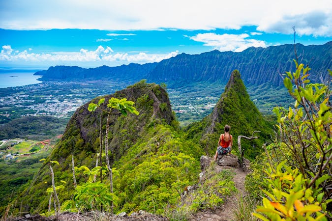
Hiking Difficult

This is a popular hiking route which is generally considered to be difficult. It's not remote, it features low exposure and is typically done all year round. From a low point of 137 m to the maximum altitude of 210 m, the route covers 1.4 km, 73 vertical metres of ascent and 73 vertical metres of descent.

Short walk with small but pretty falls as the destination.
Difficult
Hiking trails where obstacles such as rocks or roots are prevalent. Some obstacles can require care to step over or around. At times, the trail can be worn and eroded. The grade of the trail is generally quite steep, and can often lead to strenuous hiking.

The path is on completely flat land and potential injury is limited to falling over.
Close to help in case of emergency.
4.7 km away
A mellow hike to a beautiful 100-foot-tall waterfall.
Moderate Hiking
7.6 km away
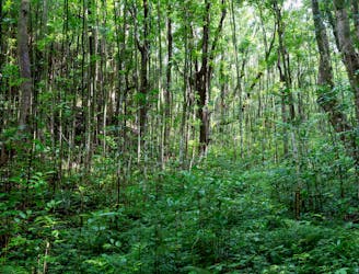
The Makiki Valley Loop
Difficult Hiking
7.8 km away
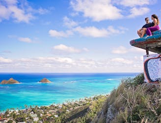
This short, popular hike leads to two historic pillboxes, which offer spectacular views of the beach and the ocean beyond.
Moderate Hiking
16 routes · Hiking