4.6 km away
Lanikai Pillbox
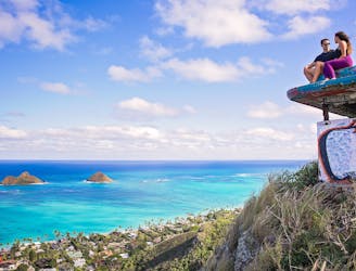
This short, popular hike leads to two historic pillboxes, which offer spectacular views of the beach and the ocean beyond.
Moderate Hiking
- Distance
- 2.6 km
- Ascent
- 176 m
- Descent
- 176 m
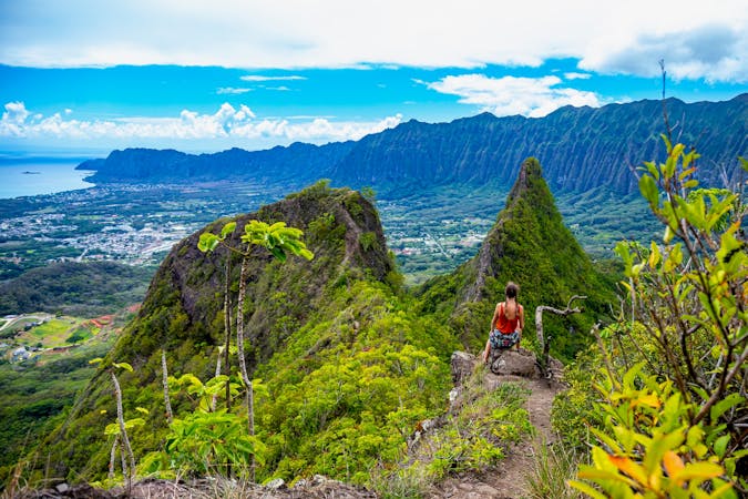
A steep, technical climb to the summit of Mount Olomana.
Hiking Extreme

Mount Olomana is a beautiful three-peaked mountain on the southeast corner of Oahu, providing a popular climb on the island. The first and highest peak is the eponymous Olomana, with the subsequent two peaks named Paku'i and Ahiki.
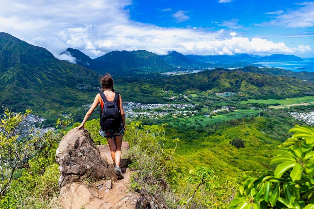
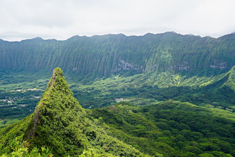
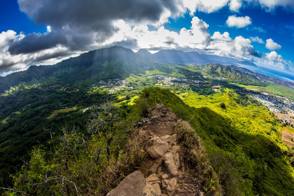
Even though these vaulted summits are extremely aesthetic and attractive destinations, this is not an easy hike. This hike requires up to class 4 scrambling, including a 15-foot vertical section of rock. You can also expect to encounter cables, ropes, slick roots, and rocks that will be wet and muddy at times. Do not underestimate this hike.
The route shown here ends at the top of Ahiki at the end of the ridge, but it's also possible to simply turn around at the summit of Olomana without doing the ridge traverse each way. That will shorten the hike and make it a bit easier.
Extreme
Scrambling up mountains and along technical trails with moderate fall exposure. Handholds are necessary to navigate the trail in its entirety, although they are not necessary at all times. Some obstacles can be very large and difficult to navigate, and the grades can often be near-vertical. The challenge of the trail and the steepness of the grade results in very strenuous hiking. Hikes of this difficulty blur the lines between "hiking" and "climbing".

Some trail sections have exposed ledges or steep ascents/descents where falling could cause serious injury.
Little chance of being seen or helped in case of an accident.
4.6 km away
This short, popular hike leads to two historic pillboxes, which offer spectacular views of the beach and the ocean beyond.
Moderate Hiking
6.5 km away
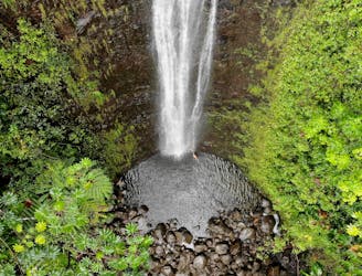
A mellow hike to a beautiful 100-foot-tall waterfall.
Moderate Hiking
9.9 km away
The Makiki Valley Loop
Difficult Hiking
16 routes · Hiking