1.5 km away
Farley and Edith Lakes

Day hike or overnight backpacking trip to a less-visited alpine lake in the Sawtooths.
Moderate Hiking
- Distance
- 19 km
- Ascent
- 547 m
- Descent
- 547 m
A spectacular backpacking trip of two or more days, among several lakes and peaks of the Sawtooth Wilderness.
Hiking Difficult

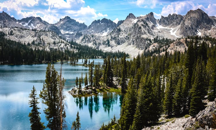
This loop to Alice and Toxaway lakes is one of the best weekend backpacking trips in the Sawtooths. It features two huge alpine lakes plus numerous smaller ones, all surrounded by impressive granite peaks and montane forest. The mileage makes it doable as an overnight trip or even as a long day hike, but the typical itinerary calls for 3 days. Alice Lake makes an ideal first night’s camp, and Toxaway the second night. However, connecting trails leave ample room for creativity in your route. Backpacking in the Sawtooths does not require a reservation or designated campsites, simply a free permit to fill out at the trailhead. But you should know the wilderness regulations in advance so that you can prepare accordingly.
To begin the Alice-Toxaway loop, you’ll park at the Tin Cup trailhead at Pettit Lake. The trail leads through sunny forest on a slope above the shore, then moves into denser woodland beyond the lake and enters the wilderness area. As the trail proceeds into a dramatic canyon, clearings grant occasional views to granite peaks above. Eventually it steepens into switchbacks on a broad apron of boulders, with epic views of the deep valley and jagged horizons. The trail continues ever upward and into a higher valley by crossing a rock-blasted traverse and a bridge above a waterfall. A look over your shoulder reveals the Salmon River plain now far below, and the White Cloud Mountains beyond.
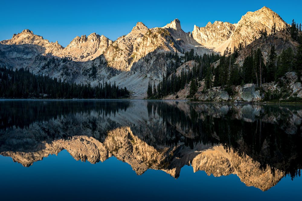
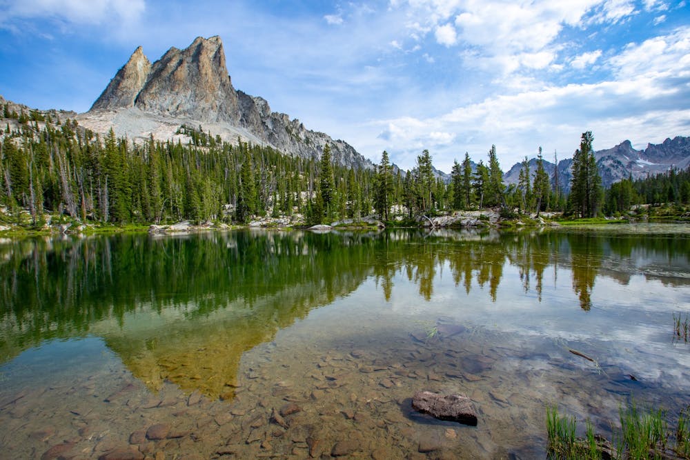
The trail continues on a zigzagging incline through scattered conifers, talus fields, and alpine meadows. Eventually you’ll reach a string of ponds and the impressive view of El Capitan piercing the sky. This pointed rock face dominates the background for the next mile, even as the trail finds beautiful Alice Lake and traces the shore. The first good camp spots can be found above outcrops overlooking the water. More can be found near the far end of the lake, and from there the trail turns uphill once more.
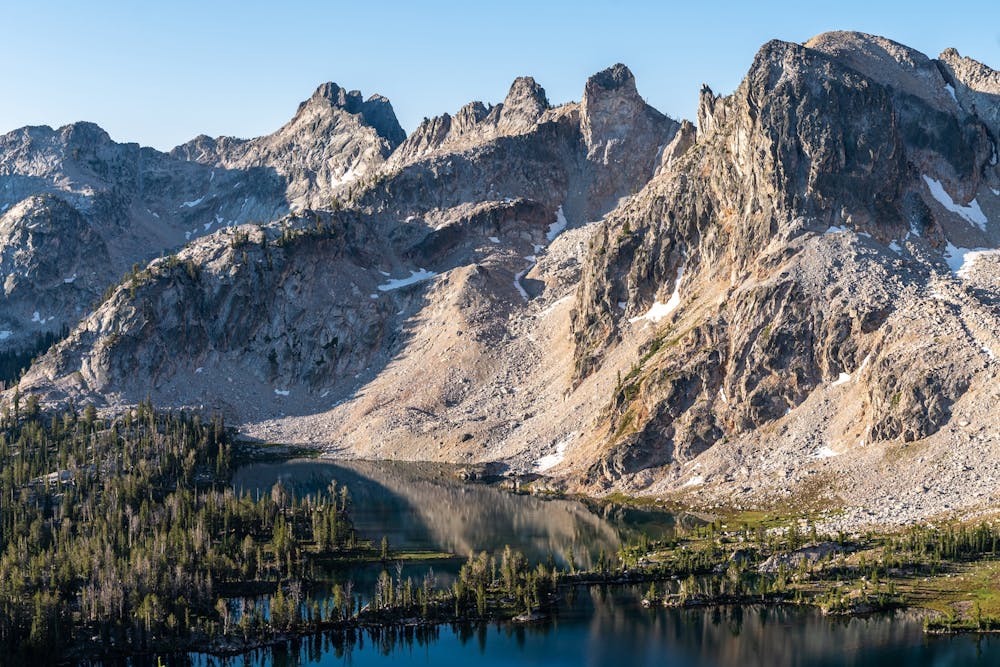
Less than a mile further is a 3-way junction, where you have the option to descend to Twin Lakes. The shorter version of the loop (mapped here) stays high, traversing barren slopes to the pass above. If you go to Twin Lakes you’ll find prime camping and fishing with fewer people around, so it could be worth the slight detour.
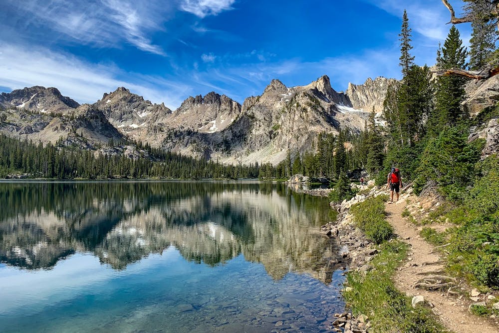
Once up at Snowyside Pass, you’ll get a stunning view of Twin Lakes on one side and smaller unnamed ponds on the other. The trail descends quickly to the ponds, entering this next basin’s patchwork of green, gray, and blue with wildflowers adding color everywhere. Eventually reaching Toxaway Lake, you’ll find even bigger and bluer water than in Alice Lake.
The main trail remains above this lake and mostly in the forest, but side trails descend to the water where campsites can be found. You may have to do some searching to find an ideal spot. Beyond Toxaway, the trail continues a downhill meander through the forest with scenic treats in smaller lakes, waterfalls, and creek crossings sprinkled throughout.
The next larger lake is Farley, which the trail again traverses above, but side trails lead to camp spots below. Past Farley Lake the trail travels three more miles through denser forest before reaching the junction for the Pettit Lake Cutoff. To complete the loop, you’ll follow this uphill for about a mile, then drop down to the starting point at Tin Cup trailhead.
Sources: https://www.fs.usda.gov/recarea/sawtooth/recarea/?recid=5958 http://cherylhill.net/blog/2019/09/08/backpacking-the-alice-toxaway-loop/
Difficult
Hiking trails where obstacles such as rocks or roots are prevalent. Some obstacles can require care to step over or around. At times, the trail can be worn and eroded. The grade of the trail is generally quite steep, and can often lead to strenuous hiking.

The trail contains some obstacles such as outcroppings and rock which could cause injury.

Little chance of being seen or helped in case of an accident.
1.5 km away
Day hike or overnight backpacking trip to a less-visited alpine lake in the Sawtooths.
Moderate Hiking
8 routes · Hiking