1.5 km away
Alice-Toxaway Loop
A spectacular backpacking trip of two or more days, among several lakes and peaks of the Sawtooth Wilderness.
Difficult Hiking
- Distance
- 30 km
- Ascent
- 975 m
- Descent
- 975 m
Day hike or overnight backpacking trip to a less-visited alpine lake in the Sawtooths.
Hiking Moderate

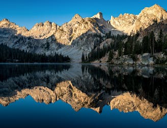
Edith Lake is a blue-green gem tucked into a high cirque within the Sawtooths, and Farley Lake holds forested shores with excellent camping along the way. At about 12 miles out and back, this can make a long day hike or an easy overnighter. Camping is not allowed at Edith Lake, but you could set camp at Farley and shed the heavy packs for the climb up to Edith. Be sure familiarize yourself with Sawtooth Wilderness regulations for hiking and camping before you go.
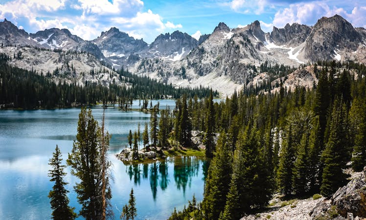
Beginning at Yellow Belly Lake trailhead (clearance and 4WD recommended), the path meanders gradually uphill for about 3 miles through dense forest. Mountain views are limited at first, but clearings reveal the peaks growing taller overhead. Eventually the trail steepens and crosses some rockslides that grant very enticing views, and soon enough Farley Lake appears.
The main trail remains on a traverse above the lake, but side trails lead down to camp spots by the shore It’s only about 3.5 miles from the trailhead to the first opportunities for camping. There are no designated sites, just look for any established clearing at take care to minimize your impact.
Beyond Farley Lake the trail continues upward, through a mosaic of shady forest, flowery meadows, and streaks of jumbled granite. You may encounter unabridged stream crossings as well as rugged sections of trail that take care to negotiate. About 1.5 miles from Farley Lake is the junction for Edith Lake, and the main trail continues toward Toxaway Lake.
Turn sharply uphill to begin the ascent to Edith. It’s less than a mile and about 500 feet of climbing from here, with tumbling creeks and expanding views to distract from the exertion. Once at the lake you’ll find an idyllic against the backdrop of a pointed Sawtooth peak. It’s the perfect place to linger for a picnic, fishing, or even a cold dip before turning and retracing the trail.
Sources: http://cherylhill.net/blog/2019/09/08/backpacking-the-alice-toxaway-loop/ https://www.evansoutdooradventures.com/?p=7926
Moderate
Hiking along trails with some uneven terrain and small hills. Small rocks and roots may be present.

The trail contains some obstacles such as outcroppings and rock which could cause injury.

Little chance of being seen or helped in case of an accident.
1.5 km away
A spectacular backpacking trip of two or more days, among several lakes and peaks of the Sawtooth Wilderness.
Difficult Hiking
8 routes · Hiking