2.7 km away
White Clouds Loop

Beginner-friendly trails with easy access, and a local go-to for early season rides.
Easy Mountain Biking
- Distance
- 6.5 km
- Ascent
- 129 m
- Descent
- 129 m
The medium-length—and most popular—variant of the Adam's Gulch Loop.
Mountain Biking Difficult

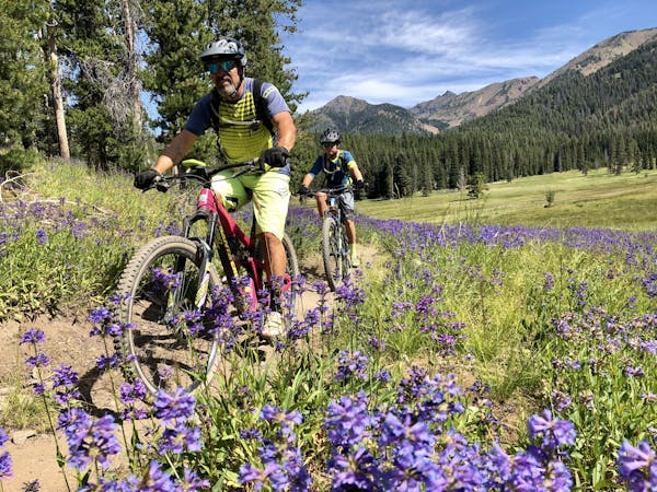
"Adams Gulch has plenty on tap for you though if you’re thirsty for. . .fun,” writes larserik on VisitSunValley.com. “If you harbor any phobias of wildflowers or stunning views, then you should probably stay away,” he continues.
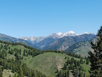
Like most trails in Sun Valley, this ride passes through an old wildfire zone. "The Eve Gulch portion of the drainage was severely burned during the Castle Rock Fire, and much of the trail was rerouted by the Ketchum Ranger District late in the summer of 2009,” according to the BCRD. Consequently, this portion of the ride can be hot and sunny… but the views are incredible!
In other areas, the Adam’s Gulch loop does drop into some deep stands of pine trees, which are surprisingly rare in the Sun Valley region. Savor the shade when you find it!
Completing this loop as mapped requires about 1,500 feet of climbing. For some riders, this may feel stiff, but if it’s not enough for you, continue further up the mountain to ride the full Adam’s Gulch Loop!
The trail itself is generally classic Sun Valley loose-over-hardpacked and like most Sun Valley trails, it’s fast and flowy almost the entire way! That said, some sections exceed. Keep your eyes out for a few challenging rock gardens and steep pitches.
Sources disagree on what difficulty ranking to assign to this trail. Depending on the source you read, the assigned difficulty ranges from blue (intermediate) all the way up to double black diamond (expert). Blue/black is most likely an accurate rating.
Sources: https://www.visitsunvalley.com/summer/sun-valley-idaho-your-next-mountain-biking-bucket-list-destination/ https://www.youtube.com/watch?v=y1x0KXh4rw8 https://summertrailink.bcrd.org/trail146oldadamsgulchroadtrailandevegulchtrail.php
Difficult
Mostly stable trail tread with some variability featuring larger and more unavoidable obstacles that may include, but not be limited to: bigger stones, roots, steps, and narrow curves. Compared to lower intermediate, technical difficulty is more advanced and grades of slopes are steeper. Ideal for upper intermediate riders.

The trail contains some obstacles such as outcroppings and rock which could cause injury.
Away from help but easily accessed.
2.7 km away
Beginner-friendly trails with easy access, and a local go-to for early season rides.
Easy Mountain Biking
5.9 km away
A stellar loop of hilly singletrack, with views over the valley and big mountains all around.
Moderate Mountain Biking
5 routes · Mountain Biking
13 routes · Alpine Climbing · Mountain Biking · Gravel Biking · Hiking · Road Biking · Sailing · Trail Running