5 routes · Mountain Biking
A perfect XC loop of flowy, smooth singletrack.
Mountain Biking Easy

While Greenhorn Gulch to Imperial Gulch may be a beginner-level loop when it comes to trail technicality, this short loop packs a wallop—over 1,700 feet of climbing in its less than 11-mile length!
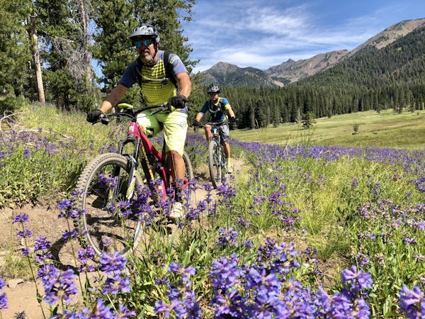
Tough climbs aside, this short loop is a classic for a reason. The sinuous singletrack sweeps through beautiful mountainside meadows, affording incredible views of the surrounding mountain ranges. A fast, flowy descent drops off the side of the ridge, dropping fast and furious back down to the trailhead.
When combined with other trails in the area, this loop is a cross country rider’s—flowy, fun singletrack, tough climbs, and almost no technical obstacles. Thanks to several trail junctions, cross country riders can choose to head deep into the mountains from this same trailhead.
Easy
Mostly smooth and non-technical singletrack with unavoidable obstacles 2in/5cm tall or less. Avoidable obstacles may be present. Ideal for beginner riders.

The trail contains some obstacles such as outcroppings and rock which could cause injury.
Away from help but easily accessed.
5 routes · Mountain Biking