3.8 km away
Around the Mountain
Scenic circuit around Bogus Basin, on quality singletrack through montane forest.
Moderate Trail Running
- Distance
- 15 km
- Ascent
- 426 m
- Descent
- 426 m
A scenic romp through mountainside meadows and montane forest, with bonus views from the iconic Stack Rock formation.
Trail Running Moderate

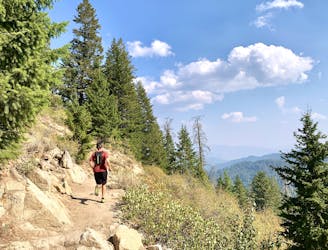
This popular Boise hike also makes for an excellent run, especially when the lower elevations get too hot. The trail signed as “Freddy’s Stack Rock” makes a stem and loop from Bogus Basin Road, traversing the mountainside then circling the ridgetop with the famous rock formation. The first couple of miles are high-quality singletrack, on a scenic ride through mountainside meadows and pockets of forest, with rocky sections here and there. The trail changes character after meeting a multi-way junction. There it dives into conifer forest, on an old road that’s wider and flatter. A bit farther on, another junction makes the start of the loop. Go left if you want to get the climbing out of the way, and get to Stack Rock sooner.
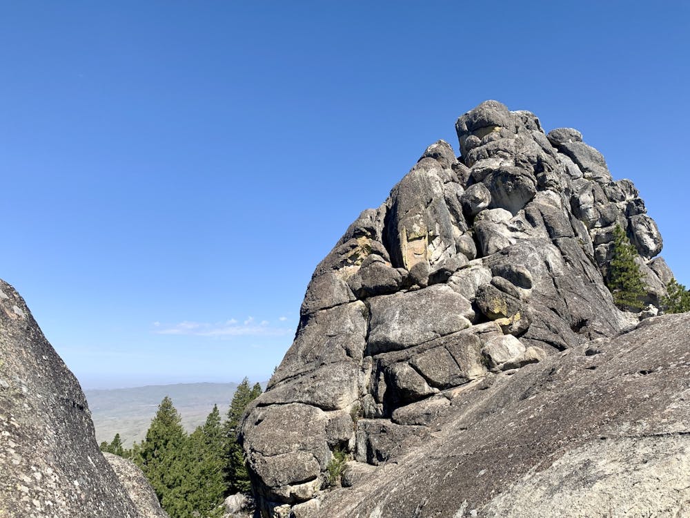
At the top of this hill is the short spur to Stack Rock, which you won’t want to miss. From the base of this huge chunk of granite, you’ll get impressive views over the valley and surrounding mountains. Scramble up one of the outcrops for an even better vantage. Back on the trail, the loop continues beneath the sheer west face of the formation, then returns to singletrack for a swooping descent through leafy forest. This soon joins another roadbed, which takes you back to the stem of the loop.
Sources: https://www.ridgetorivers.org/ https://www.cityofboise.org/departments/parks-and-recreation/parks/stack-rock-reserve/
Moderate

The trail contains some obstacles such as outcroppings and rock which could cause injury.
Away from help but easily accessed.
3.8 km away
Scenic circuit around Bogus Basin, on quality singletrack through montane forest.
Moderate Trail Running
8.4 km away
One of Boise's best local trail run loops.
Moderate Trail Running
10 routes · Trail Running