
58 routes · Hiking
A long segment of the AT that's perfect for backpacking, but still providing a couple of shorter day hikes along the way.
Hiking Difficult
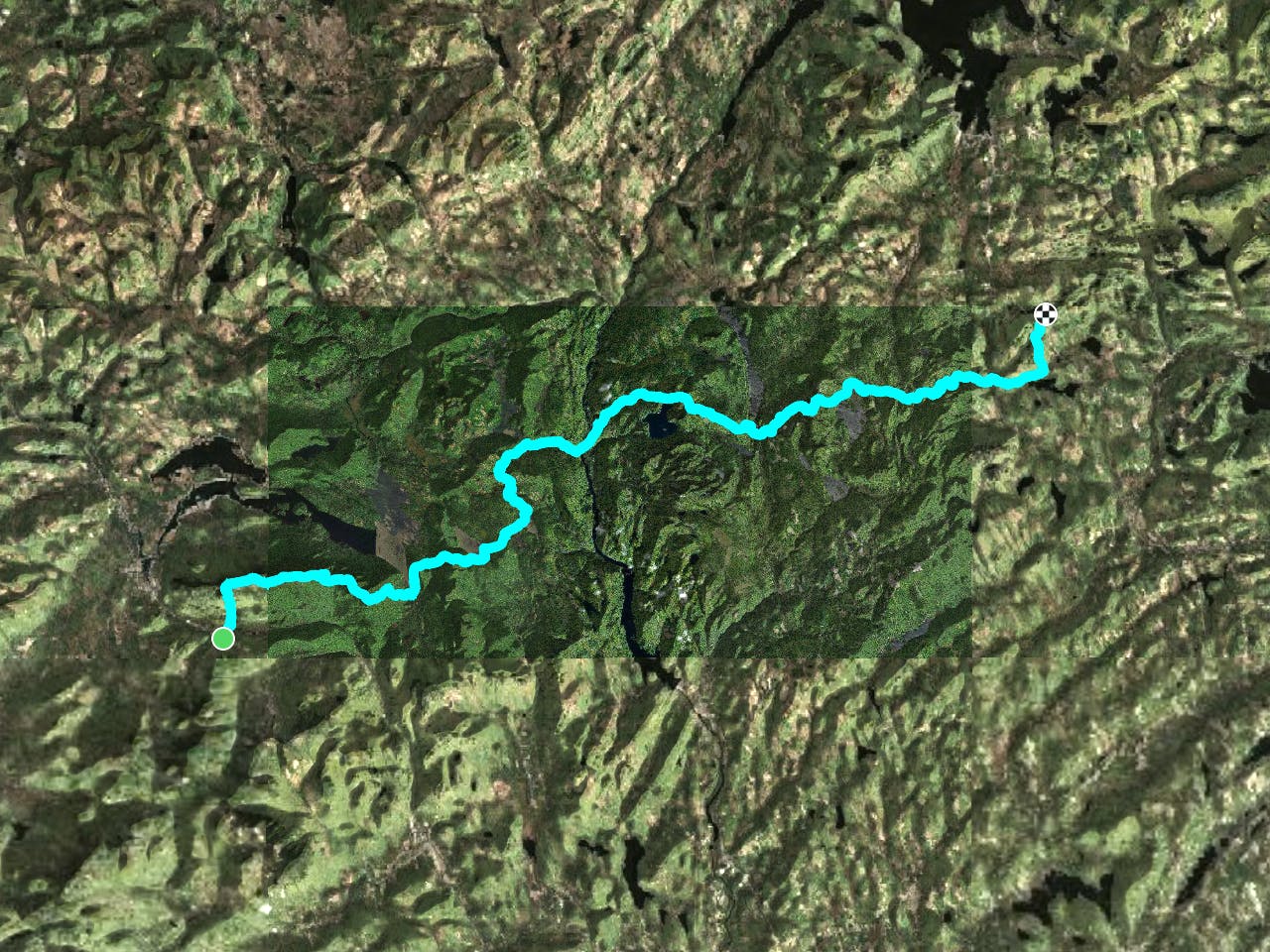
This long stretch of the Appalachian Trail is an excellent backpacking route, with a few options for day hiking along the way. The infamous 100-Mile Wilderness lies ahead of this segment and provides some extremely remote settings. If thru-hiking, use this stretch to ensure you're ready for what's ahead.
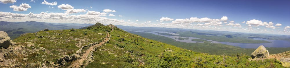
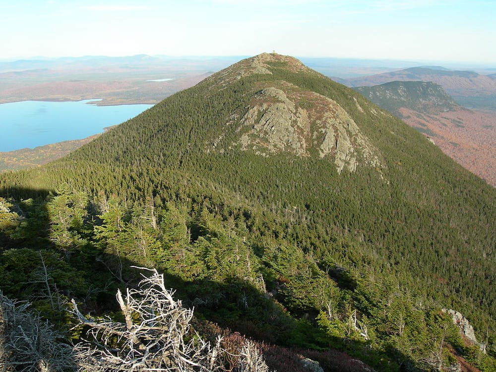
Between Carrabassett Road and East Flagstaff Road, the AT runs across the top of Mount Bigelow, arguably the highlight of this segment. According to Wikipedia, "the mountain is named after Major Timothy Bigelow who climbed the rugged summit in late October 1775 'for the purpose of observation.'3 Major Bigelow was one of Colonel Benedict Arnold's four division commanders during the 1775 Invasion of Canada. The expeditionary force passed along the Dead River on the northern edge of the Bigelow Range, now dammed into Flagstaff Lake."
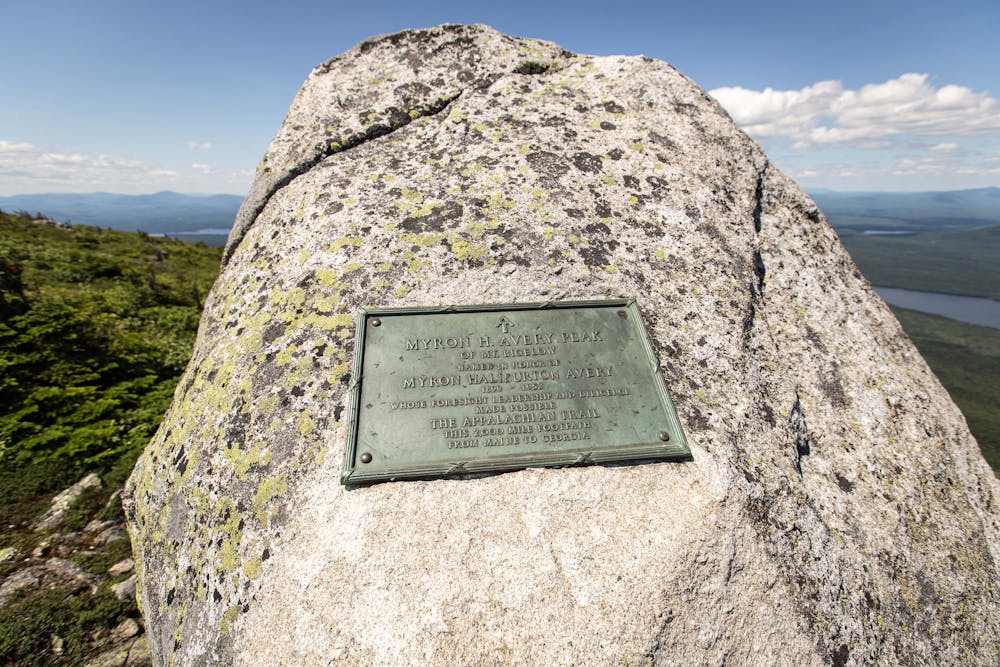
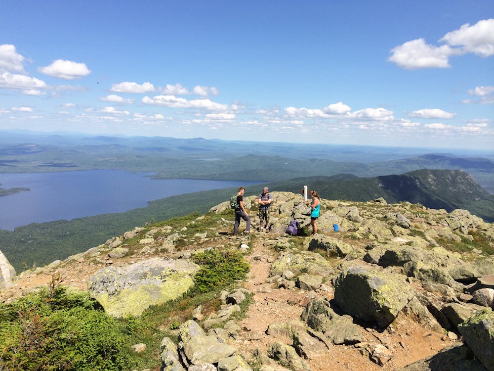
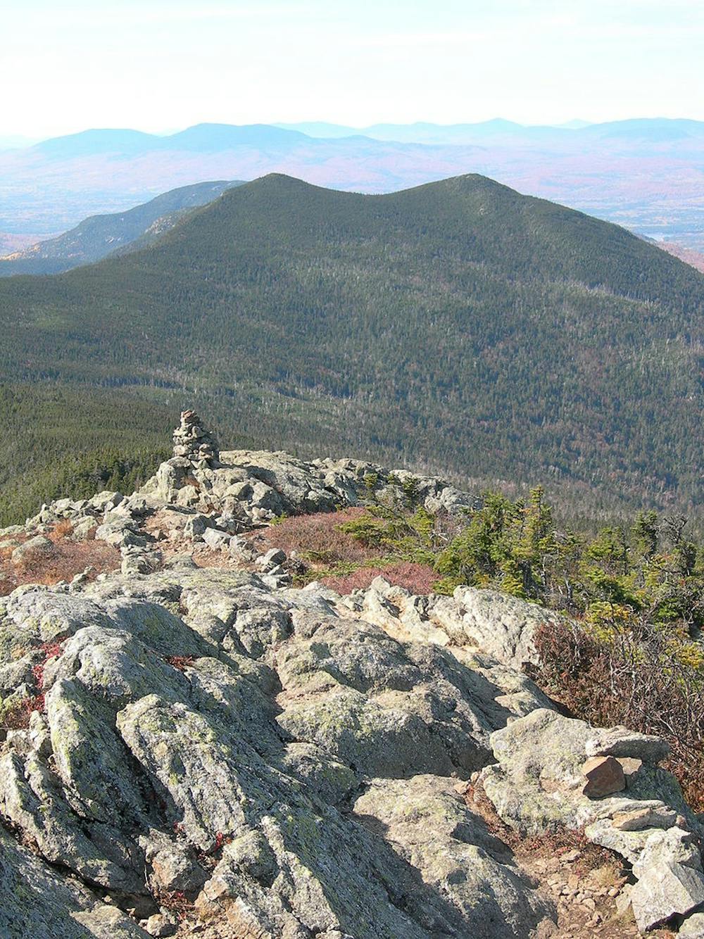
The West Peak is the highest on the mountain, with several accompanying subpeaks. Myron H. Avery Peak arguably offers some of the best views along the ridge.
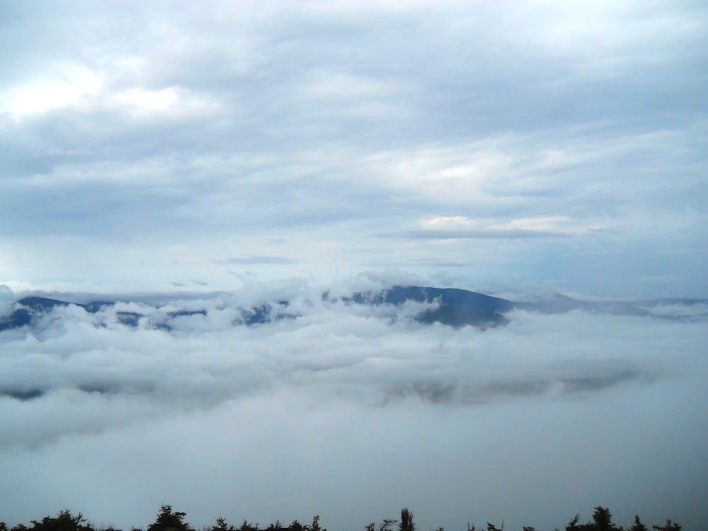
Further north, the trail skirts around the southeast corner of Flagstaff Lake and intersects Flagstaff Road. Passing over Roundtop Mountain, the trail reaches West Carry Pond.
Lean-to shelters lie along the shore of both West Carry Pond and the upcoming Pierce Pond before continuing toward Caratunk.
A unique obstacle lies ahead: the Kennebec River crossing. The official—and safest—way to cross the river is via the seasonal ferry, not by fording. Most importantly, the ferry claims to be solely available to AT thru-hikers and closed to the general public. For more information and for the ferry schedule, visit https://www.matc.org/for-hikers/kennebec-river-ferry/.
On the other side of the river, you will reach a small trailhead along the road. Follow the white blazes north to begin the second half of this segment.
On the north side of Pleasant Pond, look for a lean-to shelter before summiting Pleasant Pond Mountain. The climb is quite deceiving and challenging, despite its relatively low summit below 2,500 feet.
After crossing Trestle Road, the picturesque Bald Mountain and an adjacent pond come next, offering spectacular, serene views from its rocky, exposed summit.
Rounding out the northern portion of this segment, the trail reaches a river and follows it until it drains into Piscataquis River. Look for another lean-to along this stretch for an overnight option.
One final push will have you over Buck Hill before reaching the state highway. This trailhead serves as the beginning of the 100-Mile Wilderness. For any supplies, make your way south into Monson.
Sources: https://www.matc.org/for-hikers/kennebec-river-ferry/ https://en.wikipedia.org/wiki/MountBigelow(Maine)
Difficult
Hiking trails where obstacles such as rocks or roots are prevalent. Some obstacles can require care to step over or around. At times, the trail can be worn and eroded. The grade of the trail is generally quite steep, and can often lead to strenuous hiking.

The trail contains some obstacles such as outcroppings and rock which could cause injury.
Away from help but easily accessed.
58 routes · Hiking