1 m away
Greenstone Ridge Trail
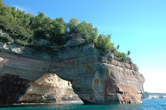
An epic 40+ mile traverse along the backbone of Isle Royale NP.
Difficult Trail Running
- Distance
- 65 km
- Ascent
- 1.3 km
- Descent
- 1.3 km
A challenging alternative to the GRT following an old fire line often blazed by nothing more than rock cairns.
Trail Running Difficult

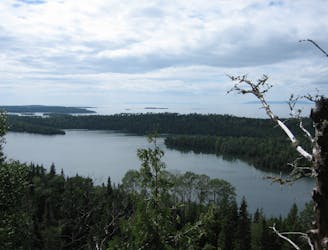
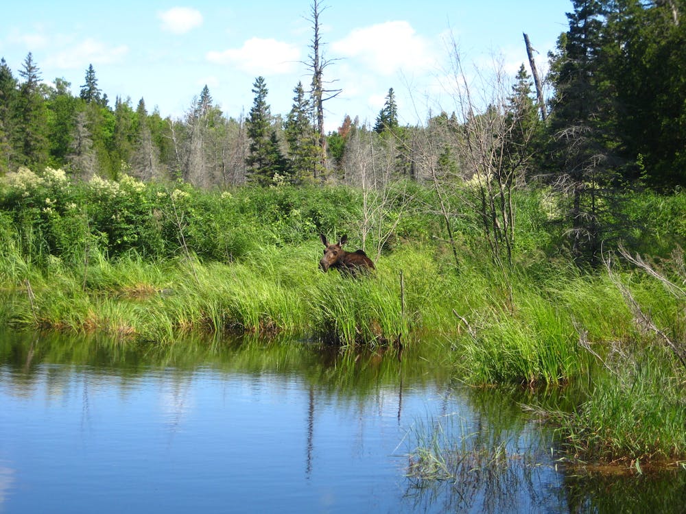
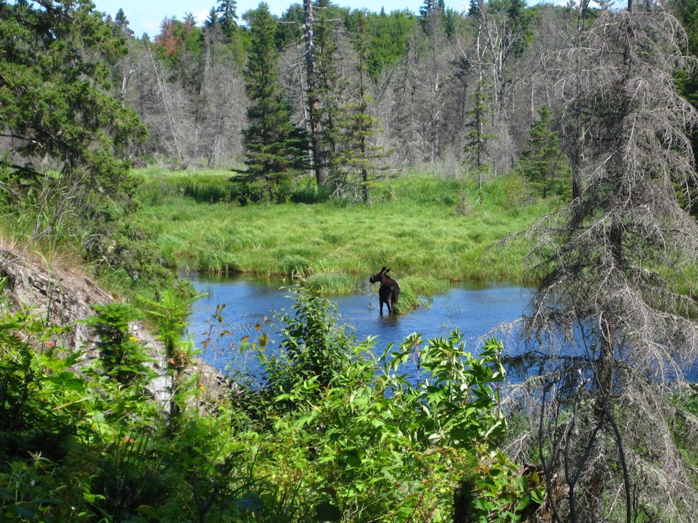
The Minong Ridge Trail is "not only the most challenging stretch of the Isle Royale's 161-mile trail system, but arguably the hardest hike in Michigan," this source proclaims! Paralleling the iconic the Greenstone Ridge Trail, Minong Ridge is a great option for any ambitious trail runner seeking 26+ miles of solidarity, epic views, wildlife, and nothing more than rock cairns to guide you along the ridge.
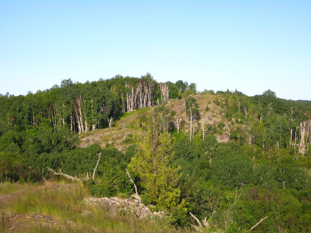
Passing through remote and rugged backcountry, backpackers first began hiking the trail after it "was cut in the mid-1960's as a 'fire manway,' a route firefighters could use to access the isolated northern half of the island." It quickly gained popularity among hikers, which led the park to "maintain the route as a primitive trail with as few markers, bridges, and boardwalks as possible." That alone, the author continues, is "the appeal and the challenge of Minong Ridge."
For ambitious trail runners seeking a single-day attempt at the near-marathon route, the largest hurdle for planning is logistics. Not only is Isle Royale only accessible by private boat, ferry, or seaplane, the eastern terminus for Minong Ridge is a remote campground far from a visitor center. Transportation between the campground and Rock Harbor must be arranged, though it's up to you on which direction you run the trail. One solution could be to camp at the cove before or after your run, with a friend or family member responsible for transporting the gear to/from Rock Harbor.
Another alternative is to continue on either Chickenbone or Indian Portage Trail to Greenstone Ridge. This allows runners the option to continue to Rock Harbor by land, though the additional mileage and added difficulty of the route should not be underestimated. Done this way, overnight gear would be wise in case you have to spend the night on the trail for any reason. Keep in mind, a similar route takes hikers upwards of 5 days to complete.
Difficult

Some trail sections have exposed ledges or steep ascents/descents where falling could cause serious injury.
Little chance of being seen or helped in case of an accident.
1 m away
An epic 40+ mile traverse along the backbone of Isle Royale NP.
Difficult Trail Running
6 routes · Trail Running