9.2 km away
Granite Peak: Huckleberry Creek Route
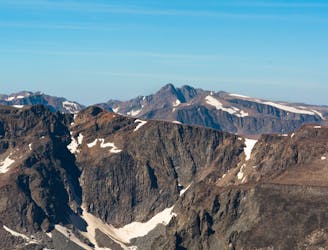
One of the most technical state high points in the USA.
Extreme Hiking
- Distance
- 33 km
- Ascent
- 2.4 km
- Descent
- 2.4 km
Beartooth Wilderness loop starting and ending at East Rosebud Lake
Hiking Severe

This is a popular hiking route which is generally considered to be severe. It's very remote, it features high exposure and is typically done between June and September. From a low point of 1.9 km to the maximum altitude of 3.4 km, the route covers 116 km, 4849 vertical metres of ascent and 4849 vertical metres of descent.
Beautiful and scenic hike through the east-end of the Absaroka Beartooth Wilderness which contains an off-trail connection
Severe
Hiking challenging trails where simple scrambling, with the occasional use of the hands, is a distinct possibility. The trails are often filled with all manner of obstacles both small and large, and the hills are very steep. Obstacles and challenges are often unexpected and can be unpredictable.

Some trail sections have exposed ledges or steep ascents/descents where falling could cause serious injury.
Little chance of being seen or helped in case of an accident.
9.2 km away
One of the most technical state high points in the USA.
Extreme Hiking