
40 routes · Hiking
The trek through the Anaconda Pintler Wilderness Area, a jewel of the Northern Rockies.
Hiking Difficult

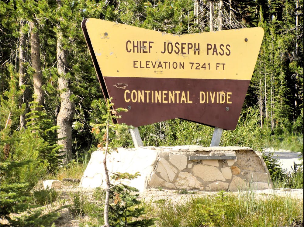
This segment of the Continental Divide Trail begins at Chief Joseph Pass on Montana Highway 43. Overnight and trailer parking are both available, though there are no water or restrooms immediately available. The trailhead also offers access to Lemhi County, a non-traditional Gateway Community, Salmon is both "the county seat and only incorporated town in Lemhi County," the CDT Coalition notes.
While agriculture, mining, and the railroad brought settlers to the area, the valley was once inhabited by the Shoshone tribe. If the name sticks out from history class, it's because the most famous member of the tribe was Sacajawea, "a translator for the iconic Lewis and Clark voyage," the article continues.
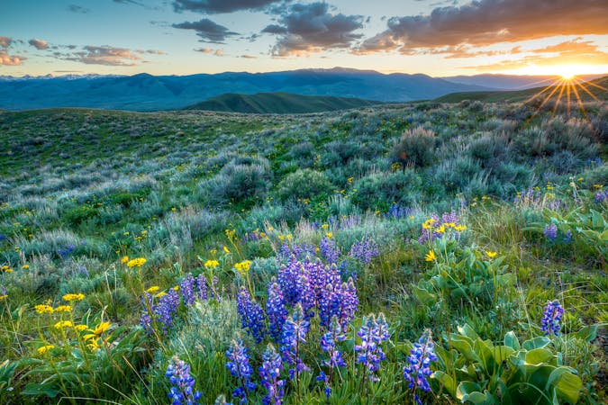
This section begins with a gradual climb from the trailhead then enters the Anaconda Pintler Wilderness Area for almost its entirety. Considered "one of the jewels of the Northern Rockies," by this source, "the ~160,000-acre wilderness area "straddles the Continental Divide along the crest of the Anaconda Range and is positioned between the Bitterroot Valley to the northwest and the Big Hole Valley to the south." As with most of the Rockies, you may encounter "mule deer, elk, moose, mountain goat, bighorn sheep, wolverine, gray wolf, puma, black bear, and the odd grizzly bear," the source notes.
When it comes to the terrain, expect sagebrush hillsides at the lower elevations, fir and pine in the subalpine terrain, and mountaintops partially shrouded with quaking aspen, pine, and alpine larch. Many of the highest peaks are also exposed and rocky, though the trail tends to stay below the peaks - rather than summiting every peak along the way. A series of small glacial lakes also line most of the trail, making water readily accessible as long as you treat or filter it first.
Exiting the wilderness, this segment ends at Seymour Creek Campground where you'll find 17 campsites at a modest 6,700-feet above sea level. Overnight parking, restrooms, and drinking water are available whether you're camping or just passing through.
Sources: https://continentaldividetrail.org/cdt-gateway-communities/lemhi-county https://wilderness.net/visit-wilderness/?ID=10
Difficult
Hiking trails where obstacles such as rocks or roots are prevalent. Some obstacles can require care to step over or around. At times, the trail can be worn and eroded. The grade of the trail is generally quite steep, and can often lead to strenuous hiking.

Some trail sections have exposed ledges or steep ascents/descents where falling could cause serious injury.

In the high mountains or remote conditions, all individuals must be completely autonomous in every situation.
40 routes · Hiking
13 routes · Hiking