31 m away
Piegan Pass
A relatively uncrowded trail that provides fantastic views.
Difficult Hiking
- Distance
- 15 km
- Ascent
- 589 m
- Descent
- 589 m
An amazing point-to-point trek over and above a stunning pass.
Hiking Difficult

This 11.3-mile point-to-point trek begins at the Siyeh Bend parking area. The best way to do this hike is to take the free park shuttle to Siyeh Bend, then catch it again when the route ends at Sunrift Gorge. Alternatively, one can park at Siyeh Bend and return from Sunrift Gorge via the shuttle.
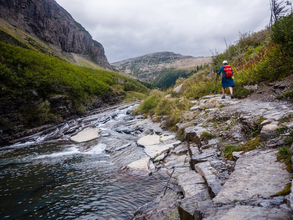
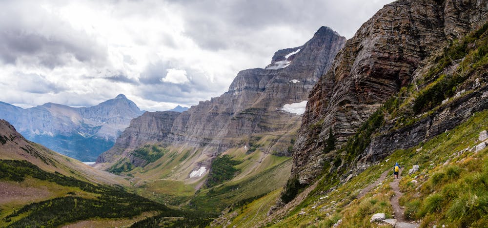
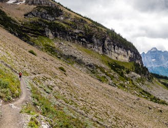
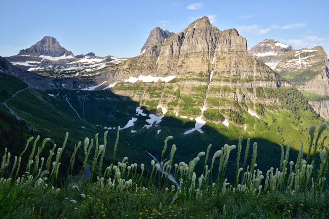
The route begins on the Piegan Pass Trail alongside pretty Siyeh Creek, then ascends into the woods for the next couple miles. There are occasional openings that allow for peeks at impressive glaciers high up on sheer cliffs.
At about 2.7 miles, the signed intersection of the Piegan Pass and Siyeh Pass Trails appears. This route heads right toward Siyeh Pass, with a stroll through lovely Preston Park that provides some stunning views of the incipient climb. After crossing a small creek, the switchbacks begin in earnest. If it is windy or looking like it might rain, it is best to add layers before leaving what remains of any protection from the elements!
In the fall, the wind and rain can be quite extreme, so be sure to always carry the 10 essentials, with plenty of extra layers and good rain gear. Fortunately, the storm systems move out as quickly as they move in, but they can move in and out repeatedly all day long!
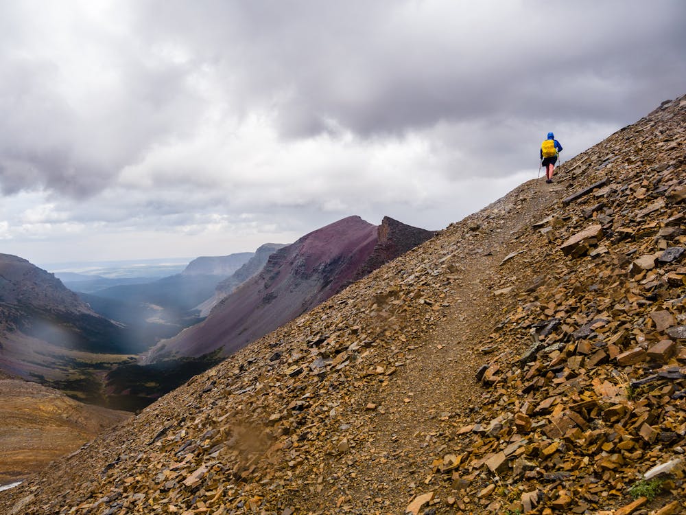
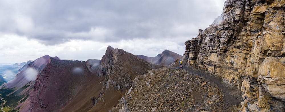
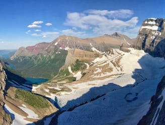
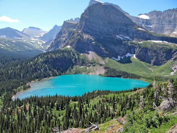
As the switchbacks continue and it looks like the pass must be close, it turns out that the actual “pass” is just a huge, broad plateau and the true destination is still 900' higher up. It is absolutely well worth the extra climb as the trail wraps around Matahpi Peak; the views from the top are positively spectacular. Some hikers turn around and return via the same route they ascended, but the far better choice is to continue over to descend via Sunrift Gorge.
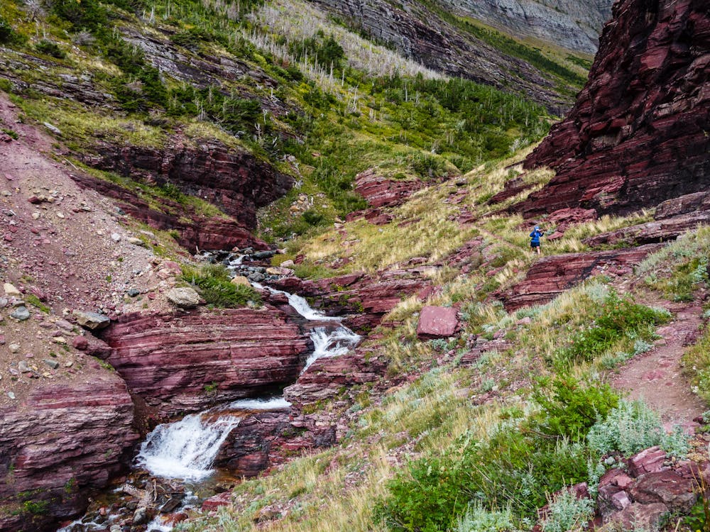
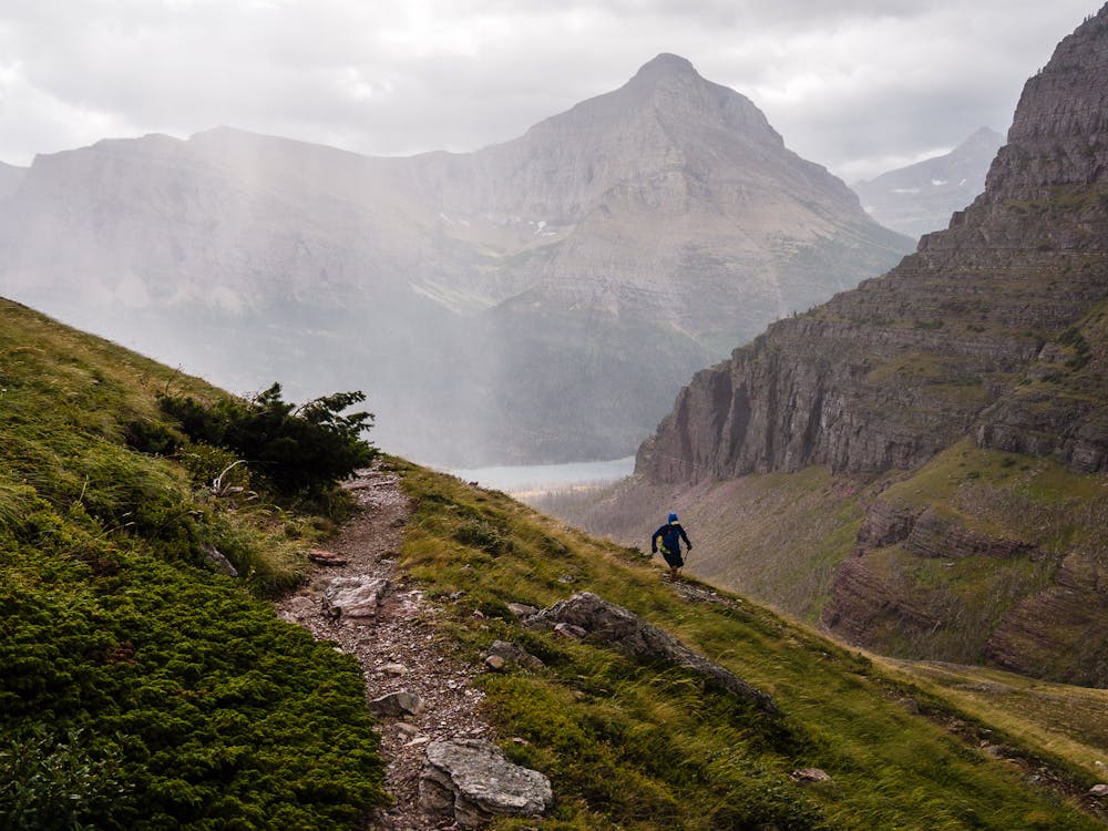
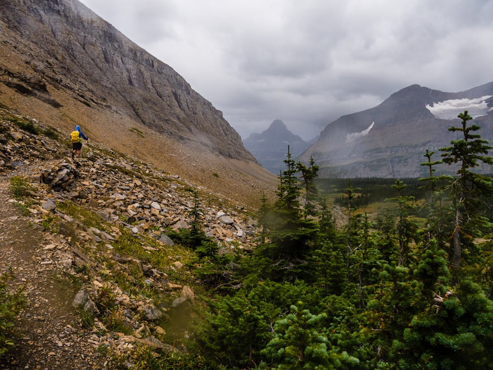
The descent into Baring Valley is breathtaking and is guaranteed to keep hikers captivated by jaw-dropping scenery. Sexton Glacier and the beautiful Baring Creek Valley, when lit up by glorious sunshine, is an unforgettable sight. From the highpoint, the trail switchbacks seemingly forever as it descends steadily into the valley below.
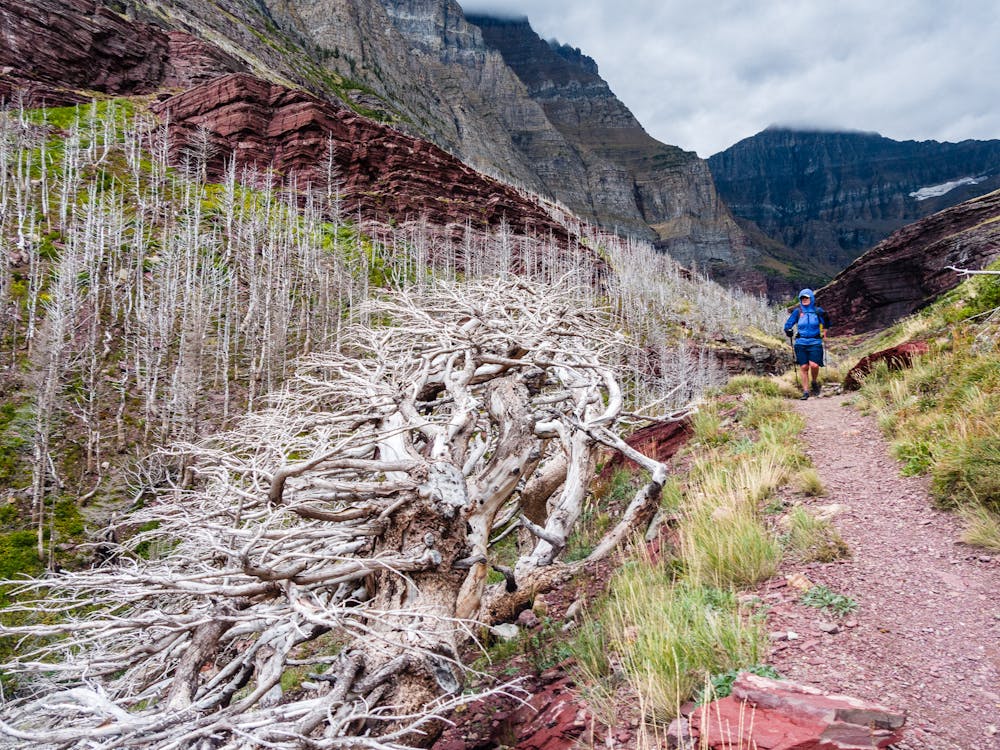
Much lower down, the trail traverses the side of a steep slope before dropping down into the protection of Sunrift Gorge. Look for the "krummholtz" along the way. "Krummholz or krumholtz (German: krumm, "crooked, bent, twisted" and Holz, "wood") — also called knieholz ("knee timber") — is a type of stunted, deformed vegetation encountered in subarctic and subalpine tree line landscapes, shaped by continual exposure to fierce, freezing winds," according to Wikipedia. These stunted trees are spooky evidence that the high winds experienced on this hike must be common!
In the fall, the final bit of the hike rewards hikers with beautiful fall-colored leaves and enticing views of St Mary Lake.
Difficult
Hiking trails where obstacles such as rocks or roots are prevalent. Some obstacles can require care to step over or around. At times, the trail can be worn and eroded. The grade of the trail is generally quite steep, and can often lead to strenuous hiking.

Some trail sections have exposed ledges or steep ascents/descents where falling could cause serious injury.

Away from help but easily accessed.
31 m away
A relatively uncrowded trail that provides fantastic views.
Difficult Hiking
3.8 km away
Simply put: One of the best day hikes in the world.
Difficult Hiking
3.8 km away
An iconic Glacier National Park trek.
Difficult Hiking
3.8 km away
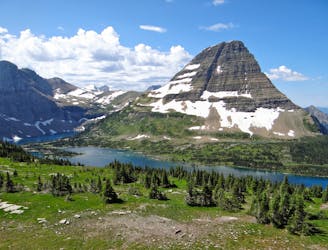
Easygoing hike to beautiful Hidden Lake.
Moderate Hiking
5.9 km away
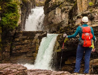
Three gorgeous waterfalls within a 5-mile loop.
Easy Hiking
11 routes · Hiking
6 routes · Hiking

25 routes · Alpine Climbing · Hiking
5 routes · Alpine Climbing · Hiking

63 routes · Alpine Climbing · Hiking