2nd Pinnacle
South Bridgers
The main line through the Pinnacle zone
Ski Touring Severe
- Distance
- 1.1 km
- Ascent
- 0 m
- Descent
- 530 m
- Duration
- 0-1 hrs
- Low Point
- 2.1 km
- High Point
- 2.6 km
- Gradient
- 43˚
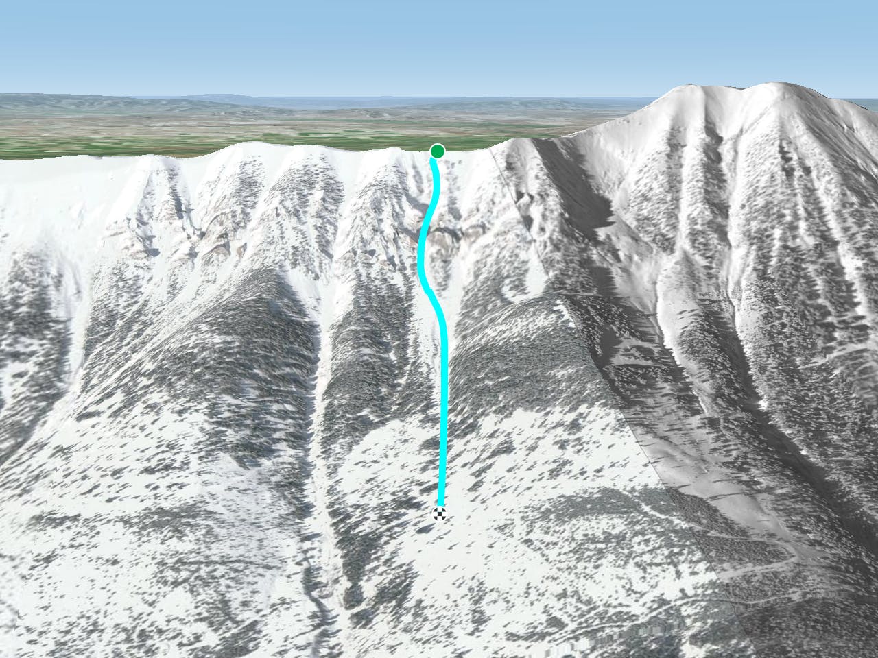
The 2nd Pinnacle is one of the most direct and straightforward lines in the Pinnacles - you can see it easily from the highway as you drive to Bridger Bowl. Head South from Saddle, past Argentina bowl. You will pass over two separate mini bowls/ snowfields. The third bowl kind of rolls over fall line; this is the one you want. You can enter here, or go a little more south to the next high point and ski one of two flutes down to the crux. This upper bowl is about 500 feet long and rolls over at 37 degrees. As you head down, you'll see the crux which can be a small 4 feet hop, or an easy ski through depending on snow levels. Here you will be amazed by the aesthetics of this zone as there are towering walls on either side of you. Once you get through the pinch, you still have a few hundred feet of low angle pow to shred. Hit the clear cut meadow, put your skins on, and hike north back to the Saddle traverse.
Difficulty
Severe
Steep skiing at 38-45 degrees. This requires very good technique and the risk of falling has serious consequences.
Medium Exposure (E2)

As well as the slope itself, there are some obstacles (such as rock outcrops) which could aggravate injury.
Remoteness

Little chance of being seen or helped in case of an accident.
Best time to visit
Features
- Trees
- Cliffs
- Walk Required
Equipment required
- Skins