5.7 km away
Stateline Lookout
Short uphill hike to a beautiful viewpoint and historic fire lookout over the north end of Lake Tahoe.
Easy Hiking
- Distance
- 2.1 km
- Ascent
- 91 m
- Descent
- 91 m
A strenuous but gorgeous segment through the Mount Rose Wilderness Area and over the trail’s highest point, Relay Peak (10,338 ft).
Also in California, United States of America
Hiking Difficult

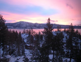
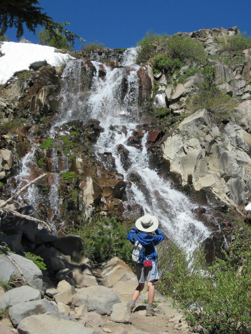
If hiking the Tahoe Rim Trail clockwise, the mellow terrain you enjoyed coming from Tahoe City ends at Brockway Summit. From here, the trail begins a steady climb of roughly 3,500 feet in 13 miles to its highest point, Relay Peak, at 10,338 feet. It then drops just as steeply for 7 more miles to Highway 431 at Tahoe Meadows. No matter which direction you hike, the work is substantial, but the rewards are immense. This section features huge panoramas along windswept ridgelines, meadows bursting with wildflowers, and a 130-foot waterfall.
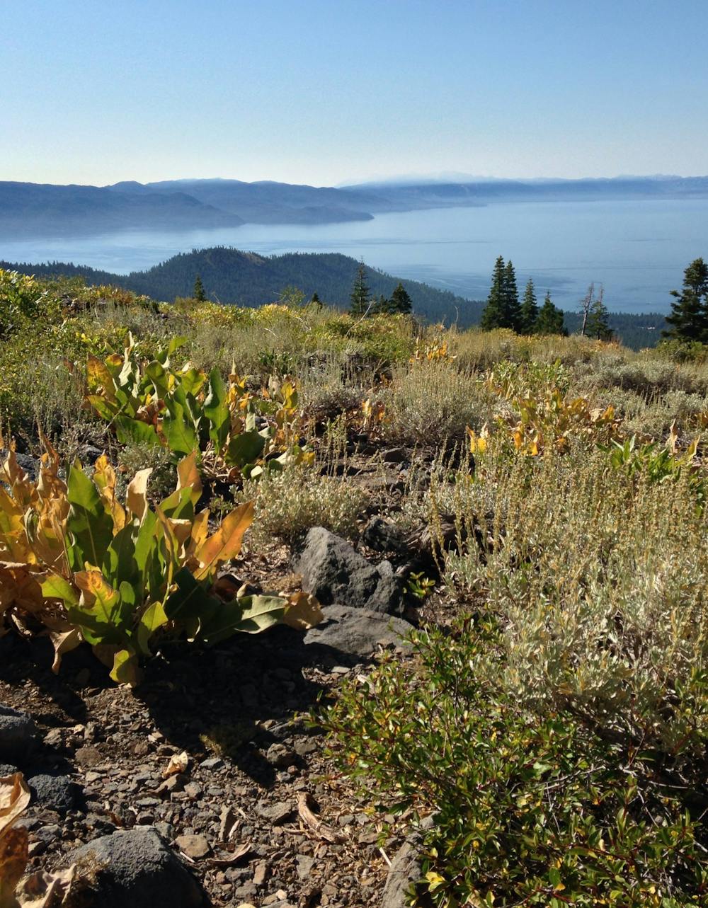
From Brockway Summit, the trail leads through thick, tranquil forest and intermittent meadows for several miles. As it gradually gains elevation, the scenery gets more alpine and rugged. Clearings and rock outcrops become more frequent, affording better and better views over Lake Tahoe in the distance. Broad fields of mule’s ear plants color the rock slopes green and yellow when they bloom in summer. Continue climbing as the trail traverses ridges and switchbacks up Relay Peak for an incredible 360-degree view of the lake and surrounding summits. Snowfields may linger well into summer on these high mountainsides.
Comfortable camping can be hard to find on this section because of the steepness and exposure in the alpine terrain. There are no developed campgrounds except for one small one at Mt. Rose/Tahoe Meadows, and much of the distance is through a designated wilderness area. Be sure to dial in your backcountry camping equipment and setup before hitting this portion of the Tahoe Rim Trail.
Sources: https://tahoerimtrail.org/maps-trail-info/ https://tahoerimtrail.org/wp-content/uploads/2017/04/MapBrochBStoMtR-TM.pdf https://en.wikipedia.org/wiki/TahoeRimTrail
Difficult
Hiking trails where obstacles such as rocks or roots are prevalent. Some obstacles can require care to step over or around. At times, the trail can be worn and eroded. The grade of the trail is generally quite steep, and can often lead to strenuous hiking.

The path is on completely flat land and potential injury is limited to falling over.

Away from help but easily accessed.
5.7 km away
Short uphill hike to a beautiful viewpoint and historic fire lookout over the north end of Lake Tahoe.
Easy Hiking
7.4 km away
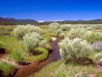
Easy nature walk along a creek with mountains on the horizon and a good chance of spotting wildlife.
Easy Hiking

8 routes · Hiking