1.7 km away
Cowboy Trails: Fossil Canyon Lariat
A beautiful run near Red Rocks that doesn't require a reservation.
Moderate Trail Running
- Distance
- 7.3 km
- Ascent
- 229 m
- Descent
- 229 m
Instead of driving through Red Rock Canyon Conservation Area, why not run a big loop instead?!
Trail Running Moderate

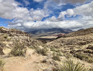
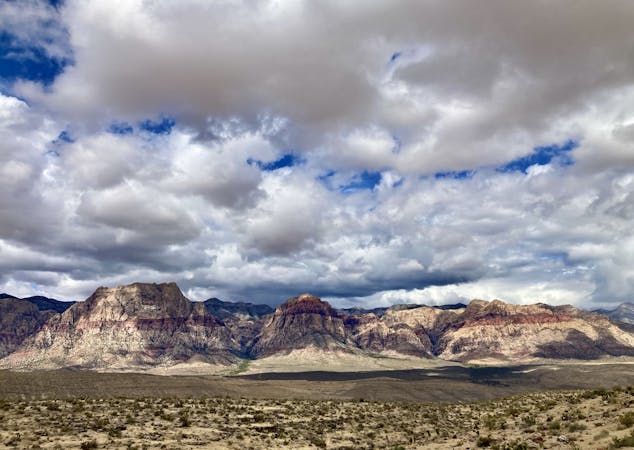
Many of the top hikes in the Red Rock Canyon Conservation Area are steep and arduous enough to reduce even the most sure-footed trail runners to hikers. But there are a few singletrack that are often overlooked by hikers that instead make for fantastic trail running objectives. The Grand Circle Loop is one such route.
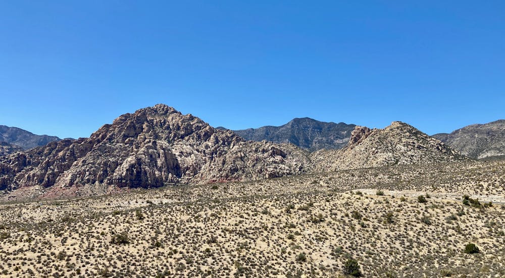
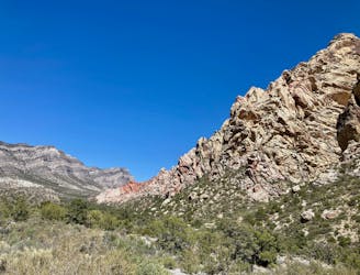
Instead of driving through Red Rock Canyon Conservation Area, why not run a big loop instead?! The Grand Circle begins and ends close to the entrance to the park, at the visitor center. This 11.5-mile loop begins by traversing the beautiful Calico Hills Trail and then heading deeper into the park, looping past White Rock, and then returning to the visitor center via mostly flat, mellow trails.
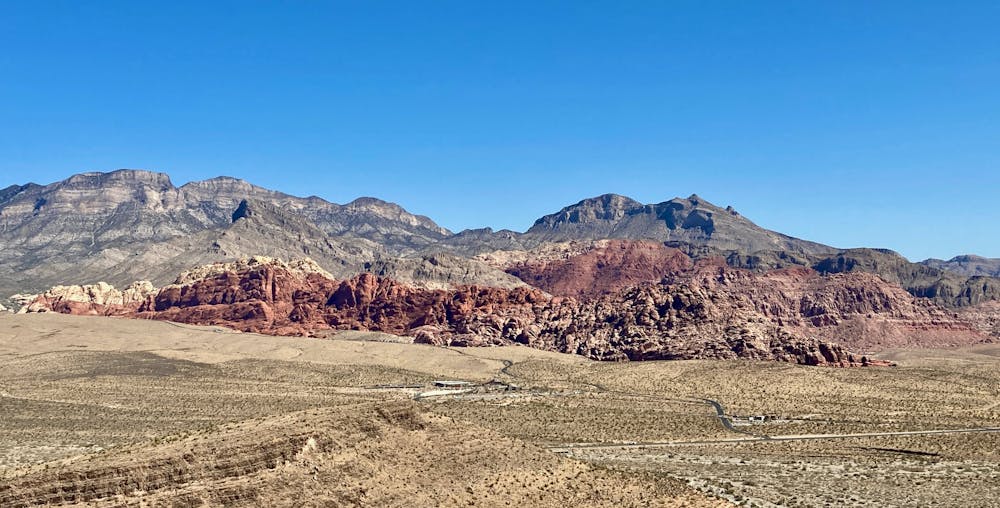
The Calico Hills are a unique formation of deep red sandstone slabs that soar into the sky, dominating the viewscape as you enter the Red Rock Canyons Conservation Area. The trails along the hills are undulating with short climbs and descents, but remain largely non-technical. You can expect to encounter numerous other trail users here.
After passing the popular trailhead for Calico Tanks, you'll traverse little-used trails as you approach the base of White Rock. The route mapped here traverses along the front side of White Rock, but if you're truly looking for an epic run, you could loop all the way around the backside of the mountain, as depicted in the dedicated White Rock Loop route.
Most of the climbing happens during these first legs of the route, with the final easy, smooth miles to the trailhead running back down a mellow grade through small arroyos in the desert floor.
Moderate

The path is on completely flat land and potential injury is limited to falling over.
Close to help in case of emergency.
1.7 km away
A beautiful run near Red Rocks that doesn't require a reservation.
Moderate Trail Running
6.2 km away
A remote loop circumnavigating a beautiful peak.
Moderate Trail Running
7 routes · Trail Running