
58 routes · Hiking
Summit the highest peak in the northeast, Mount Washington.
Hiking Severe

Continuing through New Hampshire's high peaks, this stretch of the Appalachian Trail crosses the Presidential Range, summiting the fabled Mount Washington along the way.
To begin this segment from the south, start at the trailhead at the junction of Willey House Station Road and Crawford Notch Road. This road crossing is also a stop for the AMC's shuttle, giving you the option to complete a point-to-point with only one vehicle.
A challenging climb lies past the trailhead, as the AT makes its way to a ridge to summit the first peaks of the day, Mount Webster and Mount Jackson, both slightly shy of 4,000 feet.
Just ahead, the AT reaches a trail junction and site of the Mizpah Spring Hut. This hut is a popular option for thru-hikers to spend the night inside, plus there are additional tent sites nearby. Check the AMC's website for availability, reservations, and rates for use of the hut at www.outdoors.org.
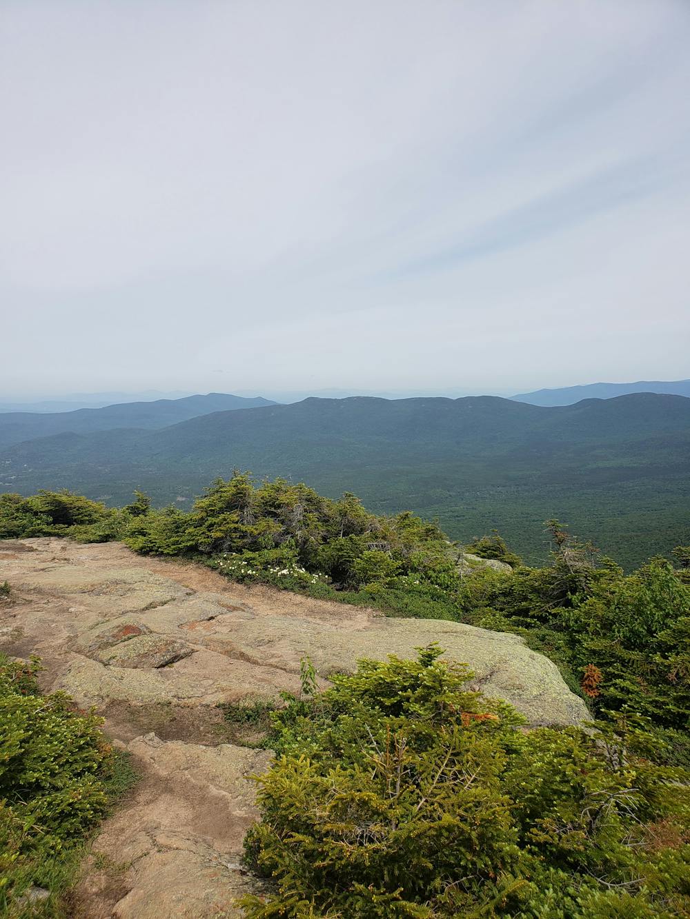
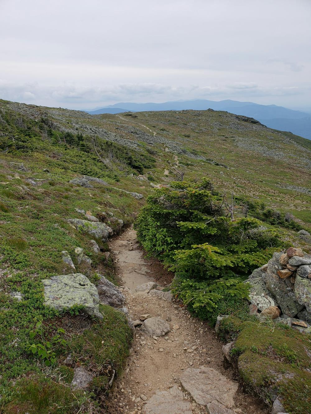
Heading north from the hut, the trail summits Mount Pierce where it also joins the Crawford Path. In this area, the trail climbs into a treeless alpine zone, offering panoramic views everywhere you turn.
Follow the white blazes north through the high country as the trail climbs gradually to Mount Eisenhower. An optional loop reaches the summit, then returns back to the AT.
Ahead, the trail continues its way along the ridge, reaching the summit of Mount Franklin.
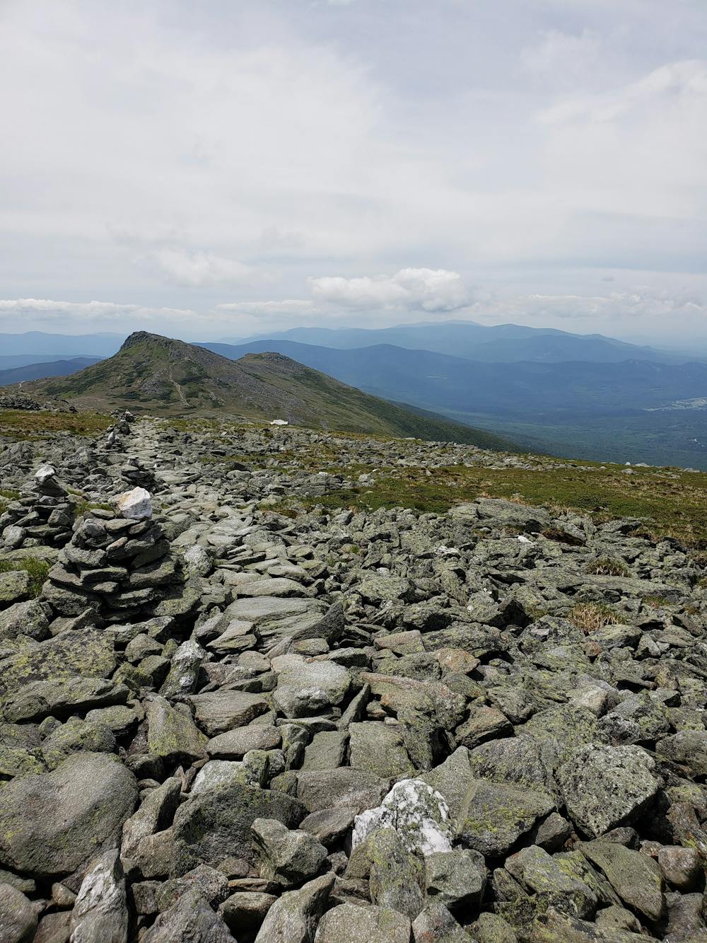
The trail approaches Mount Monroe next, with another optional loop to reach the summit while the AT skirts around the eastern side. The loop rejoins the AT as it makes a brief descent to the Lake of the Clouds Hut. This iconic area is home to picturesque ponds and serene views, and serves as a common area to refuel before making the final push to the summit of Mount Washington.
As the trail approaches the summit, the terrain becomes considerably harsher, and the dirt gives way to jagged, exposed rocks. The climb will have your legs begging for a break as you ascend to the highest point on the AT since Tennessee.
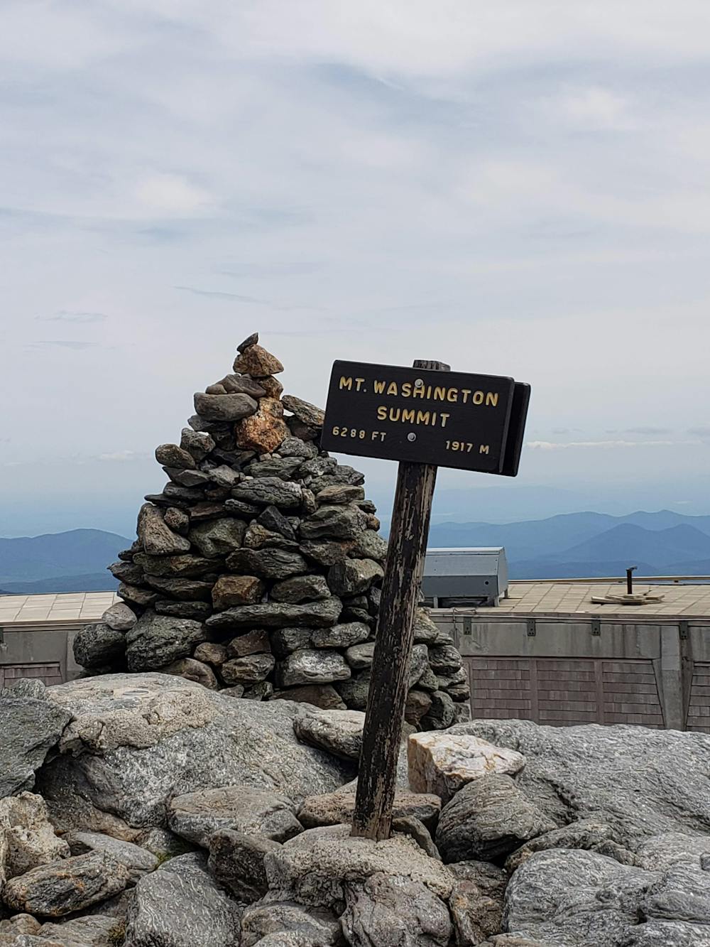
At the intersection, take a quick detour to the official summit of Mount Washington at nearly 6,300 feet. A state park with an overlook platform will give you phenomenal views from the highest point in the northeastern US.
This area is well-known for its violent and unpredictable weather and is home to one of the fastest wind speeds every recorded—231mph. The weather station atop the summit also reports hurricane force winds 100+ days per year on average.
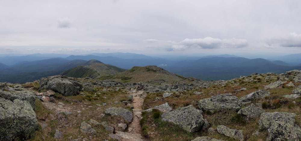
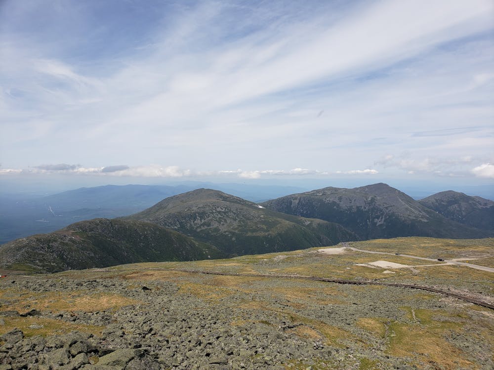
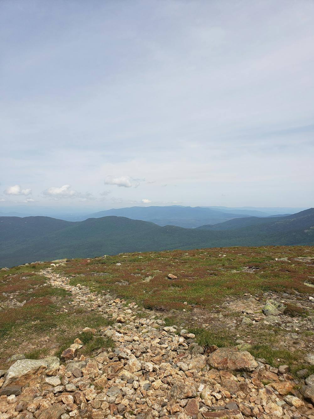
Continuing through the Presidential Range, the trail skirts around the Northern Presidentials: Mount Clay, Mount Jefferson, Mount Adams, and Mount Madison, with options to summit all.
Passing through a large trail junction, the AT makes the final push the summit of Mount Madison as it begins its descent toward the Peabody River. Several tenting opportunities lie in the area and serve as the last defined overnight spot until Pinkham Notch.
Rounding out this portion of the AT, the trail crosses over the Mount Washington Auto Road, an alternative way to reach the summit of the mountain. The Pinkham Notch Visitors Center serves as the northern terminus for this segment, with plenty of options for parking. The AMC's shuttle also services this stop should you be utilizing it.
Source: https://www.outdoors.org/lodging-camping/lodging-shuttle https://www.summitpost.org/mizpah-spring-amc-hut/392226 https://en.wikipedia.org/wiki/MountWashington(NewHampshire)
Severe
Hiking challenging trails where simple scrambling, with the occasional use of the hands, is a distinct possibility. The trails are often filled with all manner of obstacles both small and large, and the hills are very steep. Obstacles and challenges are often unexpected and can be unpredictable.

Some trail sections have exposed ledges or steep ascents/descents where falling could cause serious injury.

Away from help but easily accessed.
58 routes · Hiking