
58 routes · Hiking
A perfect segment to shuttle, bagging several 4,000-footers along the way.
Hiking Severe

This segment of the white-blazed Appalachian Trail begins with a traverse of the second-highest range in the state—Franconia Ridge. This route makes for an excellent hike, overnight trip, or trail run. Several day hiking opportunities lie in the area as well, as most peaks can be accessed by multiple trails.
To begin the route, head to the Liberty Spring Trailhead, accessible from a parking lot to both the north and south. The Appalachian Mountain Club provides a shuttle between the two trailheads that "...operates daily from May 31st through September 16th, and on weekends and holidays from September 22nd through October 21st."
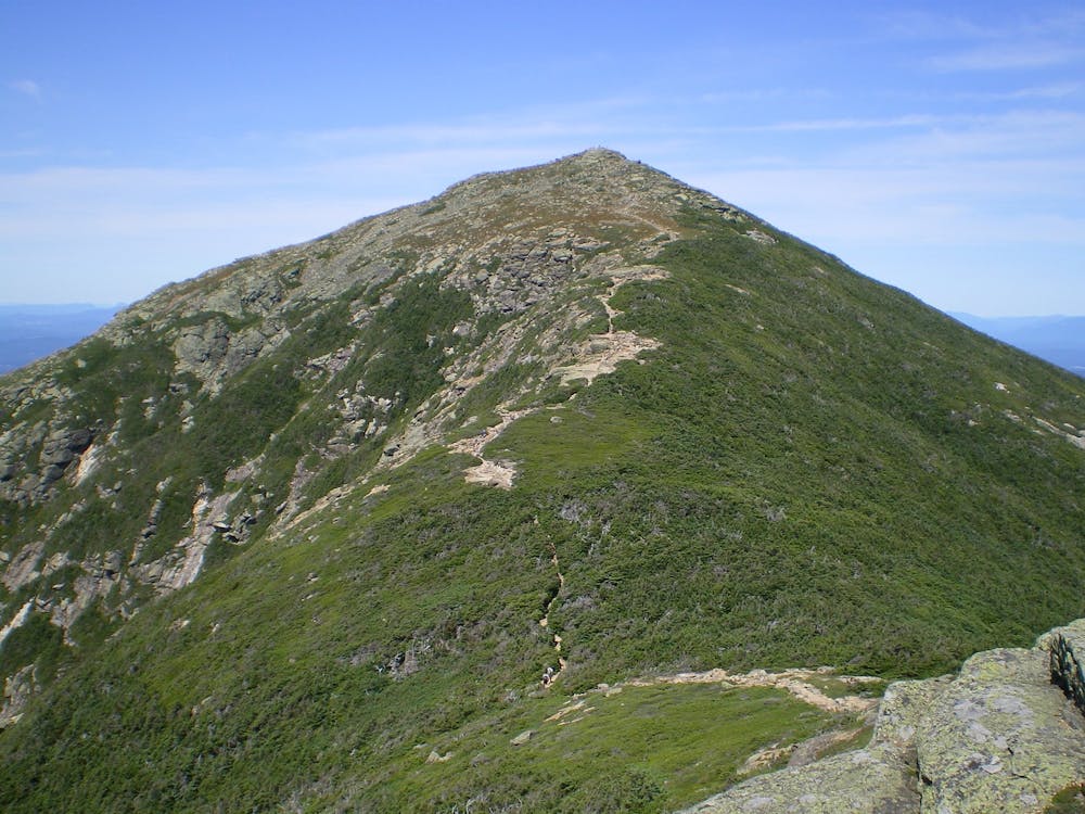
A steep 3-mile climb to the ridge takes you to the first summit, Mount Liberty, at 4,400 feet. Take the Franconia Ridge Trail south, away from the Appalachian Trail, to officially summit the mountain. Take in the views from the rocky, exposed overlook before turning around and heading north back on the AT.
4,700-foot Little Haystack Mountain lies ahead, also accessible by the Falling Waters Trail. This summit is a popular option among day hikers as it passes a series of waterfalls along the way.
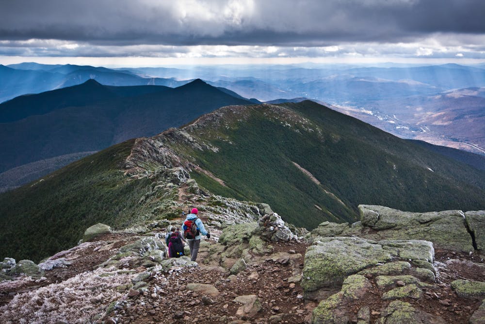
Ahead, pass over the summits of Mount Lincoln and Mount Truman, both above 5,000 feet. The highest peak, Mount Lafayette, lies ahead at 5,250 feet. According to Wikipedia, "The mountain's upper reaches are located in the alpine zone, an area where only dwarf vegetation exists due to the harsh climate."
Enjoy some incredible views from the exposed summit before continuing north. To turn this into an overnight trip, head west on the Greenleaf Trail from the summit to the AMC's Greenleaf Hut.
Further north, the trail traverses Garfield Ridge, passes Garfield Pond, then pushes up one more slope to the summit of Mount Garfield at 4,400 feet.
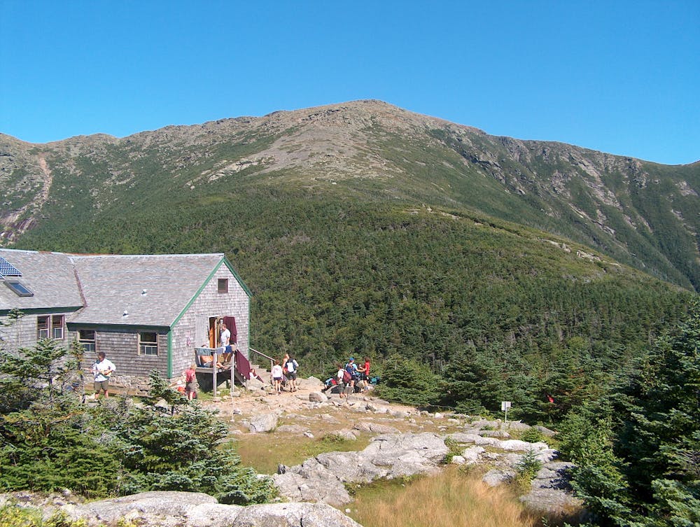
Ahead, the AT passes through a few trail intersections before skirting the summit of Galehead Mountain. To bag this 4,000-footer, take the spur trail to the summit before heading onto South Twin Mountain, Mount Guyot, and Mount Zealand. After a brief descent, the trail reaches Zealand Falls Hut, named for the adjacent pond and waterfall.
Leaving the high peaks, the trail descends a drainage via the Ethan Pond Trail. At Ethan Pond, look for a shelter and campsite along the east side of the lake. As you continue descending, the harsh mountainous terrain will give way to more diverse flora and fauna, including certain berries.
To round out this segment, a couple of parking opportunities lie along Willey House Station Road, just after crossing over a railroad track. The AMC's shuttle also stops here, should you opt to utilize it.
For another day hiking opportunity, Mount Willey and other summits along the ridge can be accessed by taking the AT south to the Willey Range Trail.
Sources: https://en.wikipedia.org/wiki/MountLafayette https://en.wikipedia.org/wiki/FranconiaRange https://www.outdoors.org/lodging-camping/lodging-shuttle http://snowplug.blogspot.com/2008/07/on-at-franconia-notch-to-crawford-notch.html
Severe
Hiking challenging trails where simple scrambling, with the occasional use of the hands, is a distinct possibility. The trails are often filled with all manner of obstacles both small and large, and the hills are very steep. Obstacles and challenges are often unexpected and can be unpredictable.

Some trail sections have exposed ledges or steep ascents/descents where falling could cause serious injury.
Little chance of being seen or helped in case of an accident.
58 routes · Hiking

25 routes · Alpine Climbing · Hiking

10 routes · Hiking