6.4 km away
Appalachian Trail: Pinkham Notch to Grafton Notch
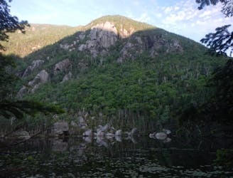
A beautiful segment of the AT, summiting the final 4,000-footers in New Hampshire before heading into Maine.
Severe Hiking
- Distance
- 72 km
- Ascent
- 5.1 km
- Descent
- 5.2 km
Easy way up Carter Dome
Hiking Difficult

This is a popular hiking route which is generally considered to be difficult. It's extremely remote, it features high exposure and is typically done between May and November. From a low point of 538 m to the maximum altitude of 1.5 km, the route covers 18 km, 1010 vertical metres of ascent and 1010 vertical metres of descent.
Lightly trafficked loop located near Jackson, NH that has beautiful wild flowers and takes you to the top of Carter Dome. This is the easier way up Carter Dome. Dogs must be kept on leash.
Difficult
Hiking trails where obstacles such as rocks or roots are prevalent. Some obstacles can require care to step over or around. At times, the trail can be worn and eroded. The grade of the trail is generally quite steep, and can often lead to strenuous hiking.

Some trail sections have exposed ledges or steep ascents/descents where falling could cause serious injury.

In the high mountains or remote conditions, all individuals must be completely autonomous in every situation.
6.4 km away
A beautiful segment of the AT, summiting the final 4,000-footers in New Hampshire before heading into Maine.
Severe Hiking

58 routes · Hiking