6.3 km away
Appalachian Trail: Pinkham Notch to Grafton Notch
A beautiful segment of the AT, summiting the final 4,000-footers in New Hampshire before heading into Maine.
Severe Hiking
- Distance
- 72 km
- Ascent
- 5.1 km
- Descent
- 5.2 km
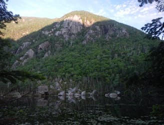
Trail to the top of Hall's Ledge
Hiking Moderate

This is a popular hiking route which is generally considered to be moderate. It's remote, it features medium exposure and is typically done all year round. From a low point of 352 m to the maximum altitude of 786 m, the route covers 5.3 km, 442 vertical metres of ascent and 442 vertical metres of descent.
Lightly trafficked trail to the top of Hall's Ledge located in Jackson, NH. The trail offers a chance to see wildlife.
Moderate
Hiking along trails with some uneven terrain and small hills. Small rocks and roots may be present.

The trail contains some obstacles such as outcroppings and rock which could cause injury.
Away from help but easily accessed.
6.3 km away
A beautiful segment of the AT, summiting the final 4,000-footers in New Hampshire before heading into Maine.
Severe Hiking

58 routes · Hiking