17 routes · Ski Touring
A classic, technical, intimidating couloir.
Ski Touring Extreme

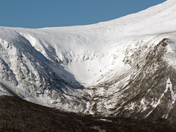
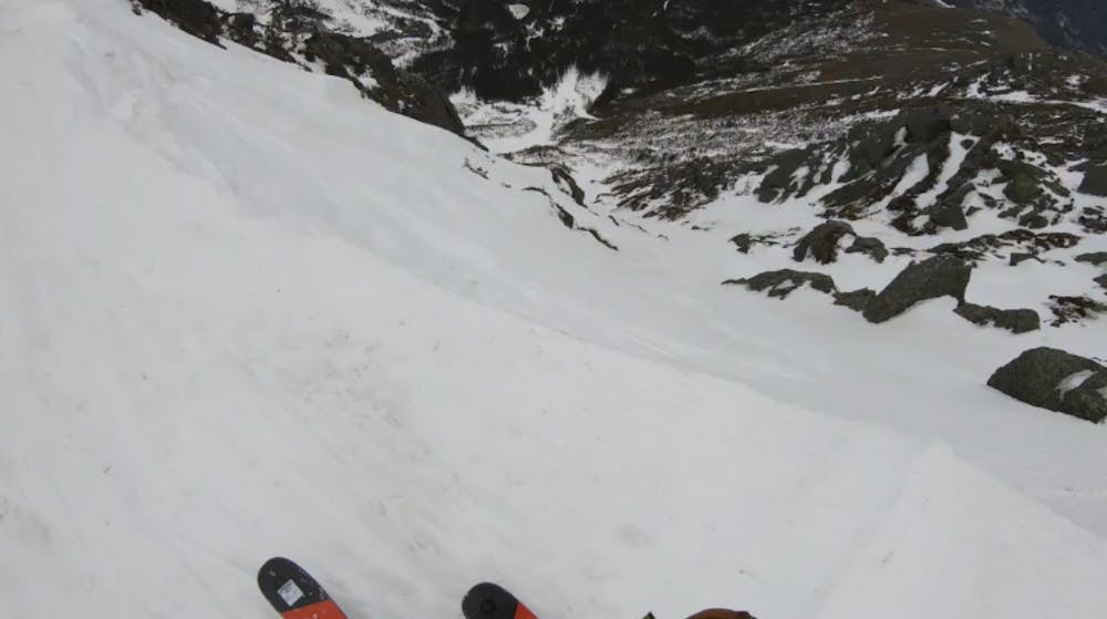
Dodge’s Drop is one of the gnarliest lines anywhere. With a max pitch of 55 degrees and a sustained pitch of 45+ (until you hit the run out), it’s steeper than any inbounds run. Dodge’s Drop is front and center on the Hillman’s side and easily recognized by its funnel shape. You can access Dodge’s by hiking over from the top of Hillman’s, but it’s better to climb from the bottom to get a feel for the snow. Dodge’s begins with a drop in off a small cornice, into a steep couloir. The top is the steepest section, you funnel diagonally into the fall line. From here the couloir drops straight down and stays about 25 feet wide. After about 150-200 feet it chokes out to a ski length across, sometimes this has a non vertical ice bulge. After you negotiate this section, the pitch mellows and you reach a meandering gully that terminates into Hillman’s. Dodge’s Drop is steep and dangerous, a fall anywhere on this line could be deadly. Do not ski if you even think you’re going to fall. If you plan to ascend from below, you will need an ice axes and crampons.
Extreme
Extreme skiing terrain above 45 degrees. These routes are reserved for experienced experts.

In case of a fall, death is highly likely.
Little chance of being seen or helped in case of an accident.
17 routes · Ski Touring