17 routes · Ski Touring
Steep, narrow, technical.
Ski Touring Extreme

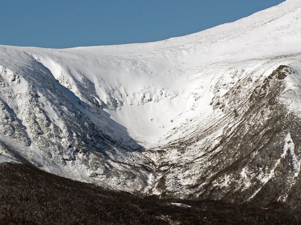
Lookers left off Dodges, you'll see a narrow, diagonal couloir, this is Stovepipe. It doesn't go often and getting there wont be easy, but you won't find anything like it in the northeast. The best approach is to ascend the runout gully from the bottom or cut over from Dodge's, the boot up it. Be aware that this will expose you to avalanche paths and plan your route accordingly. Stovepipe tops out in a jumble off big rocks, once you reach these, you'll need to dig out a spot for your skis. Stovepipe is just over a ski length across, so you will need to be good at hop turns. Ski one at a time through the couloir. The run out is long, bushy and not all that fun until you reach Hillman's. Be aware that skiing Stovepipe is no easy feat, a fall anywhere could lead to serious injury or death, if you don't feel comfortable when you get there, ski back the way you came or choose another option.
Extreme
Extreme skiing terrain above 45 degrees. These routes are reserved for experienced experts.

In case of a fall, death is highly likely.

Away from help but easily accessed.
17 routes · Ski Touring