17 routes · Ski Touring
Route to the premier New England ski tour, Tuckerman Ravine.
Ski Touring Moderate

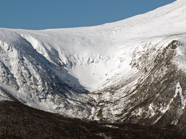
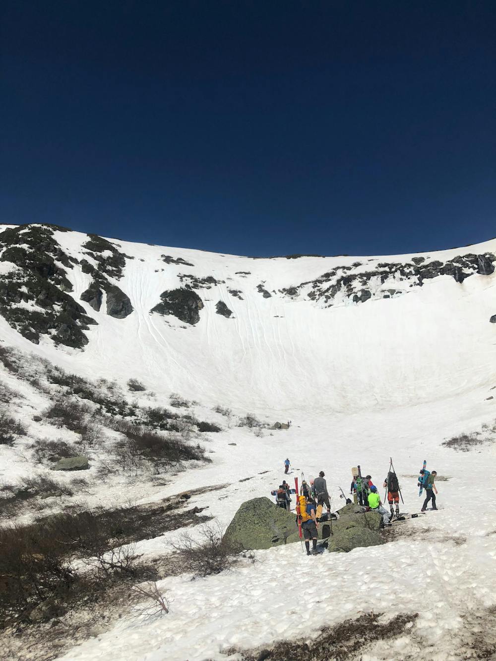
Tuckerman Ravine is one of the most well known backcountry tours in the northeast, if not the country. Every spring, when the bulletproof windslab becomes soft corn snow, thousands of people make the pilgrimage to this steep glacial cirque nestled between Mount Washington and Boott Spur. The steep couloirs and gullies resemble west coast backcountry more than a northeast mountain. The adventure begins just behind the Pinkham Notch Visitor Center. Begin climbing the Tuckerman Ravine Trail, if you are doing this in November through early April It is possible to skin all or most of the trail, but later in the season you won’t find snow until you reach the ravine. It’s about 1.5 hour of hiking until you pass the Hojo Hut and the Hermit Lake Shelter. Then the lines come into view. From here you can split off shortly after to the “Hillman’s Highway” terrain, or continue another 20 minutes to the floor of “The Bowl”. The Mount Washington Avalanche Center releases an avalanche forecast every 24 hours for the Presidential Range, and there are signs detailing current conditions. It is important to carry a beacon, probe and shovel when entering the alpine zone. You can now begin climbing your desired line. Some lines require more time than others to ascend. Chances are Left Gully, The Chute and The Lip will have many people ascending at once. The others will only have a handful of people. When choosing your line, it is important to stick to the lines that are in the sun, since those in the shade tend to ice over.. When exiting the ravine, remember that you cannot ski the Tuckerman Ravine Trail, you must use the Sherborne Trail which is designed for skiers. If you are skiing here earlier in the spring, you can ski the Little Headwall, but in late April-May this becomes open water and must be hiked around before you can connect with the Sherborne Trail. Sometimes the Sherborne Trail will be closed if there is not enough snow, if so you can hike down the way you came. Be sure to take this into account when you plan your day. You may see people eating lunch or hanging out on an area called “The Lunch Rocks”, though it may sound inviting, people have been injured and or killed by falling ice here, best to avoid this area. Remember that popularity doesn't mean easy. The terrain in Tuckerman Ravine is steeper, more hazardous and more remote than any inbounds run. Skiers must be fit, well prepared and completely autonomous in their travel, decision making and if needed, rescue.
Moderate
Slopes become slightly steeper at around 25-30 degrees.

Exposure is limited to that of the slope itself. Getting hurt is still likely if the slope is steep and/or the snow is hard.

Away from help but easily accessed.
17 routes · Ski Touring