2.7 km away
Bald Knob
The best views-to-effort ratio in the entire Ossipee Range hands down.
Moderate Trail Running
- Distance
- 6.2 km
- Ascent
- 358 m
- Descent
- 359 m
Yes, it is really called Faraway Mountain and no it is not really that far
Trail Running Moderate

The Faraway-Roberts loop is one of the most pleasing routes to do in the Ossipees. It is a route with the best of both worlds. Mount Roberts is one of the most hiked ridges in this area and Faraway Mountain might arguably be one of the least hiked peaks here (for a somewhat good reason). The loop can be done in either direction based on your preference but I prefer running down from Roberts as it is a great view to have when descending however it is slightly steeper but totally run-able.
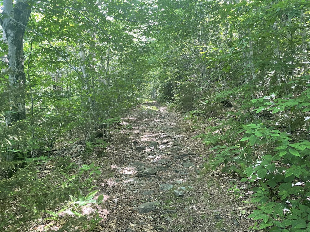
Make your way to the Castle in the Clouds parking area that is accessed via the service road (not the main gate on RT 171). From here, you head towards the pond and then make a left towards the stable following the road. This road (turning slightly right) will take you all the way to a roundabout - if you get here, you have missed your turn. Follow signs for the Faraway Mountain Connector Trail but stay on the Cold Springs Trail when given the option as it is more direct and does not have any tradeoffs. If you miss this, you will still end up in the same place. This track is a wide, ATV/carriage road all the way up but is plenty wild. The hike up to faraway mountain might have some people on it but chances are they are headed to Mount Shaw. Keep in mind, foot travel is only permitted here in the summer - no bikes or vehicles.
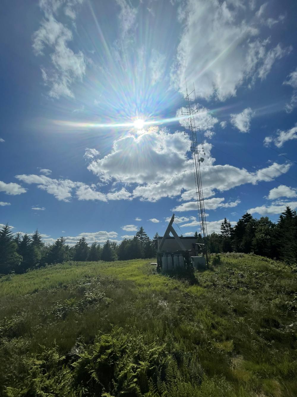
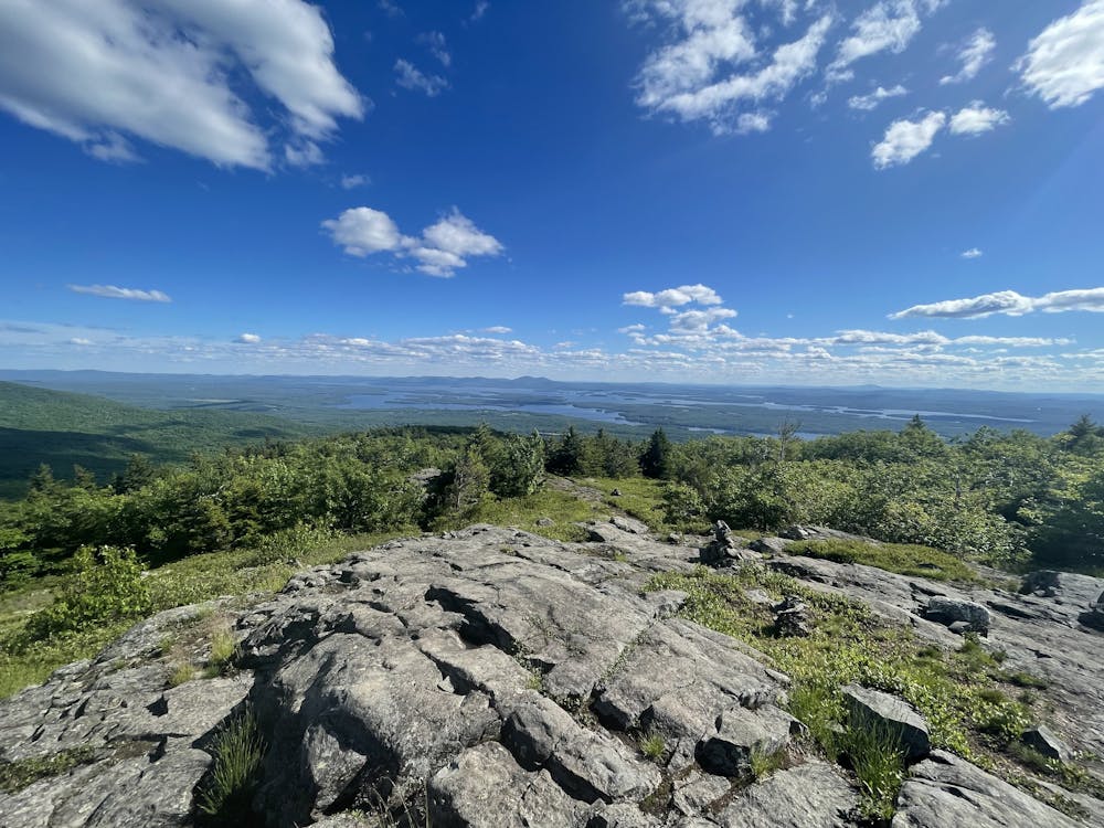
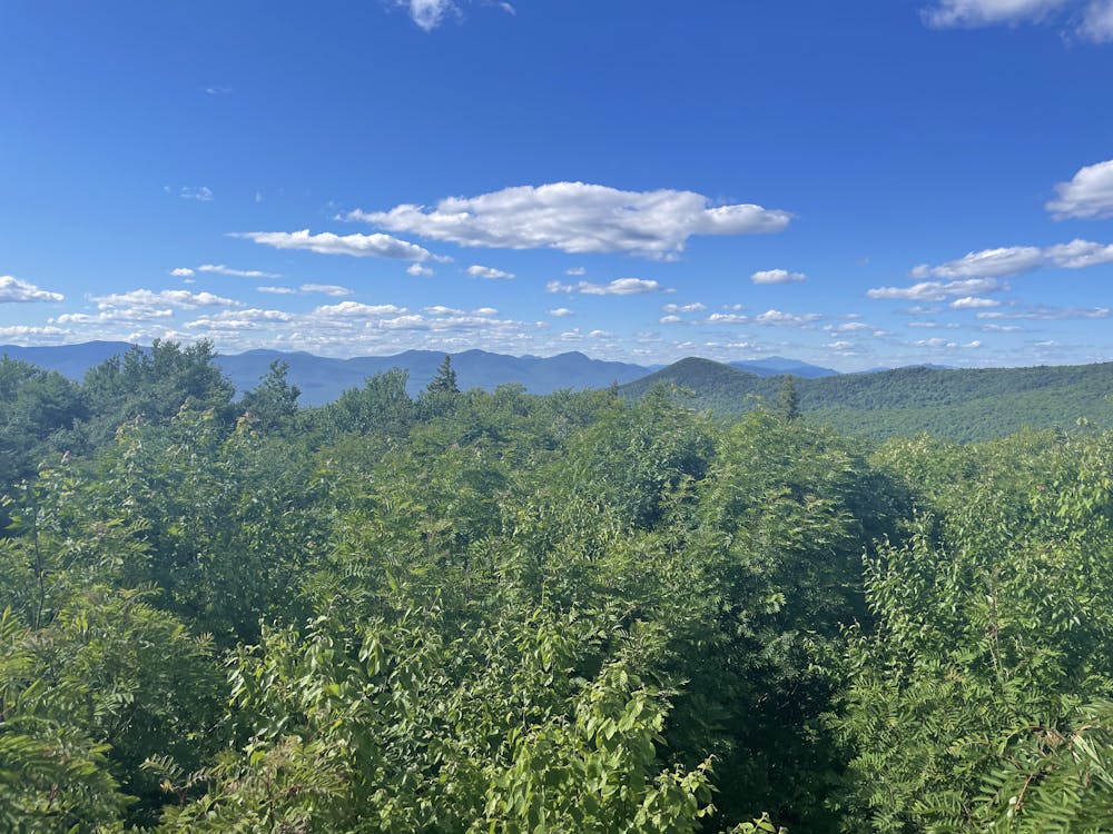
The Cold Springs Trail will meet up with the Faraway Mountain Trail and then they will both head towards the High Ridge Trail. At this split, go left towards Mount Roberts and not towards Mount Shaw. This is when you know you are getting pretty close to your first summit. Make sure to take in the views along this ridge trail when you can as the Faraway Mountain peak might underwhelm you a bit. While not necessary, this route does include the out-and-back trail up to the peak where you will find a nice, open, grassy area with some cell towers and solar panels. There is usually a chain across this entrance but that is for vehicles - this trail is open to hikers and runners. This section might be the most wild/untracked section of your trip.
Once done here, start your first decent back to the High Ridge Trail and continue along to Mount Roberts. The Ridge Trail over to Mount Roberts is mostly flat with one small incline to reach the peak. This will be one of the more wild/untracked sections of the route and I would not plan on seeing anyone here although it is possible.
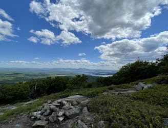
Falling in line with the Ossipee Range theme, the Mount Roberts peak is somewhat underwhelming compared to its ridge. It faces north-northwest looking out towards the Sandwich Range. However, don't lose hope and think this run was for nothing!
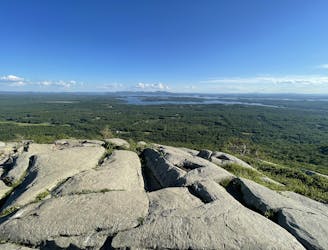
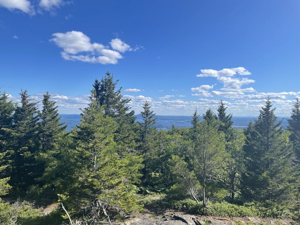
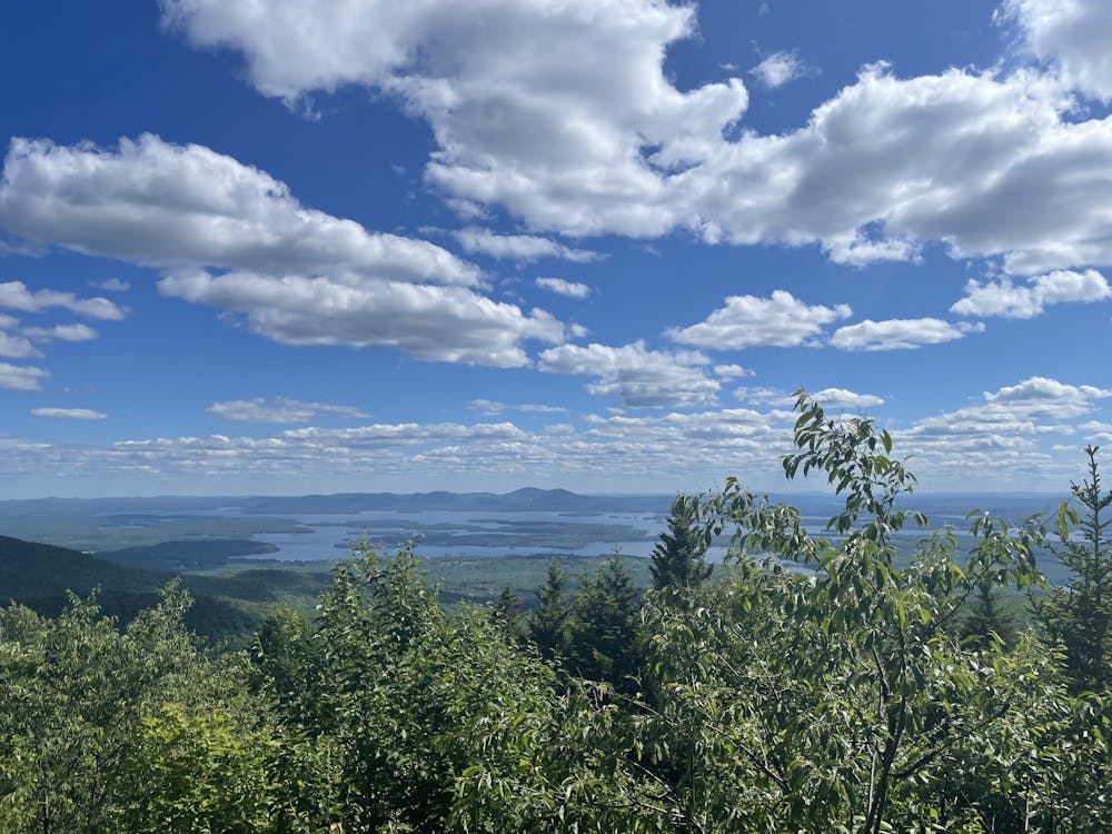
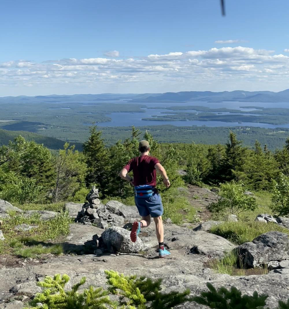
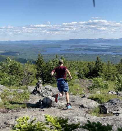
Finally, we are ready for our long, beautiful descent from Mount Roberts back to the parking area. You will immediately see a stark difference in the trail. Steeper than our ascent (but perfectly fine to run), a lot more traveled and maintained, and just overall a better trail to run. You will go through some trees as you descend right from the peak but then you will pop out onto the ridgeline - this is the best view on this run hands down. If you only want to stop once or you would like to take a food break, this is the place to do it if you can make it. This is looking south-southeast over Lake Winnipesaukee towards Gunstock Mountain and Mount Major. The trail is marked very well from here down and you will have a few viewpoints along the way. If you are running on the weekend in the summer, prepare to pass quite a few people along this descent as it is usually busy.
When you reach the bottom of the Mount Roberts Trail, it separates into 3 different trails. The best way to get back to the car is to cut through the fields which are mowed - this will place you right back at the road we took to the right in the beginning and you simply follow the road back to the parking area.
Moderate

The path is on completely flat land and potential injury is limited to falling over.

Away from help but easily accessed.
2.7 km away
The best views-to-effort ratio in the entire Ossipee Range hands down.
Moderate Trail Running
3.5 km away
Explore one of the least traveled sections of the Ossipee Mountains
Moderate Trail Running
3 routes · Trail Running