5.6 km away
Northside at Taos: Bull-of-the-Woods Lollipop
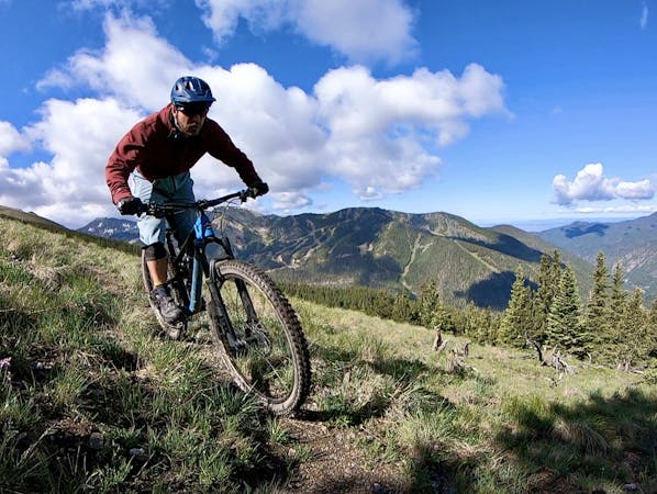
A steep climb leads to stunning views of the tallest mountains in New Mexico.
Difficult Mountain Biking
- Distance
- 17 km
- Ascent
- 768 m
- Descent
- 768 m
An excellent 14-mile ride that includes secluded forest and exposed rock zones.
Mountain Biking Difficult
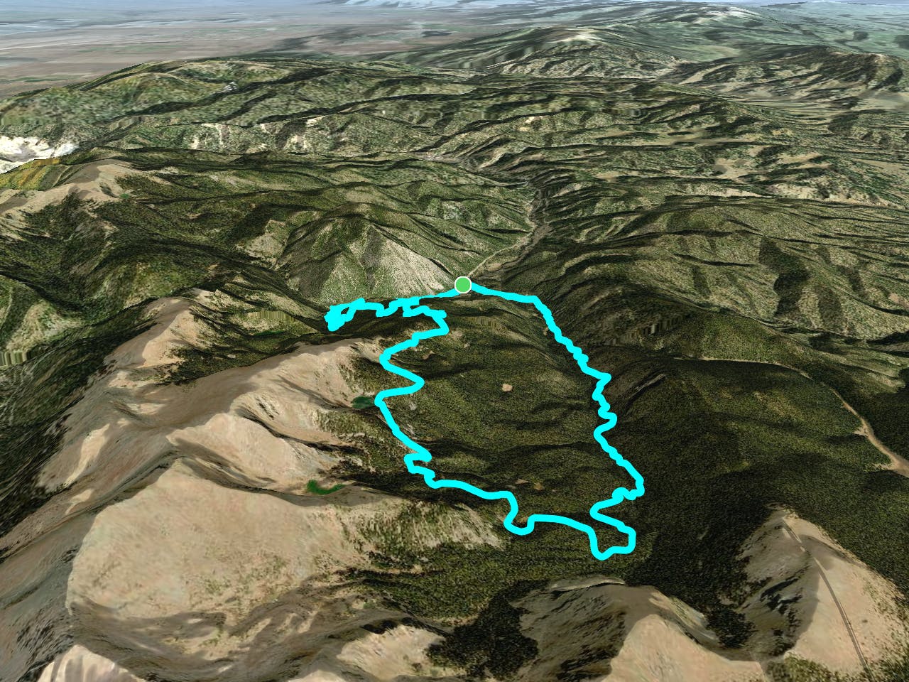
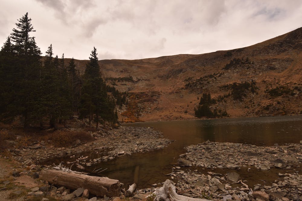
This 14-mile loop offers everything from secluded forest singletrack to very exposed sections, with amazing views from large rock outcroppings, and of course: a beautiful alpine lake.
The best place to park and start the ride is at the end of state road 578 (NM 578), at the junction where Middle Fork Road (Forest Rd 58) continues on the right side of the creek. Ride across the bridge and turn right onto Forest Road 58A, which then changes into Wheeler Peak Rd. Stay on this road until you reach the East Fork Trailhead parking lot and continue straight ahead onto the singletrack.
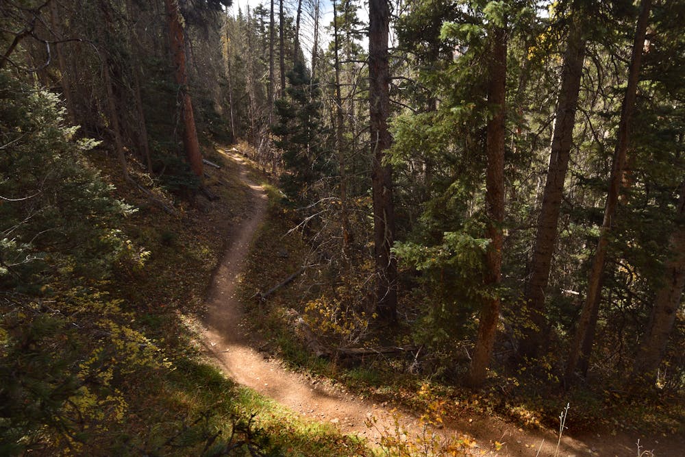
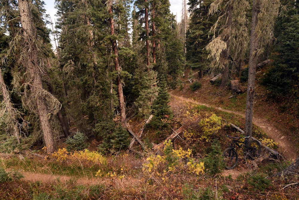
The trail begins with a decent climb until you reach a large informational sign, which tells you all about the Big Ditch (built by the Moreno Valley Water and Mining Co, up to 41 miles of ditch to provide water to the Moreno Valley). From here on the climb is a bit more mellow, with a great mixture of dark dirt, moss, roots and lots of tree cover; a really nice green zone.
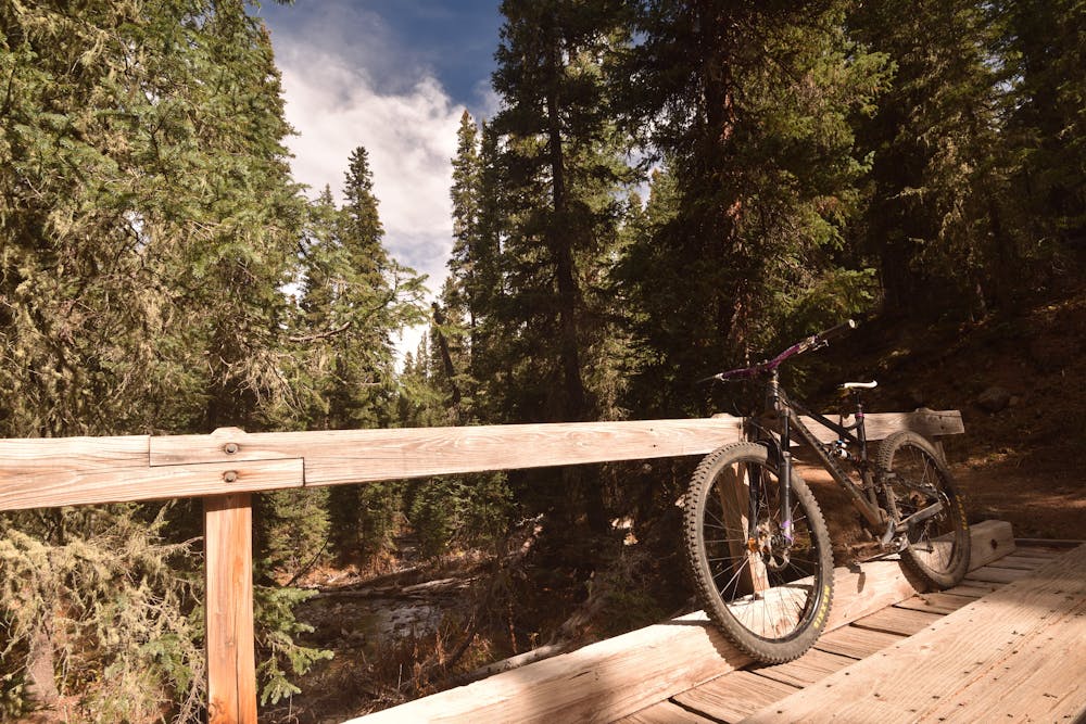
This setting changes when you arrive at the bridge, to cross the East Fork Red River, where way more rock welcomes you. The climbing gets harder and more technical, with a few tricky sections to keep you honest.
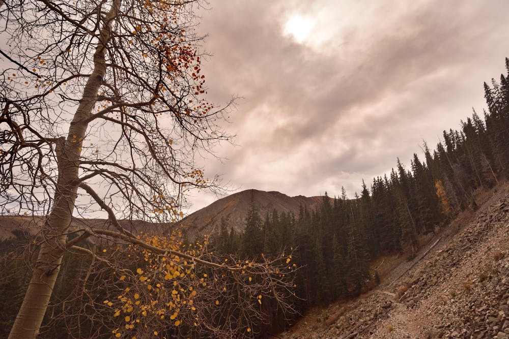
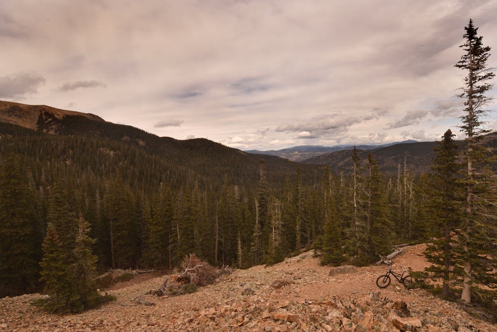
Soon after the trail turns north, things open up and you have arrived at the first of several exposed rock outcroppings, which provide views of the valley and the eastern slopes of Wheeler Peak.
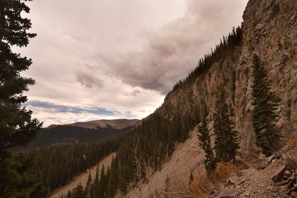
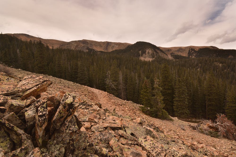
The trail gets harder yet, and crosses Horseshoe Creek, and ends at the junction with Lost Lake Trail (91). Turn right (left goes into the Wheeler Peak Wilderness where bikes are not allowed), the trail continues to skirt the Wheeler Peak Wilderness boundary, through several rock fields and avalanche zones, separated by shorter sections with trees. The views are stunning through here. After 7 miles of uphill, you’ll arrive at Lost Lake, which offers plenty of opportunities to find a great spot for a long (lunch) break.
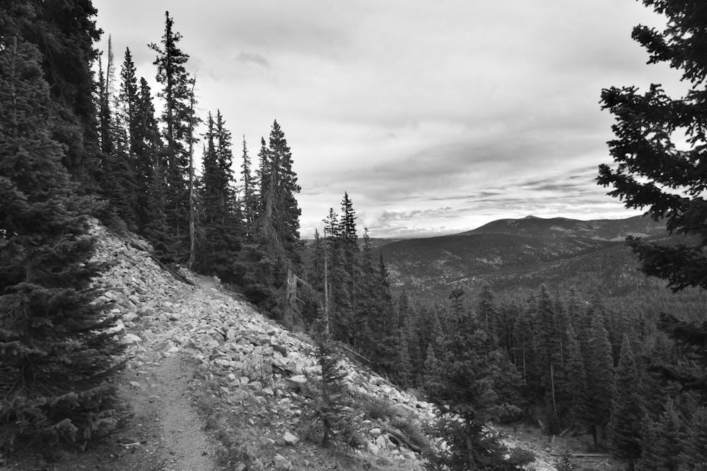
After leaving Lost Lake the trail continues through a few rock fields, still with awesome views. Enjoy them while they last, as the trail soon starts to pitch down, and you’ll find yourselves in deep forest again, on a wider trail (old roadbed). This very fast section of trail includes a number of larger switchbacks, before the junction with Middle Fork/FR 58. Turn right here, down FR 58 (which goes along the Middle Fork Red River). This gets you back to your car at the end of this road.
Caution notes: this is a high alpine-style ride. Be self-sufficient. The weather can change quickly here—thunder and lighting are common in this zone. The typical riding season is June - October. Also, this is black bear and mountain lion country.
Difficult
Mostly stable trail tread with some variability featuring larger and more unavoidable obstacles that may include, but not be limited to: bigger stones, roots, steps, and narrow curves. Compared to lower intermediate, technical difficulty is more advanced and grades of slopes are steeper. Ideal for upper intermediate riders.

Some trail sections have exposed ledges or steep ascents/descents where falling could cause serious injury.

Away from help but easily accessed.
5.6 km away
A steep climb leads to stunning views of the tallest mountains in New Mexico.
Difficult Mountain Biking
7.6 km away
Taos Ski Valley's inaugural downhill run.
Moderate Mountain Biking
9 routes · Mountain Biking