870 m away
Rainbow Falls / Castle Point Loop
A beautifully diverse hike with endless views and a waterfall.
Difficult Hiking
- Distance
- 15 km
- Ascent
- 441 m
- Descent
- 446 m
An epic loop across exposed rocky bluffs, beginning and ending at Lake Minnewaska.
Hiking Difficult

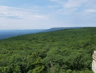
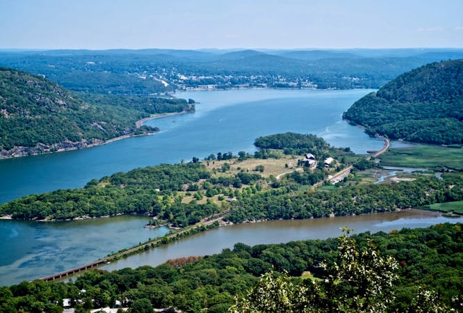
This day hiking loop connects the serene Lake Minnewaska to exposed, rocky bluffs at Gertrude's Nose. Along the way, you'll be rewarded with fantastic views of the surrounding Hudson Valley. This 22,000+ acre preserve is also home to a wide array of flora and fauna, in addition to some wildlife that is considered rare to the state.
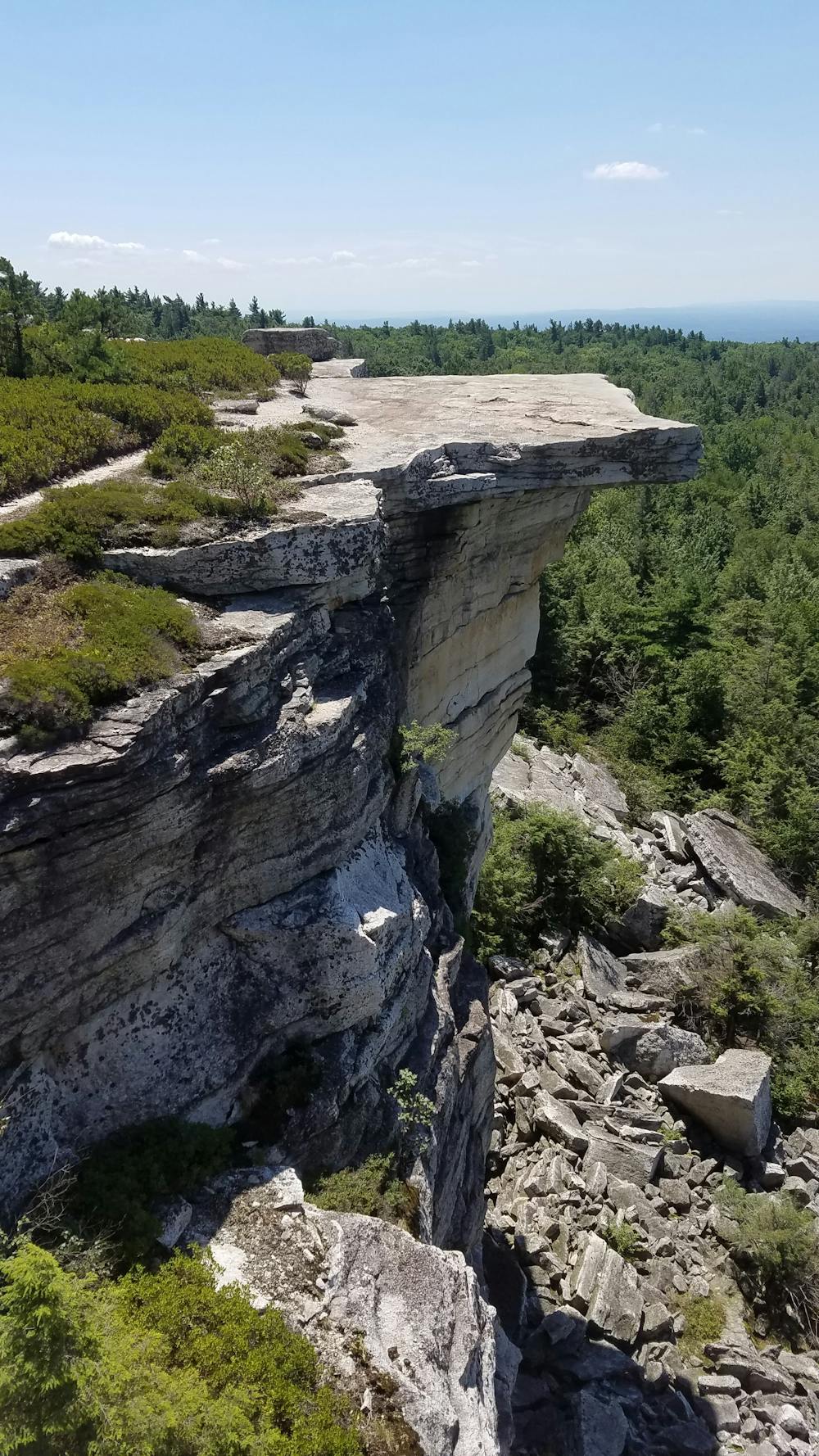
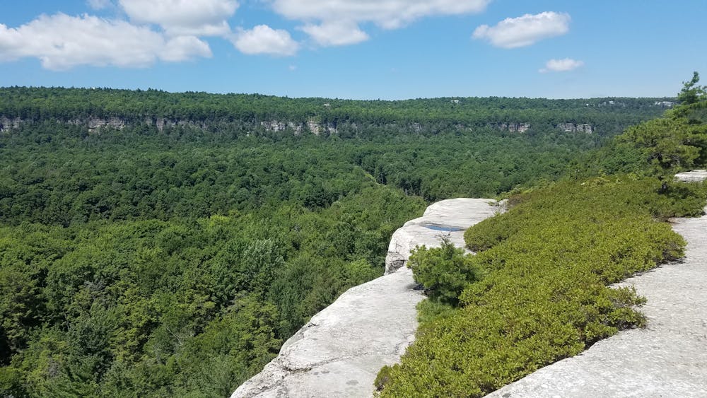
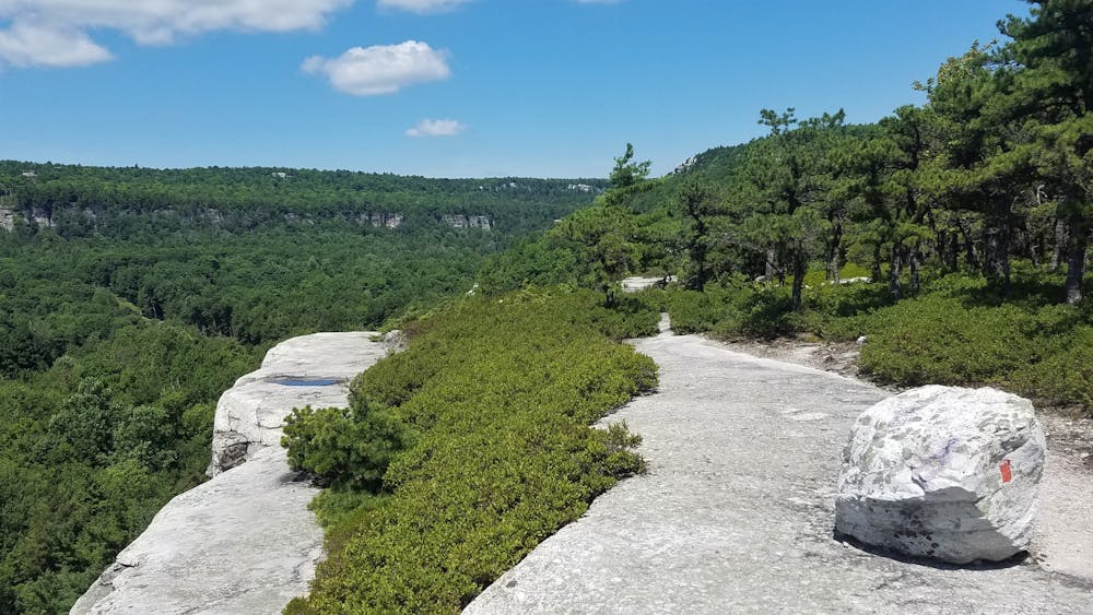
This loop can be completed in either direction, though counter-clockwise tends to be the preferred route. This way, you are constantly met with panoramic views as you hike down the cliffs to Gertrude's Nose.
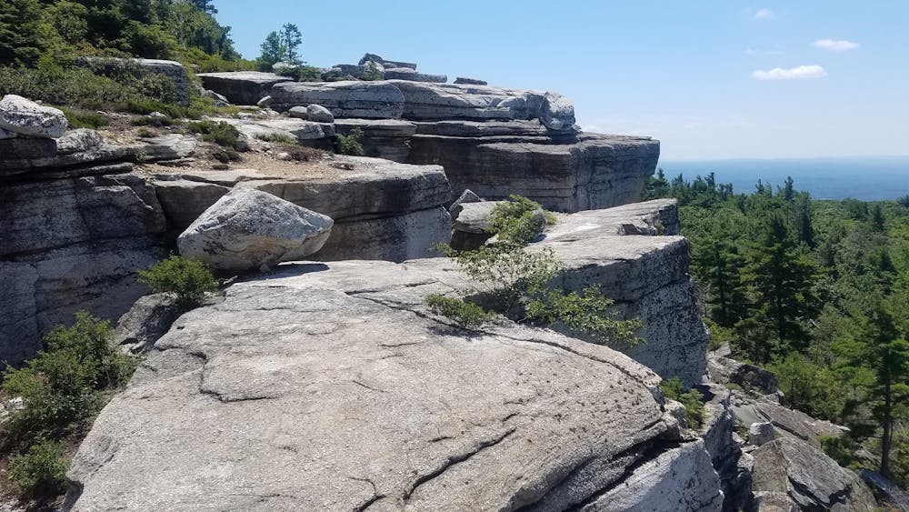
Begin your hike at the parking lot on the north side of Lake Minnewaska. Old carriage roads circle the lake and offer their own series of picturesque views along the way. At the south end of the lake, take the Millbrook Mountain Carriage Road southwest to the junction with Gertrude's Nose Trail—the namesake of the loop. As you enter the trail, follow the red blazes across the exposed rocky bluff. Be mindful of your footing as you make your way across the vertigo-inducing cliffs.
Rounding the tip of the bluff, the trail again enters under the protection of oak forests for a stretch before terminating on Millbrook Mountain. Here, the trail offers familiar, but fewer exposed views through the foliage. Climb the Millbrook Mountain Trail back to Lake Minnewaska, navigating around the east side of the lake to finish your hike.
Sources: https://en.wikipedia.org/wiki/MinnewaskaStateParkPreserve
Difficult
Hiking trails where obstacles such as rocks or roots are prevalent. Some obstacles can require care to step over or around. At times, the trail can be worn and eroded. The grade of the trail is generally quite steep, and can often lead to strenuous hiking.

Some trail sections have exposed ledges or steep ascents/descents where falling could cause serious injury.

Away from help but easily accessed.
870 m away
A beautifully diverse hike with endless views and a waterfall.
Difficult Hiking
8 routes · Hiking