3.8 km away
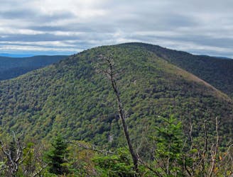
Kaaterskill High Peak: Northern Approach
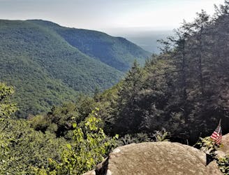
An intense, lesser-traveled approach to the Kaaterskill High Peak.
Severe Hiking
- Distance
- 17 km
- Ascent
- 1.2 km
- Descent
- 1.2 km
A straightforward hike leads to a staggering natural feature
Hiking Moderate

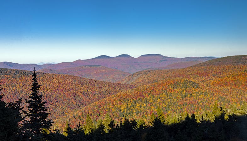
Offering a trip to the foot of the spectacular Kaaterskill Falls, and a viewpoint which overlooks it, this is a disproportionately spectacular hike for how little effort is required to complete it! As one of the tallest waterfalls in New York State, Kaaterskill Falls cascades down two tiers, plunging a total of 260 feet into a rocky pool below. The water smashing into the pool creates a fine mist which keeps the area around the falls cool even on the hottest of summer days.
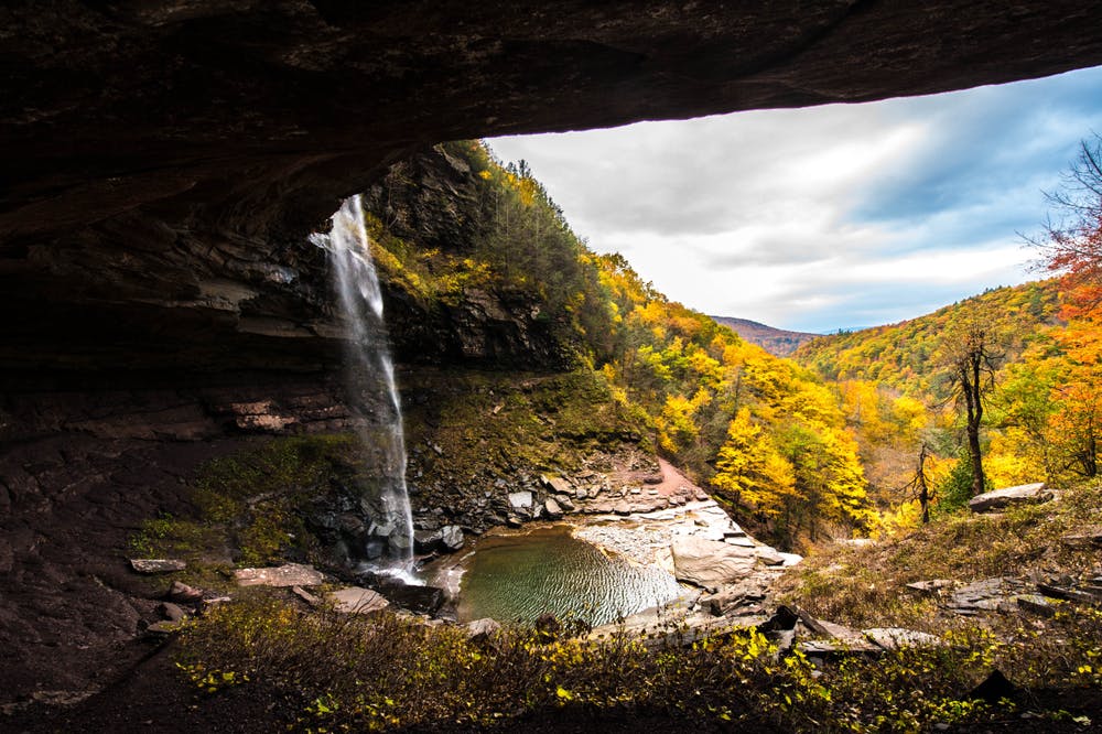
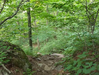
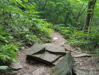
As well as the falls themselves, the forests through which you hike are charming, and the views across the surrounding hills are spectacular. The trail is not overly challenging, but it is featured and undulating, and steep in places. After rainfall (or when the wind has blown water from the falls onto the trail) it can be slippery, so sturdy footwear and a bit of caution is advised.
Moderate
Hiking along trails with some uneven terrain and small hills. Small rocks and roots may be present.

The trail contains some obstacles such as outcroppings and rock which could cause injury.
Away from help but easily accessed.
3.8 km away
An intense, lesser-traveled approach to the Kaaterskill High Peak.
Severe Hiking
7.1 km away
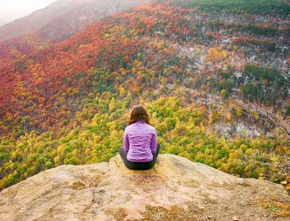
A shorter day hike to an excellent vista atop Huckleberry Point.
Moderate Hiking
7.1 km away
A popular route to summit the Kaaterskill High Peak.
Difficult Hiking
7.5 km away
A challenging day hike connecting three trails and summiting Sugarloaf Mountain.
Severe Hiking
7.7 km away
A relentless day hike to the summit of Indian Head Mountain.
Severe Hiking
7.7 km away
A rugged thru-hike bagging five of the Catskill High Peaks.
Severe Hiking
7 routes · Hiking