4.6 km away
Kitsuma Loop
One of the fastest descents in Pisgah with easy access from town.
Difficult Mountain Biking
- Distance
- 15 km
- Ascent
- 570 m
- Descent
- 569 m
Arguably the most epic loop in Pisgah National Forest
Mountain Biking Severe

Depending on who you talk to, the mere mention of Heartbreak Ridge will invoke either excitement, or fear in their eyes. This ride should not be taken lightly, as it climbs over 4,000 feet in just 20 miles. Expect to spend the majority of the day on the trail if attempting this loop.
Heartbreak Ridge is the highlight of this ride, and Old Mitchell Toll Road is arguably the most popular way to access it. Privately owned, Old Mitchell Toll Road is closed from October 1st - January 1st for hunting season.
A short hike-a-bike from the Blue Ridge Parkway makes it possible to shuttle Heartbreak Ridge, but its seasonal closures and distance make it a less popular option.
Beginning at the Kitsuma Trailhead, follow the road along Ridgecrest Conference Center before turning right at the main gate. A left on West Ridge Drive will have you heading in the correct direction. Even for those who have completed this loop before, this section can be tricky to navigate as there is no signage denoting the right way to the trailhead.
Once past the conference center, follow the signs for Rattlesnake Trail. The obscure trailhead can be found after passing by a couple of fields. This section is extremely steep and will likely turn into a hike-a-bike for most. After reaching the 3-way intersection, keep right to continue onto Old Mitchell Toll Road.
Countless intersections with other trails and roads lie ahead and at times it can be tricky to follow. Not far up, you'll pass a clearing that serves as a rarely-used landing pad for helicopters.
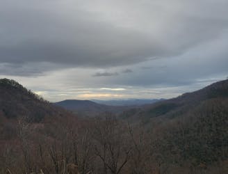
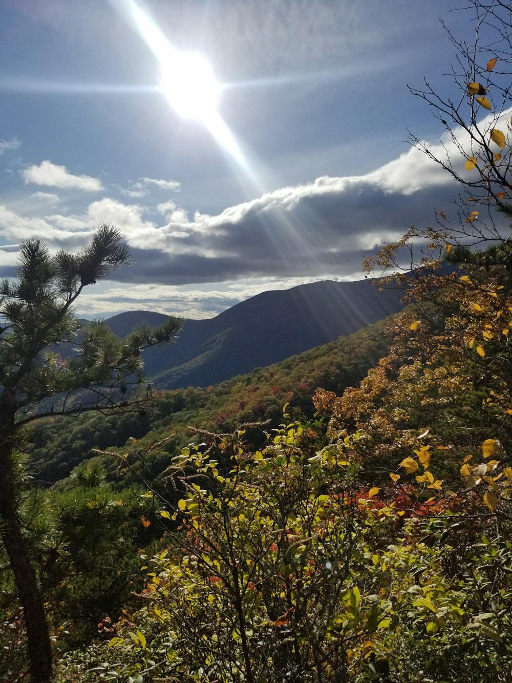
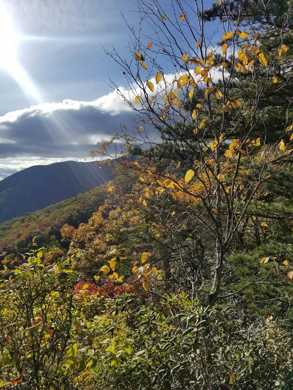
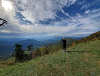
The trail continues to climb steadily as it passes countless hunting camps and cabins along the way. A handful of overlooks are located along the path and during the winter months, the views are even more spectacular. Natural springs can be found along the way, but should always be filtered.
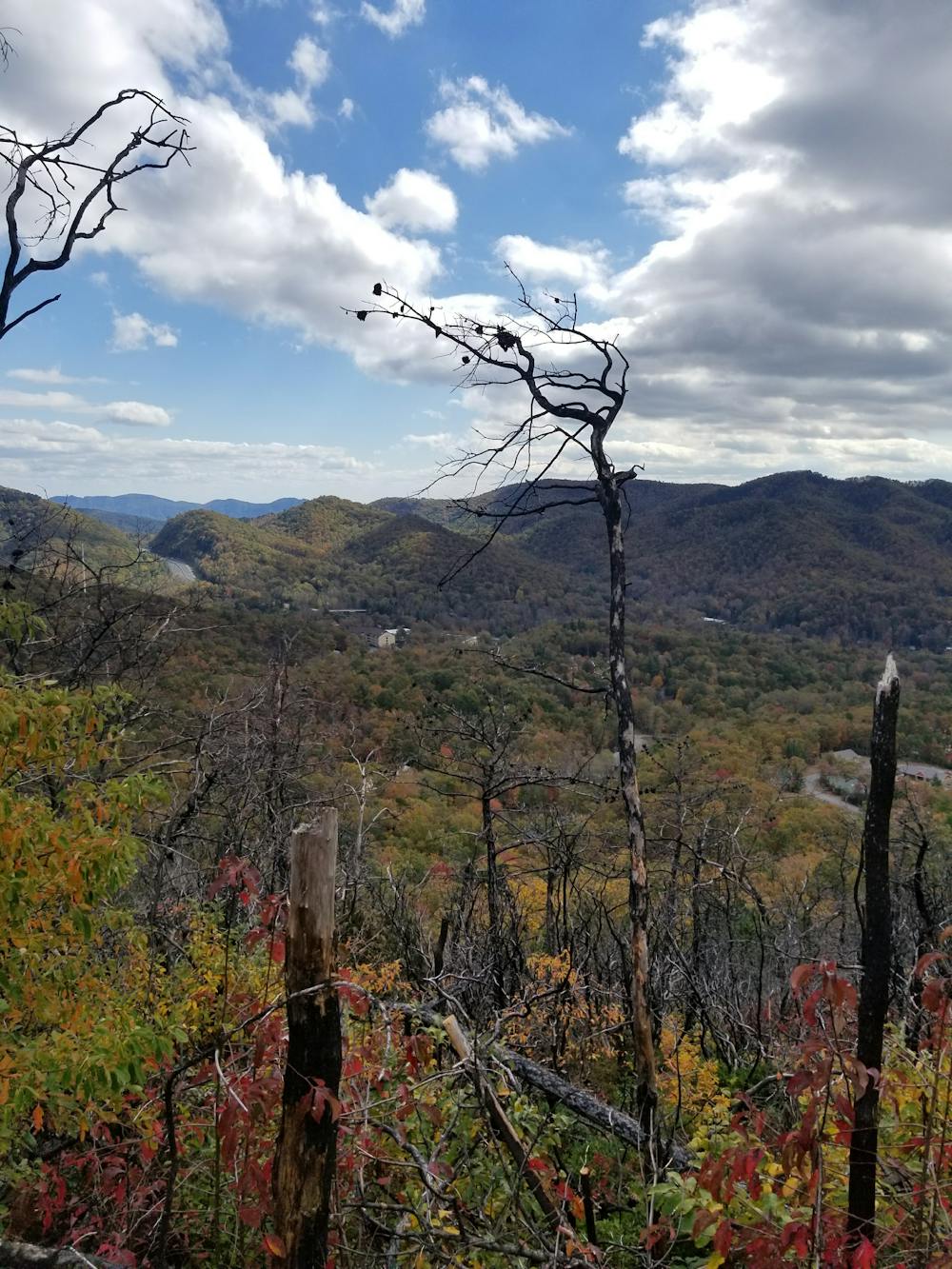
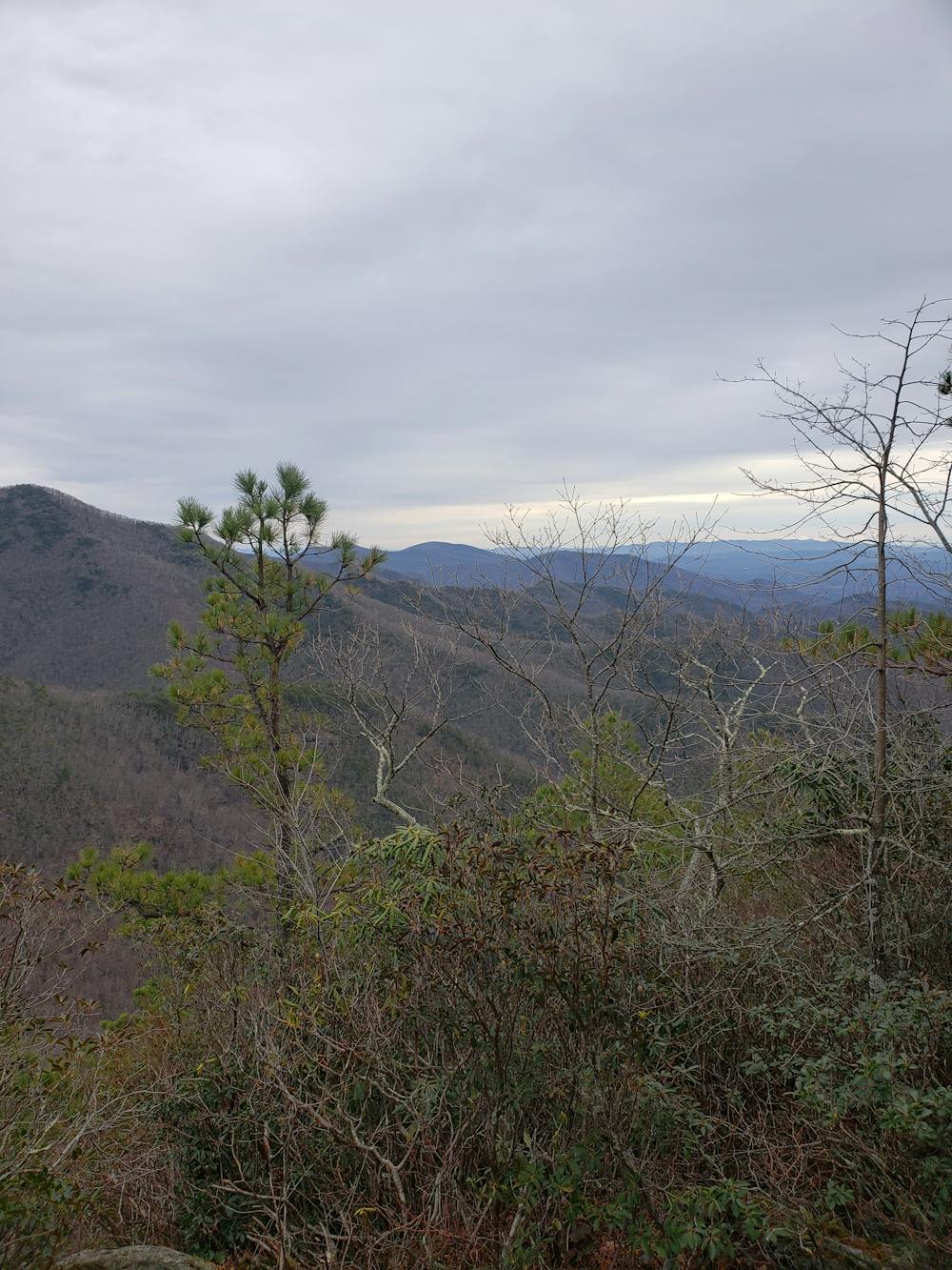
As the road climbs, the often wet and muddy road turns to toaster-sized rocks, and the climb will become much more grueling. As the path takes a hard left, you'll find a final rocky overlook that serves as a great place to catch your breath before pushing through the final gut-wrenching piece of the climb.
A trailer and old RV serve as landmarks for the top of the climb and the beginning of the upper portion of Heartbreak Ridge. Though wide, the first portion of the descent is extremely wild and rocky and will likely spike your heart rate higher than it ever got on the climb up.
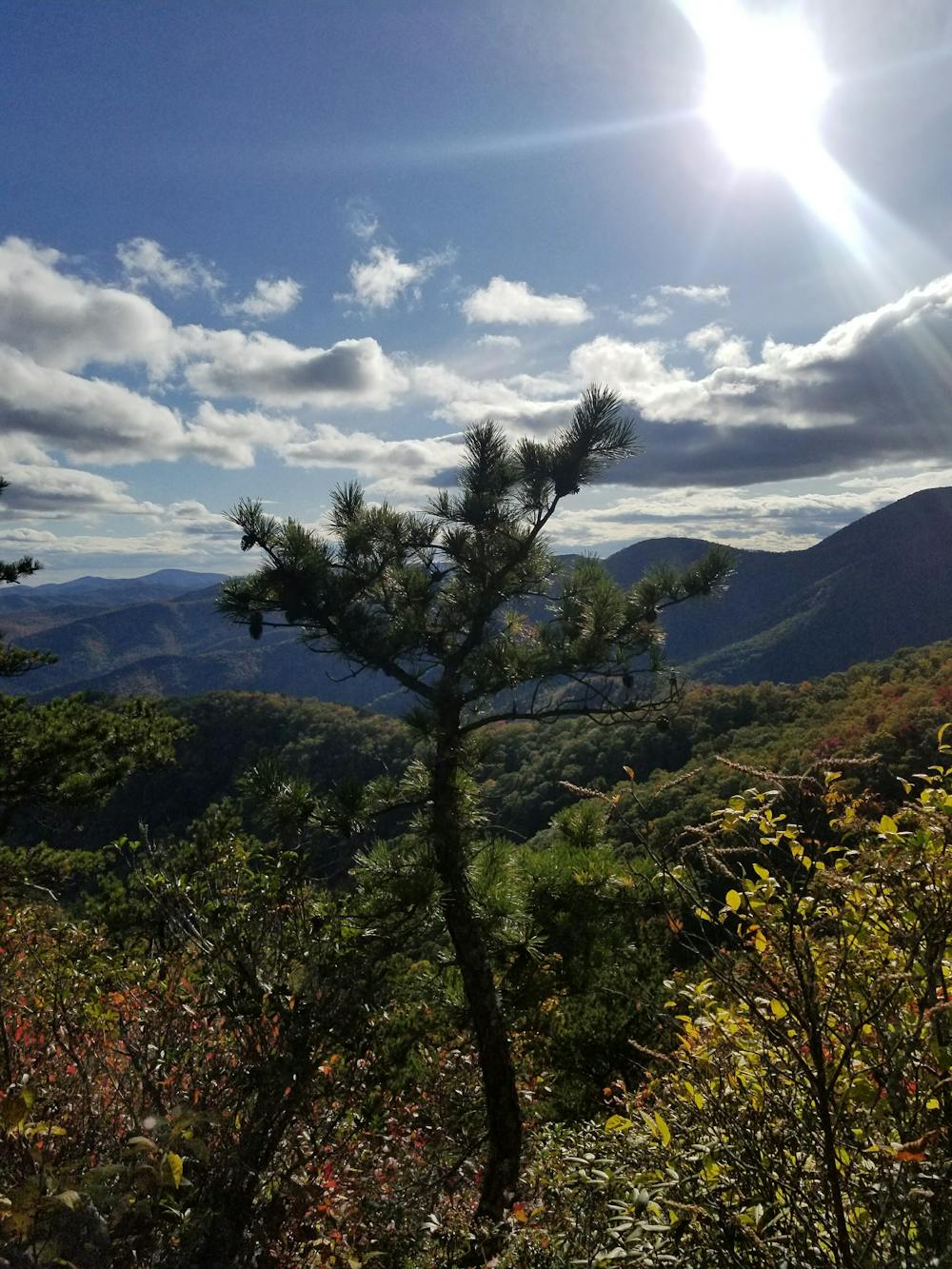
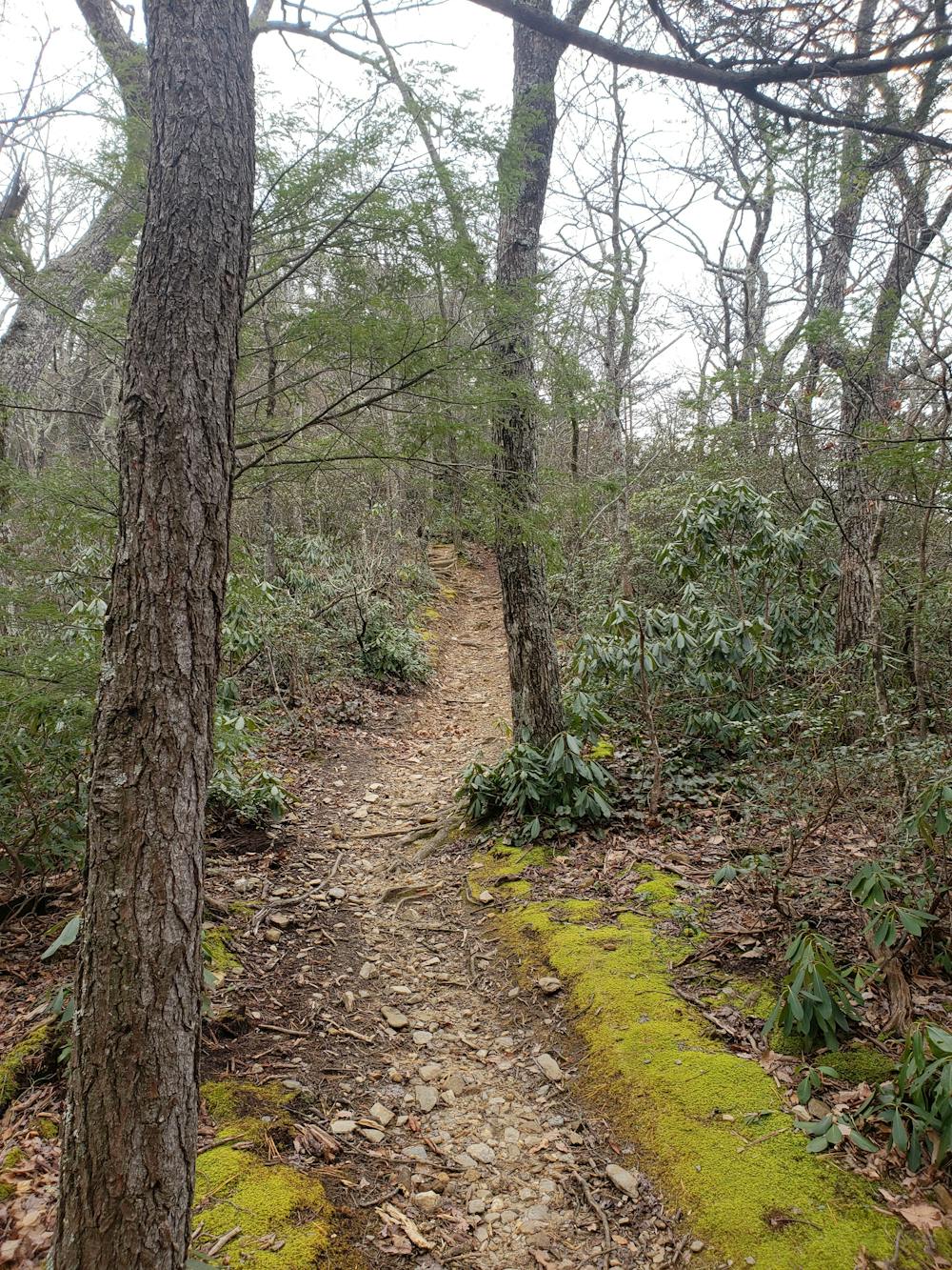
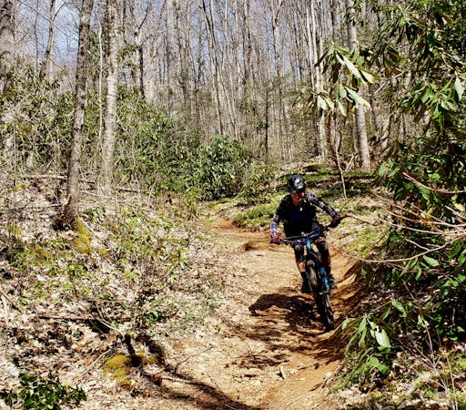
After passing through a meadow, the trail narrows as it begins its epic descent down the ridge. Alternating between the eastern and western sides of the ridge, the tight singletrack will give you an adrenaline rush as the rhododendron tunnels alternate with panoramic views off the side. At times, one part of you will want to stop to take a picture, while the other part is screaming for you to pedal faster.
Along the descent, two steep but short climbs will give your hands and arms a chance to rest.
Narrow, off-camber, rocky, and full of roots, this trail is the very best of what Pisgah National Forest has to offer.
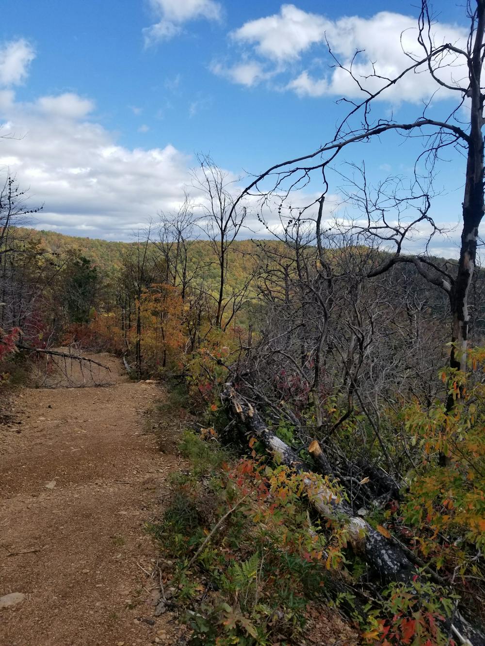
As you reach the end of Heartbreak Ridge, take the right onto Star Gap. This section has seen a significant amount of trail work over the years and is constantly changing due to erosion. The clay-covered switchbacks can be a challenge when wet and the leaves can be just as tricky in the fall and winter. One final rock roll denotes the end of the epic descent.
Cross over the creek and then the railroad tracks, you'll be on a paved road. Take the left onto Graphite Road, then right onto Mill Creek Road, where you'll climb this dirt road nearly back to the trailhead. Alternatively, you could take the left onto Mill Creek Road and then follow Old US 70 W onto the Point Lookout Trail/Greenway. This route is a couple of miles longer, but more gradual and paved the entire way back.
Severe
Widely variable, narrow trail tread with steeper grades and unavoidable obstacles of 15in/38cm tall or less. Obstacles may include unavoidable bridges 24in/61cm wide or less, large rocks, gravel, difficult root sections, and more. Ideal for advanced-level riders.

Some trail sections have exposed ledges or steep ascents/descents where falling could cause serious injury.
Little chance of being seen or helped in case of an accident.
4.6 km away
One of the fastest descents in Pisgah with easy access from town.
Difficult Mountain Biking
8.9 km away
A steep lollipop loop up Curtis Creek and down to the South Toe River.
Easy Mountain Biking
8 routes · Mountain Biking