990 m away
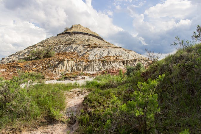
Coal Vein
A short, self-guided loop highlighting the geological history of the badlands.
Easy Hiking
- Distance
- 1.3 km
- Ascent
- 11 m
- Descent
- 11 m
An easy and accessible hike to the top of Theodore Roosevelt National Park!
Hiking Easy

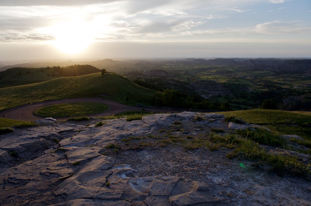
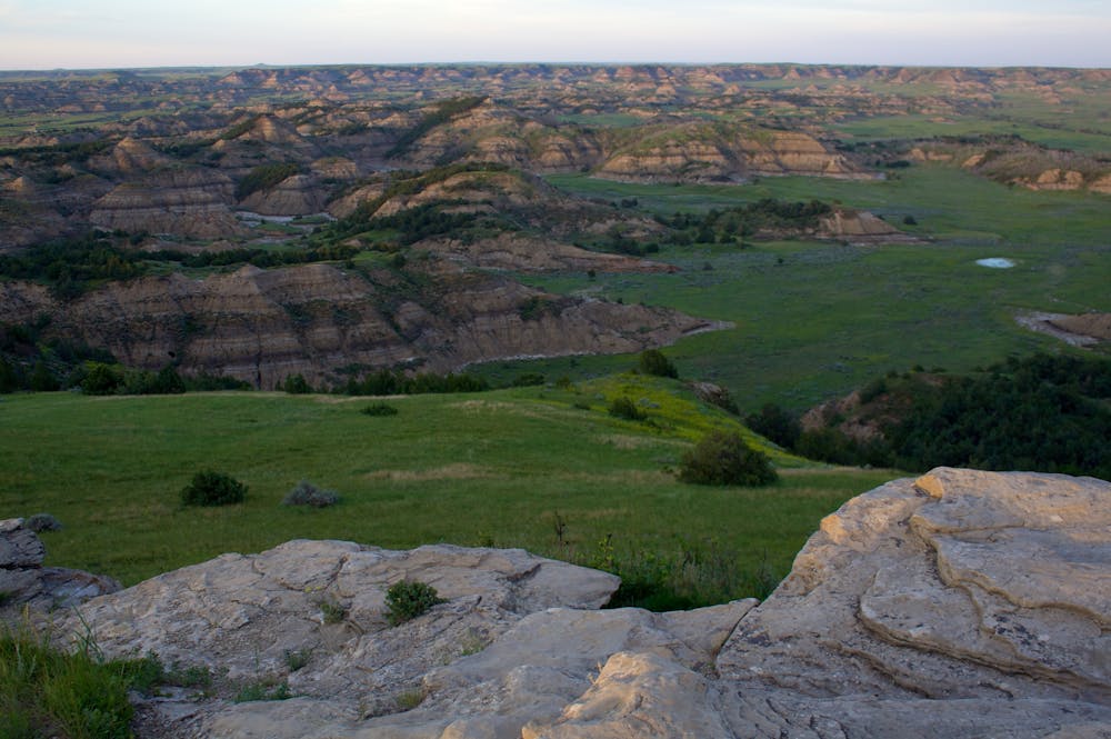
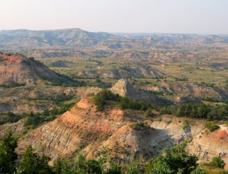
The Buck Hill Trail is one of the must-stop overlook hikes on the park's main scenic road. It's short and steep, but worth every step as you hike to the highest point in the park. At just 2,850', it isn't a particularly high peak, but "the comparative flatness of the surrounding area means you'll get breathtaking views of the surrounding North Dakota prairie and badlands, this source writes.
Looking south from the overlook, enjoy panoramic views of the North Dakota badlands as far as the eye can see. To the north, the prairies and grasslands define the horizon, painting a more gentle picture to contrast the barren landscape. Sightings of wild horses and bison are also common in the area, and the hillsides hosts an abundance of dangerous critters and cacti, so watch your step if you leave the trail to find your own spot to enjoy the view.
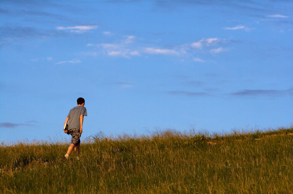
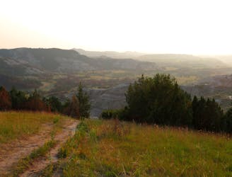
The trail originates at the end of Buck Hill Road off of the park's Scenic Loop Road. Neither restrooms nor water are available, so plan accordingly. The entire out-and-back is less than 0.5-miles and takes an average of 15 minutes to complete. That said, the open landscape warrants spending "more time in the Buck Hill area wandering around the various hills and lookouts," this author notes.
Easy
Walking along a well-kept trail that’s mostly flat. No obstacles are present.

The path is on completely flat land and potential injury is limited to falling over.
Close to help in case of emergency.
990 m away
A short, self-guided loop highlighting the geological history of the badlands.
Easy Hiking
3.6 km away
A "moderate challenge with massive rewards," and the one-stop introduction to the stunning beauty seen throughout Theodore Roosevelt NP.
Moderate Hiking
3.8 km away
An awe-inspiring overlook hike, and a ranger favorite for watching the sunset.
Easy Hiking
5.6 km away

A short, family-friendly overlook hike with breathtaking views of the badlands and their native wildlife.
Moderate Hiking
8.6 km away
A long circuit through remote badlands with multiple access points and plenty of options to shorten or lengthen your hike.
Difficult Hiking
4 routes · Hiking
10 routes · Hiking