99 m away
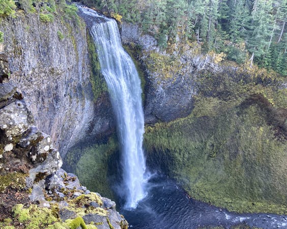
Salt Creek Falls
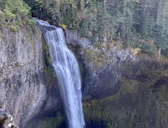
Hike to the lower viewing platform to get a better view of Salt Creek Falls.
Easy Hiking
- Distance
- 1 km
- Ascent
- 96 m
- Descent
- 96 m
Experience the best of the Cascades on this stunning hike to Diamond Creek Falls.
Hiking Moderate

This stunning hike to Diamond Creek Falls provides a lovely selection of the very best that the Cascades has to offer.
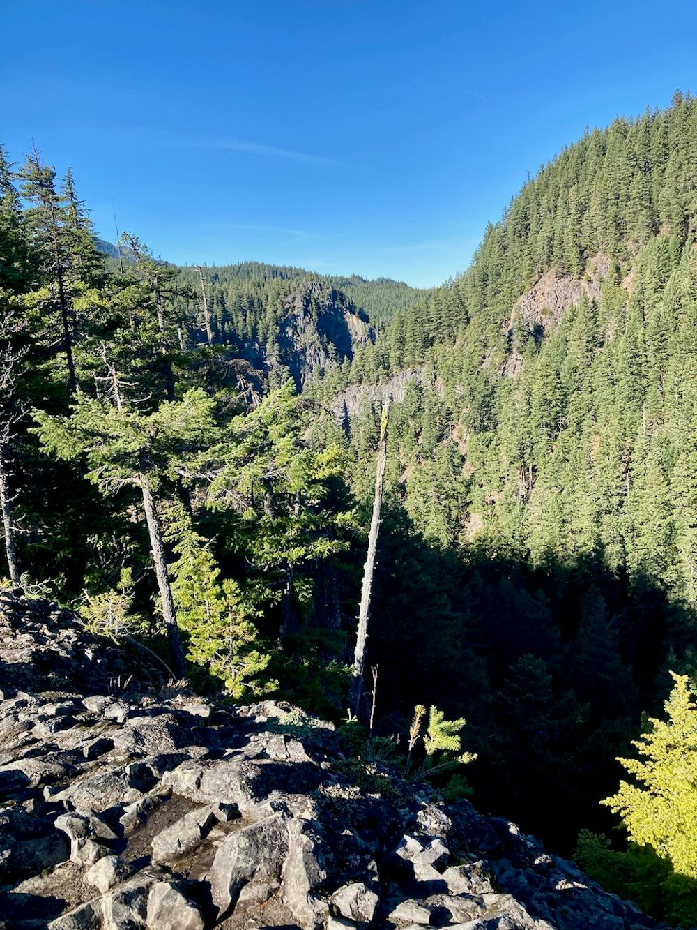
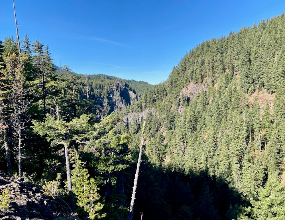
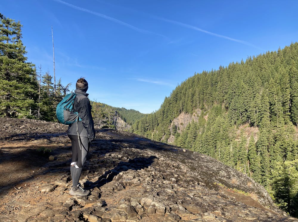
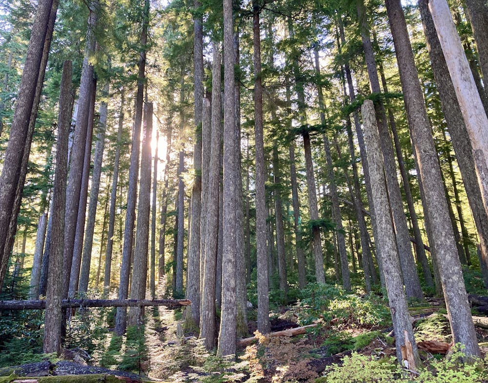
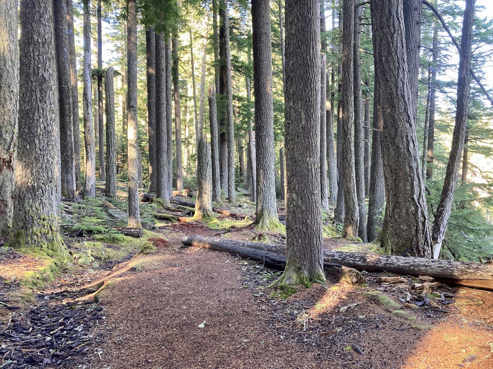
The route begins by meandering beneath a towering canopy of Douglas Fir trees on pine needle-covered trails. You'll soon pass Too Much Bear Lake and then pop out at the first view point above the canyon. These views of the canyon and long-range views of the far off mountains continue throughout most of the hike.
After traversing the rim of the Salt Creek Canyon, the trail turns away from the views as it follows the course of the Diamond Creek tributary toward the waterfalls. Even here, the trail is a stunning work of art, with dry stacked stone walls covered in moss.
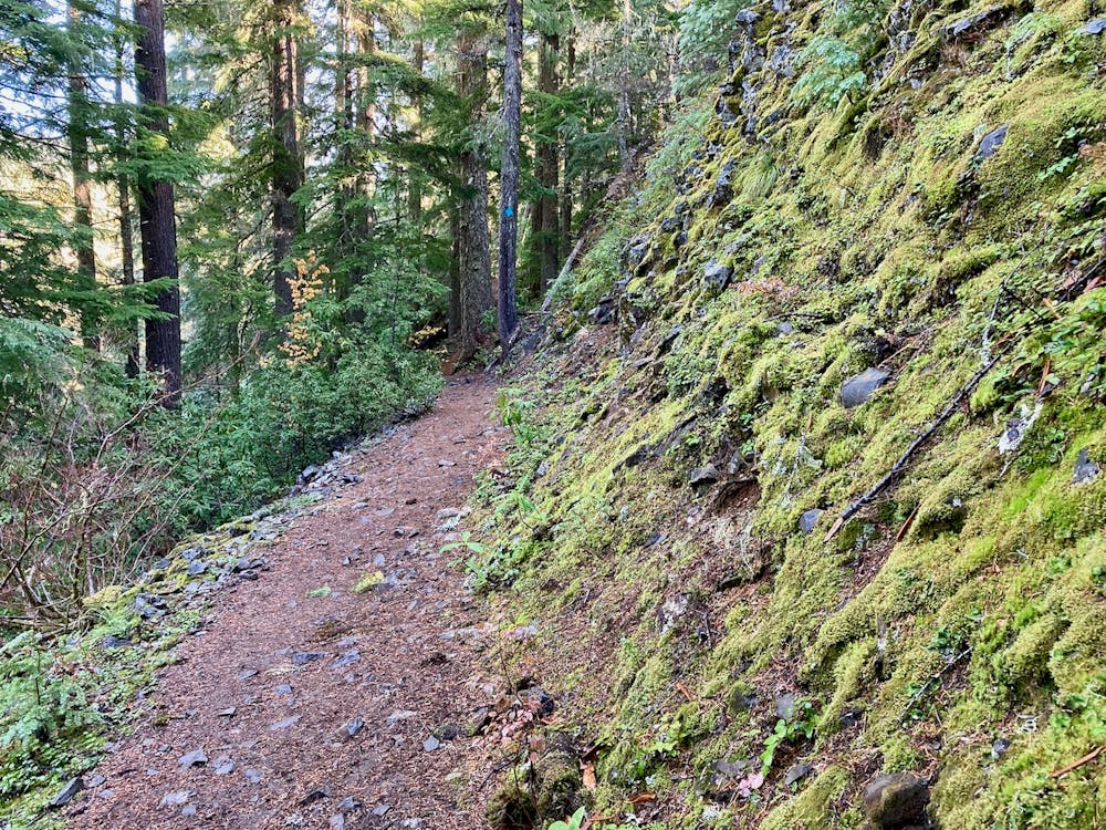
Up until this point, most of the trail has been quite mellow, with gradual climbs and descents and no major technical obstacles. After taking the right turn toward Diamond Creek Falls, the trail gets steeper as it drops into the narrow valley below. A few staircases aid in your descent and subsequent climb back up, but this section of the hike is the trickiest.
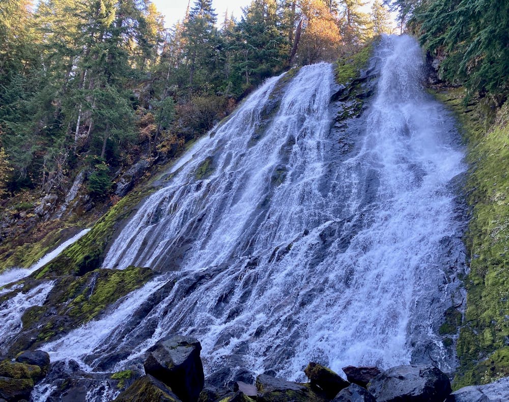
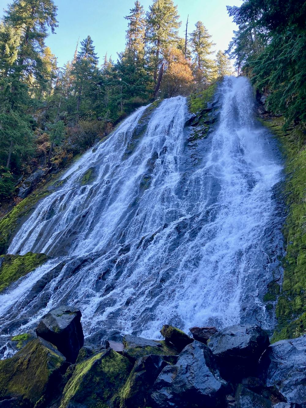
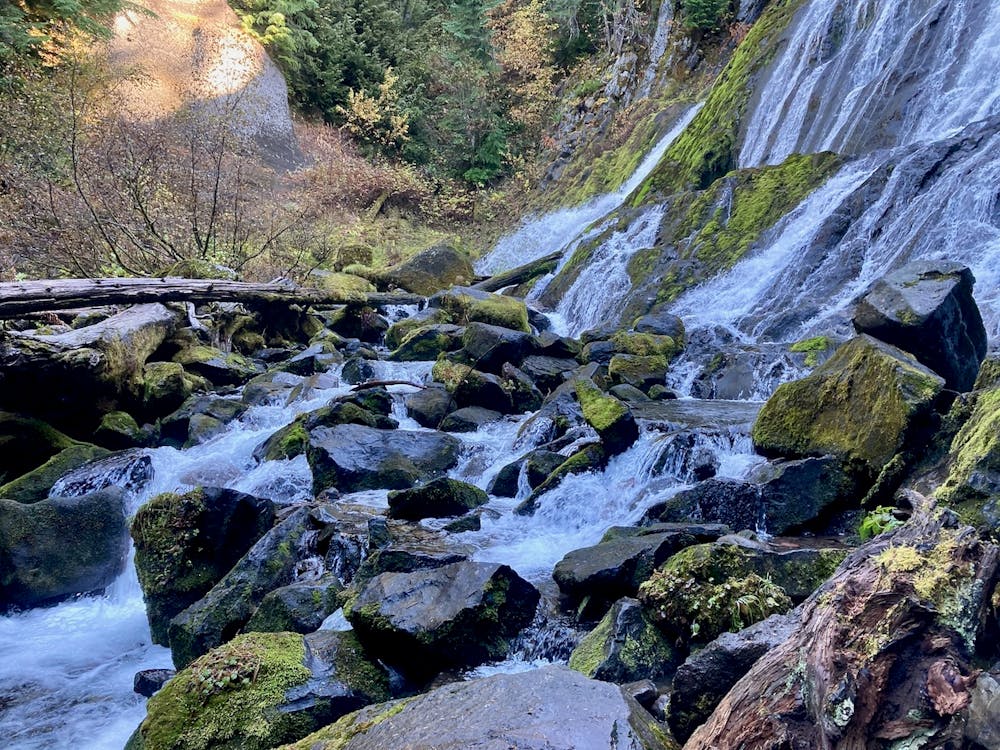
After crossing a log bridge and following a narrow stretch of singletrack in the bottom of the valley, you'll reach Diamond Creek Falls itself. This thundering cascade is nowhere near as tall as nearby Salt Creek Falls, but it's impressive and beautiful in its own right. Since you can easily reach the very bottom of the falls, you can feel the power of the rushing water in your bones.
After enjoying the waterfall to the fullest, the route mapped here returns along the same path. Since this trail is so packed with views, it's easily the most attractive option for the return. However, if you want to follow a different trail on the way back, you can complete the Diamond Creek Falls Loop instead. Check out this route for the loop map.
Moderate
Hiking along trails with some uneven terrain and small hills. Small rocks and roots may be present.

The trail contains some obstacles such as outcroppings and rock which could cause injury.
Away from help but easily accessed.
99 m away
Hike to the lower viewing platform to get a better view of Salt Creek Falls.
Easy Hiking
7.7 km away

Miles 1907.9-1952.6 of the northbound PCT: Traveling expansive old-growth forest on a land of ancient volcanism, entering the Three Sisters Wilderness.
Moderate Hiking
5 routes · Hiking
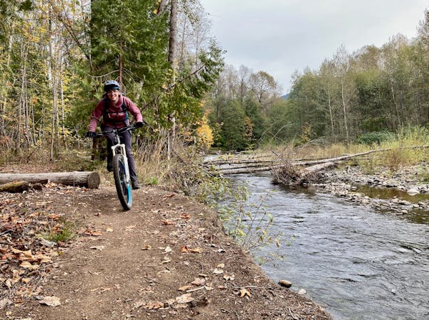
5 routes · Mountain Biking · Hiking · Trail Running

72 routes · Hiking