99 m away
Diamond Creek Falls
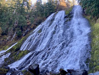
Experience the best of the Cascades on this stunning hike to Diamond Creek Falls.
Moderate Hiking
- Distance
- 5.2 km
- Ascent
- 176 m
- Descent
- 176 m
Hike to the lower viewing platform to get a better view of Salt Creek Falls.
Hiking Easy

Salt Creek Falls plunges 286 vertical feet off of a sheer cliff into a beautiful canyon far below. This impressive natural formation is the third tallest waterfall in the state of Oregon.
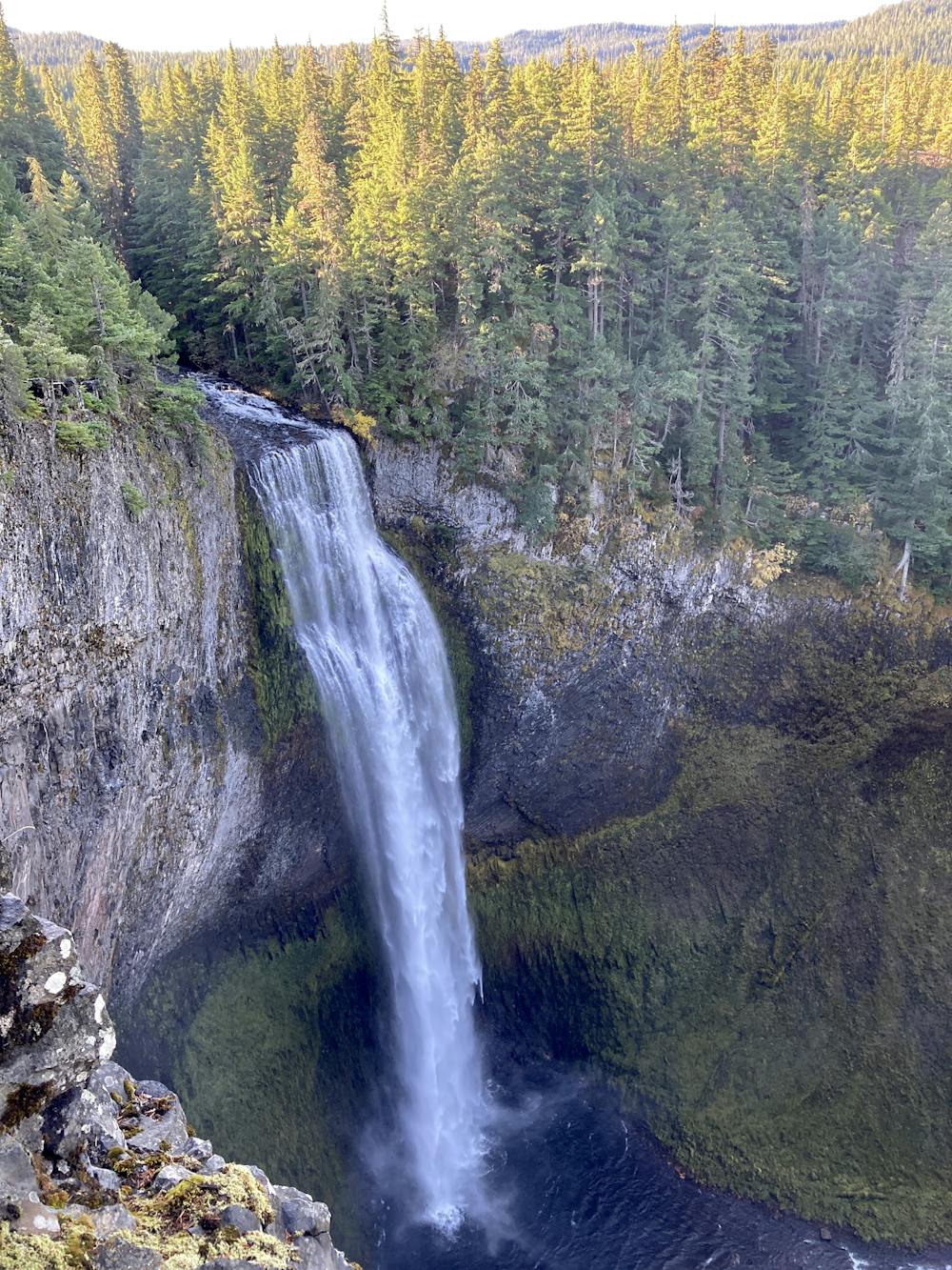
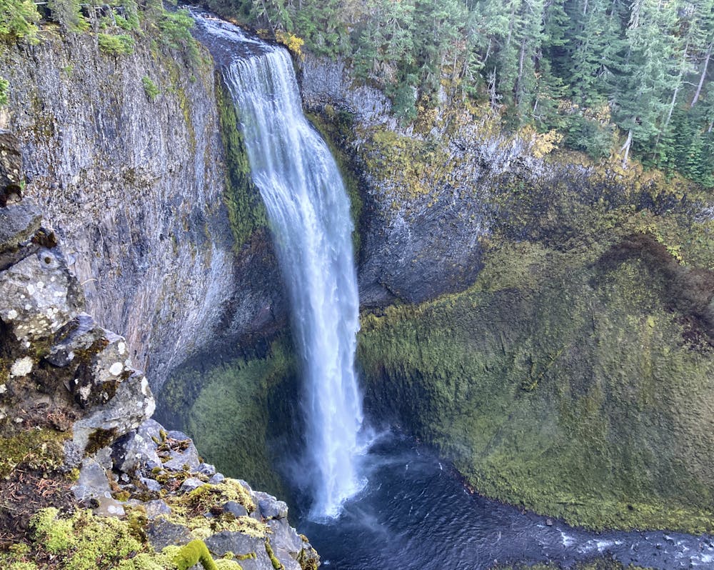
While the falls can be viewed from above just a few feet from the parking lot, the short route mapped here descends a smooth but sometimes steep trail to a lower viewing platform.
The trail tread consists of a smooth, well-maintained gravel path with handrails to keep hikers from cutting the switchbacks. A few of the pitches can be a bit steep. Those unaccustomed to hiking should consider this on the way down, as there's only one way back up the hill.
A rock slide wiped out the original lower viewing platform, and a new one has been built higher up the mountainside just before the rock slide path. Signs warn hikers against continuing beyond the viewing platform due to shifting rocks and sand.
The lower platform offers an incredible view of this stupendous waterfall, allowing you to feel the power of the water as it thunders into the canyon below. Even though the falls are still a ways off, you'll get to bask in the mist from the water--a surreal experience!
Easy
Walking along a well-kept trail that’s mostly flat. No obstacles are present.

The path is on completely flat land and potential injury is limited to falling over.
Close to help in case of emergency.
99 m away
Experience the best of the Cascades on this stunning hike to Diamond Creek Falls.
Moderate Hiking
7.8 km away

Miles 1907.9-1952.6 of the northbound PCT: Traveling expansive old-growth forest on a land of ancient volcanism, entering the Three Sisters Wilderness.
Moderate Hiking

5 routes · Hiking

5 routes · Mountain Biking · Hiking · Trail Running

72 routes · Hiking