9.5 km away
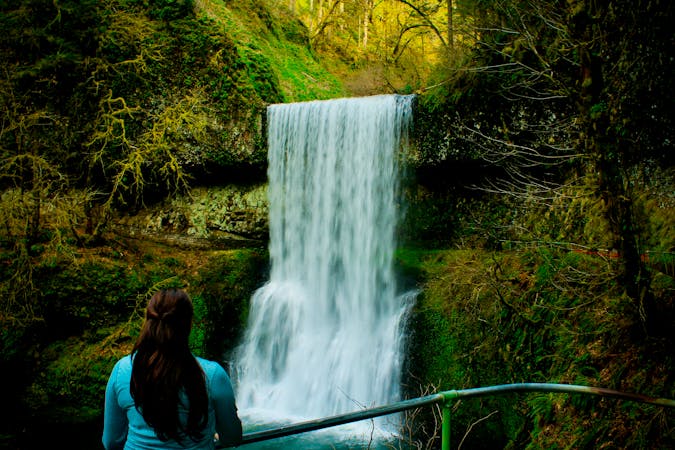
Tamanawas Falls
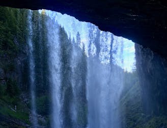
A beautiful hike through a narrow stream valley leads to a picture-perfect waterfall.
Moderate Hiking
- Distance
- 5.2 km
- Ascent
- 159 m
- Descent
- 159 m
Gain otherworldly views of Mount Hood from this ridge above Laurance Lake.
Hiking Difficult

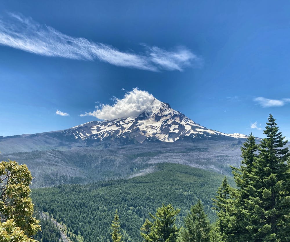
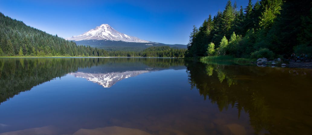
Mount Hood is arguably one of the most photogenic mountain peaks in the USA. This imposing monolith stands solitary on the skyline, soaring above treeline, with the upper reaches of the peak covered in glaciers and rock freshly scraped by the receding ice flows. Visible from miles in all directions, Mount Hood is photographed, painted, and admired by many millions of people every year.
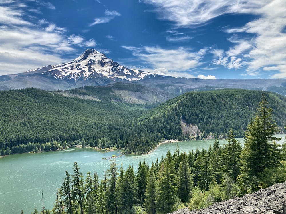
But sometimes, finding the perfect view of the mountain can seem difficult. There'll often be a powerline in the way, a road, a house, a tree that's perfectly blocking your view. But if you know where to go, you can find the perfect vista. This hike above Laurance Lake on the Hood River side of Mount Hood provides a series of stunning views along the route and from the top of the ridge, looking toward the vaulted peak of Mount Hood.
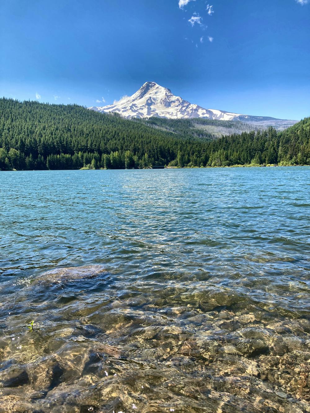
The hike begins on the shores of the crystal-clear Laurance Lake—in and of itself a fantastic destination for swimming and SUPping. After crossing the dam, the trail begins climbing in earnest, switchbacking back and forth as it winds its way up a steep-sided ridge. The hiking is very aerobic in the first section, and a few rocky bits and steep ascents could prove tricky to the uninitiated. Yet with reasonable fitness, you'll press ahead, and make for the ridgeline.
Upon arriving at the ridge, you'll, unfortunately, find yourself shrouded in trees. The grade mellows out, though, the trail rolling up and down as it continues to ascend along the top of the ridge. Occasional views toward Mount Adams will open up through the trees, but Mount Hood remains obscured.
Keep hiking until the end of this route, as mapped. Here, you'll find a break in the trees, and the promised unobstructed vistas of Mount Hood will open up grandly before you! Break out your lunch and maybe a trail bevy, perch on one of the rocks, and drink in this incredible view of this majestic peak!
Once done, it's recommended to return the way you came. While on the map it might look like you could hike a loop back to Laurance Lake, the trail going around the opposite side of the lake is little-traveled and can be hard to follow. Returning the way you came is highly recommended.
Difficult
Hiking trails where obstacles such as rocks or roots are prevalent. Some obstacles can require care to step over or around. At times, the trail can be worn and eroded. The grade of the trail is generally quite steep, and can often lead to strenuous hiking.

The trail contains some obstacles such as outcroppings and rock which could cause injury.
Away from help but easily accessed.
9.5 km away
A beautiful hike through a narrow stream valley leads to a picture-perfect waterfall.
Moderate Hiking
10 routes · Hiking · Trail Running
7 routes · Hiking

10 routes · Hiking