2.6 km away
Chief Joseph Mountain
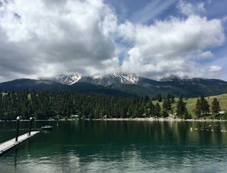
Adventurous peak climb to a prominent mountain looming over Wallowa Lake.
Extreme Hiking
- Distance
- 21 km
- Ascent
- 2.1 km
- Descent
- 2.1 km
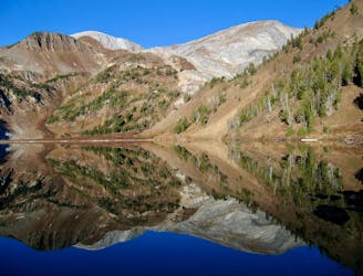
Hike from the summit of Mount Howard along the flanks of East Peak
Hiking Moderate

This trail runs from the summit of Mount Howard, accessible via the sightseeing tram ride. From Howard, this trail runs along a ridge and then traverses across the slopes of East Peak. The trail as mapped doesn't make for the summit of East Peak, although you could very easily remain on the ridge to tag that summit.
Moderate
Hiking along trails with some uneven terrain and small hills. Small rocks and roots may be present.
2.6 km away
Adventurous peak climb to a prominent mountain looming over Wallowa Lake.
Extreme Hiking
2.6 km away
Bag two summits over 9,000 feet in the Eagle Cap Wilderness.
Extreme Hiking