2.6 km away
Chief Joseph Mountain
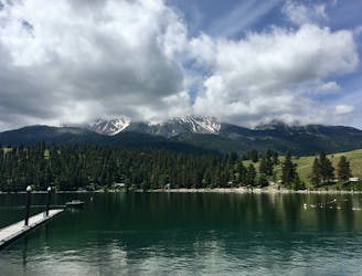
Adventurous peak climb to a prominent mountain looming over Wallowa Lake.
Extreme Hiking
- Distance
- 21 km
- Ascent
- 2.1 km
- Descent
- 2.1 km
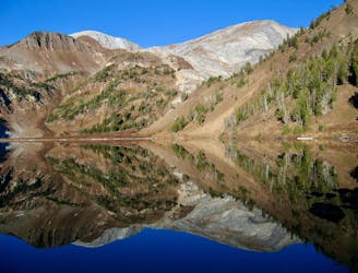
Easy sightseeing hike around the summit of Mount Howard
Hiking Easy

This is a popular hiking route which is generally considered to be easy. It's an unknown remoteness, it features unknown exposure and is typically done in an unknown time of year. From a low point of 2.4 km to the maximum altitude of 2.5 km, the route covers 2.8 km, 101 vertical metres of ascent and 101 vertical metres of descent.
This is an easy sightseeing hike around the summit of Mount Howard, accessible from the top of the scenic tram ride.
Easy
Walking along a well-kept trail that’s mostly flat. No obstacles are present.
2.6 km away
Adventurous peak climb to a prominent mountain looming over Wallowa Lake.
Extreme Hiking
2.6 km away
Bag two summits over 9,000 feet in the Eagle Cap Wilderness.
Extreme Hiking