2.4 km away
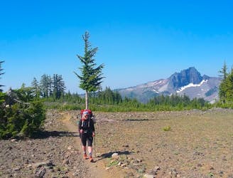
Broken Top: Northwest Ridge via Green Lakes Trail
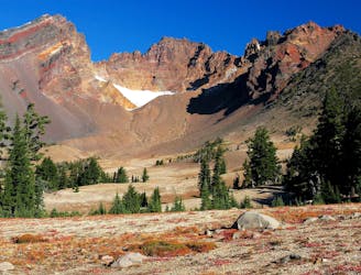
A ridge hike and scramble to an impressive summit in the Three Sisters Wilderness.
Extreme Hiking
- Distance
- 20 km
- Ascent
- 1.1 km
- Descent
- 1.1 km
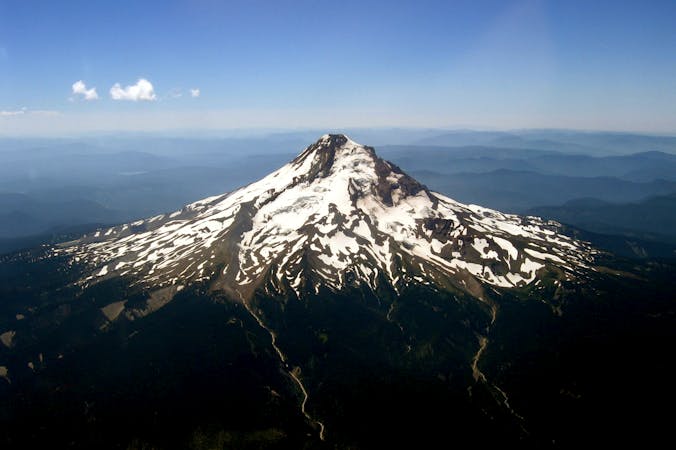
Climb the tallest of Oregon's Three Sisters, the third tallest mountain in the state.
Hiking Severe

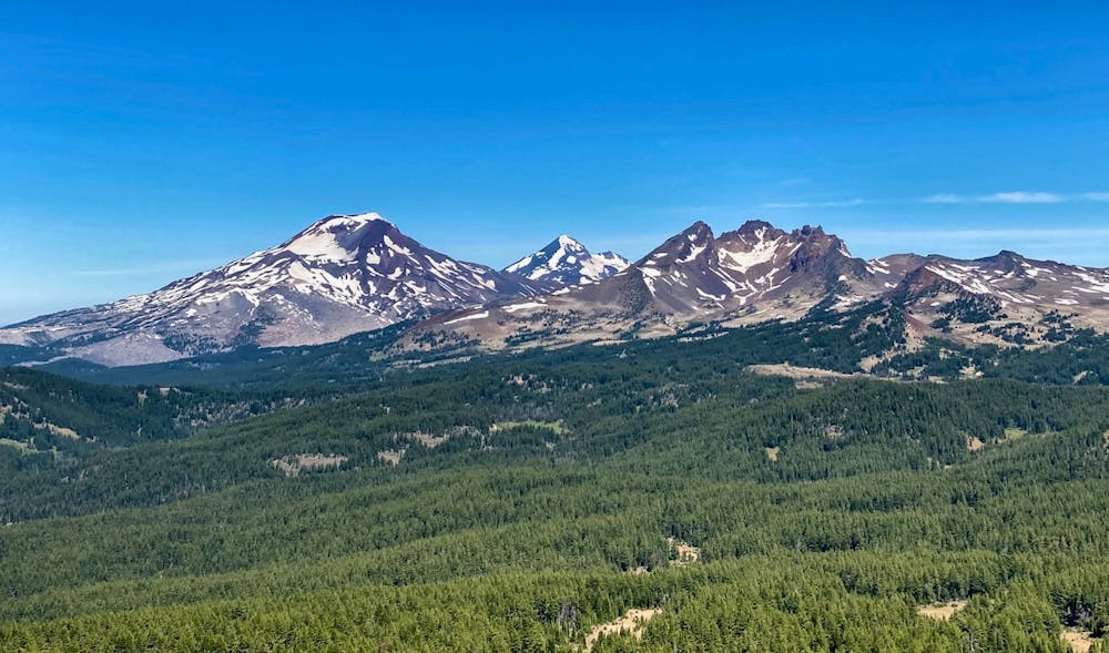
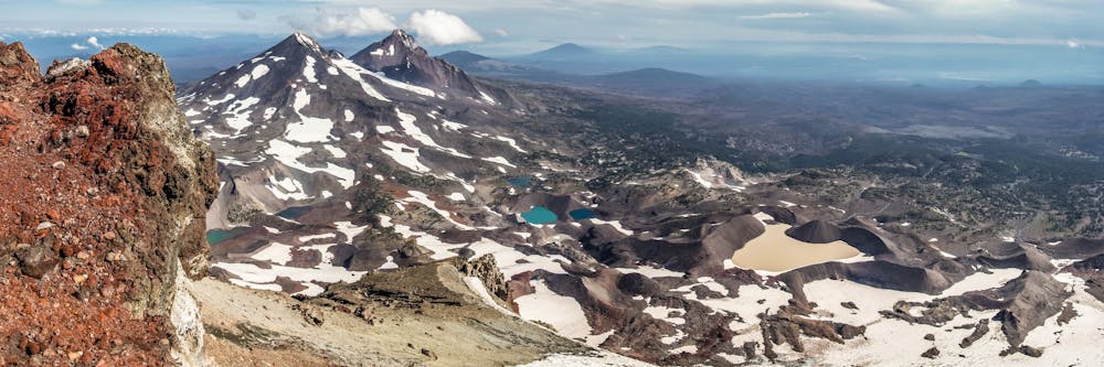
The Three Sisters formation of volcanoes dominates the skyline of the Cascade Mountains as they march up the spine of Oregon, just to the west of Bend. The tallest of the three is 10,358-foot South Sister, and consequently, it is a popular hiking, trail running, and mountaineering objective. South Sister is also the third tallest mountain in Oregon, and its summit cauldron “holds the highest lake in Oregon–when it’s not frozen and buried in snow,” according to Jeff Hester on SoCalHiker.net. Also of note, South Sister is home to eight glaciers, including the largest in Oregon—Pouty Glacier.
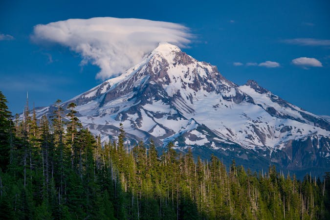
While there are a few technical routes up the South Sister, the popular south side route beginning from either Green Lakes or Devils Lake is a non-technical ascent that is achievable for most fit hikers. "The route requires only decent physical conditioning and a tolerance for massive amounts of scree,” according to Josh Lewis on SummitPost.org. That may be true in comparison to the more technical mountaineering routes found on the same mountain, but the 5,000 foot climb over the course of almost 6 miles (one-way) to reach the summit, and the subsequent return trip, makes South Sister a full-day summit hike.
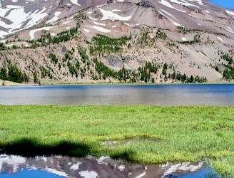
The trail to the summit is "exceedingly steep, long and rugged,” according to Oregon.com. The lower sections are mellow, but the trail steepens quickly. Along the way, it passes beautiful alpine lakes, including Moraine Lake. An out-and-back to Moraine Lake is a beautiful hiking objective in its own right.
The final mile to the crater rim is the most difficult of the climb, as you must ascend a volcanic scree field. The trail "spiders into a series of multiple routes, scurrying up steep volcanic scree that takes half a step back for each step forward,” according to Hester. This final push to the summit is completely exposed. In mid-summer, if you don’t get an early enough start, the heat of the sun can be brutal. If the weather is adverse, you can easily be caught out in rain, hail, snow… or worse.
Once at the top, enjoy the stunning views from Oregon’s third-highest mountain and the unique volcanic landscape around you! The route mapped here circumnavigates the summit cauldron—consider hiking around the entire cauldron as a way to truly savor this unique experience.
Once done, return to the trailhead the way you came.
Sources: https://www.summitpost.org/south-sister/150455 https://www.oregon.com/recreation/hike-south-sister https://socalhiker.net/hiking-south-sister/
Severe
Hiking challenging trails where simple scrambling, with the occasional use of the hands, is a distinct possibility. The trails are often filled with all manner of obstacles both small and large, and the hills are very steep. Obstacles and challenges are often unexpected and can be unpredictable.

The trail contains some obstacles such as outcroppings and rock which could cause injury.

In the high mountains or remote conditions, all individuals must be completely autonomous in every situation.
2.4 km away
A ridge hike and scramble to an impressive summit in the Three Sisters Wilderness.
Extreme Hiking
2.4 km away
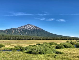
One of the most rewarding hikes near Bend, Oregon.
Moderate Hiking
7.6 km away
Miles 1952.6-1983.8 of the northbound PCT: Out of the woods and into a mosaic of black and green, crossing volcanic plateaus and lava flows at the feet of the Three Sisters.
Moderate Hiking
9 km away
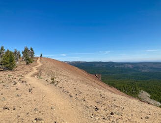
Enjoy stunning 360-degree views from the top of this quick climb.
Difficult Hiking
9.6 km away
Climb to the iconic volcanic summit towering above the Cascade Lakes Highway.
Severe Hiking

3 routes · Alpine Climbing · Hiking
9 routes · Hiking
10 routes · Alpine Climbing · Hiking
5 routes · Alpine Climbing · Hiking

72 routes · Hiking