1 m away
Sahalie Falls and Koosah Falls Out-and-Back
This short but sweet hike offers spectacular views of two of Oregon's most beautiful waterfalls.
Moderate Hiking
- Distance
- 1.4 km
- Ascent
- 51 m
- Descent
- 51 m
This spectacular loop hike offers a multitude of views of two of Oregon's most beautiful waterfalls.
Hiking Moderate

The Waterfall Trail is a short, relatively easy loop that offers a multitude of views of two spectacular waterfalls: Sahalie Falls and Koosah Falls.
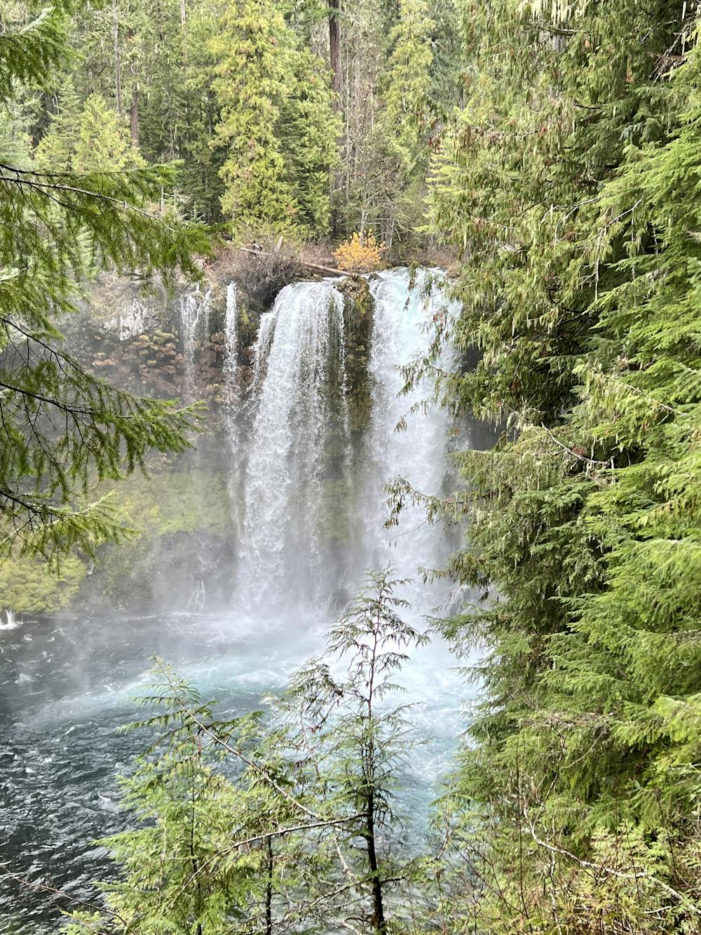
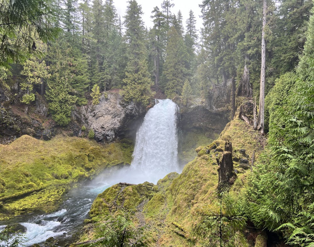
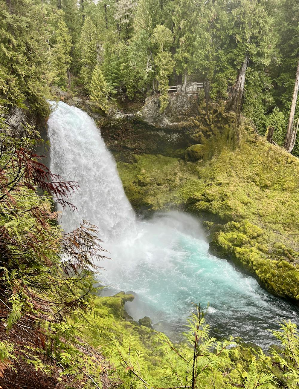
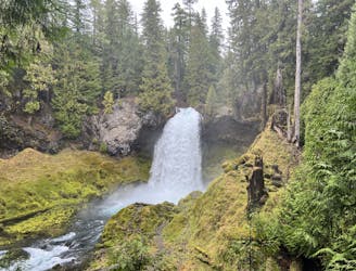
The hike begins from the Sahalie Falls viewpoint, where you'll enjoy views of the Sahalie immediately. This waterfall is about 75 feet tall (although some interpretive signs may exaggerate its height to 100 feet), but the thundering water pouring over a restricted cleft in a lava ledge is absolutely impressive! It pounds into a pool below, with the mist from the crashing water nourishing the moss that covers the lava rock around the pool.
After enjoying the initial viewpoint, it's time to get hiking! You'll begin by hiking downhill toward Koosah Falls, descending a combination of rough steps, roots, and rocks. The footing on these wooden steps, roots, and rocks is often very slippery due to the mist from the falls and the constant precipitation here in the rainforest. The dirt is also often muddy, so take care on the descent.
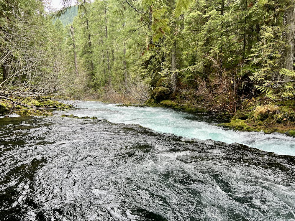
As you walk down the banks of the McKenzie River, be sure to stop and appreciate the towering canopy of Douglas-fir, western hemlock, and western red-cedar. You'll also get to enjoy numerous rapids and minor falls before reaching Koosah Falls.
Koosah has a variable appearance depending on the time of year, ranging from two separate streams in drier months to a single 70-foot-wide plunge during full flow in the springtime. The falls drops about 70 feet into the beautiful pool below.
After passing Koosah, you'll continue hiking down a gorgeous trail until you hit a dirt road near a reservoir. Take a right turn to cross the bridge, and then look for a singletrack trail picking up near the pit toilet. This small feeder trail leads to the main McKenzie River Trail, where you'll take a right turn to head back upriver.
Since you're hiking back upriver, you'll get to see both Koosah and Sahalie Falls again from totally different vantage points! This stretch of the trail also swings away from the river at times, dropping you into the quiet solitude of the forest.
On this uphill section, you'll hike past Sahalie to cross the river on a narrow bridge before turning right once again to head back down to the parking lot. Before reaching the parking lot, you'll enjoy one more vantage of Sahalie Falls before this stunning hike concludes.
Moderate
Hiking along trails with some uneven terrain and small hills. Small rocks and roots may be present.

The trail contains some obstacles such as outcroppings and rock which could cause injury.
Away from help but easily accessed.
1 m away
This short but sweet hike offers spectacular views of two of Oregon's most beautiful waterfalls.
Moderate Hiking