4.5 km away
Heckletooth Loop
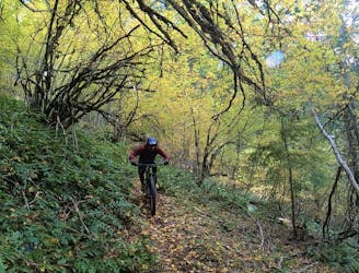
An overgrown but rewarding trail!
Severe Mountain Biking
- Distance
- 39 km
- Ascent
- 1.4 km
- Descent
- 1.4 km
Flowy intermediate-friendly shuttle run.
Mountain Biking Moderate

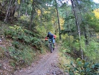
The shuttle runs in Oakridge range in difficulty from intermediate to expert, and Dead Mountain holds down the easy end of the spectrum. While advanced riders can definitely pick up some serious speed on Dead Mountain, the smooth, well-built trail is enticing to intermediate riders that are still honing their skills. With perfect dirt and delightful flow, Dead Mountain might be just the confidence boost that many intermediate riders need to progress to the next level!
Upper Dead Mountain begins with an optional loop up a road and down a short stretch of singletrack. Ironically, the roughest chunk of trail is found in this first tenth of a mile, so for an easier ride, just head straight downhill from the noted shuttle drop point.
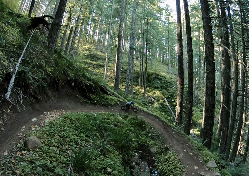
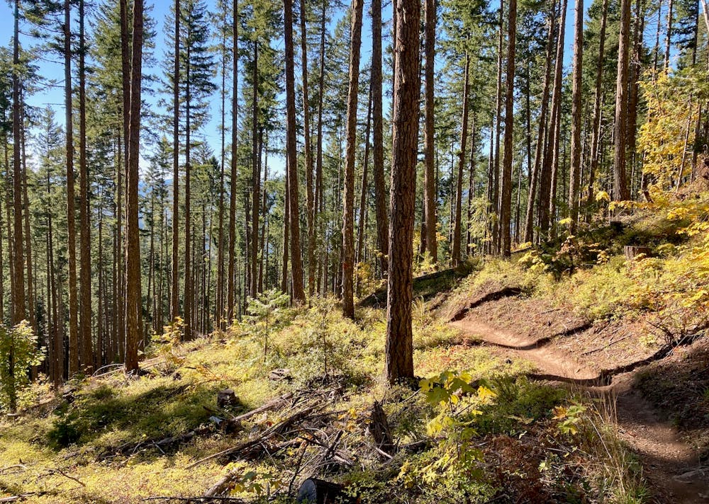
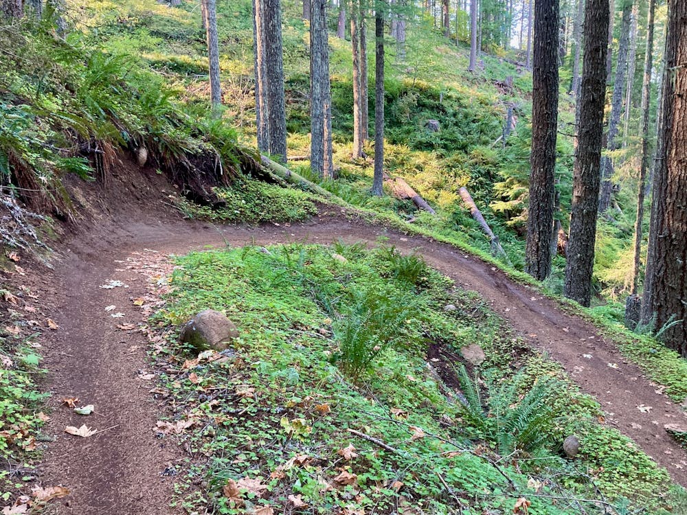
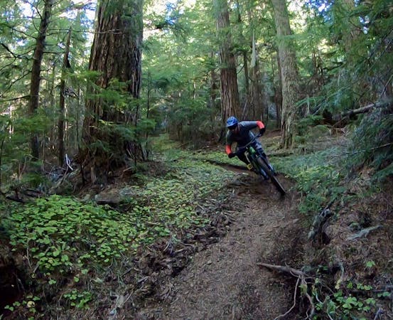
If you've ridden plenty of other trails in Oakridge, the next section of Dead Mountain may seem very unexpected: you'll drop into a couple miles of machine-built flow trail! The dirt still consists of Oakridge's classic rich, black soil, but it's compacted into an expertly-built flow trail. With massive berms, rollers, and jump opportunities, this smooth, flowy, bike-optimized rollercoaster rips down the mountainside to a junction with the gravel road.
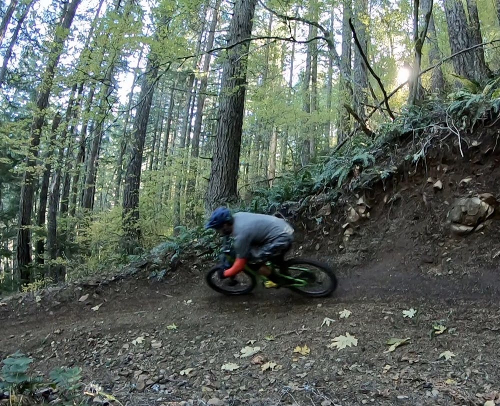
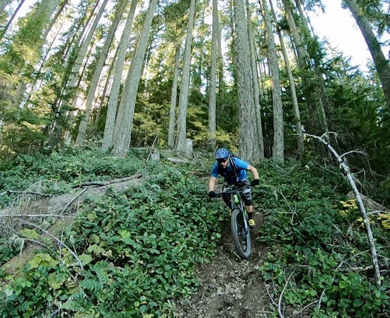
Once you cross the gravel road, the trail turns into an old school bench cut affair, with tighter switchbacks and less flow than the previous section. While the trail tread is still quite smooth and intermediate-friendly, you can still expect to negotiate a few roots and narrower sections of trails. View these as an opportunity for growth instead of a major obstacle.
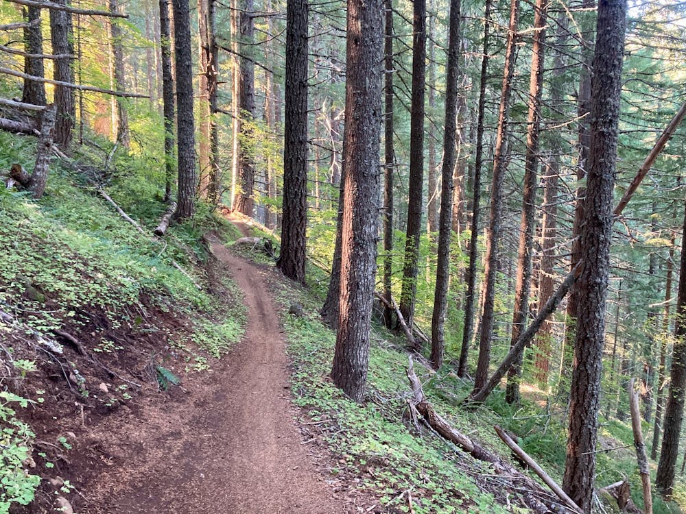
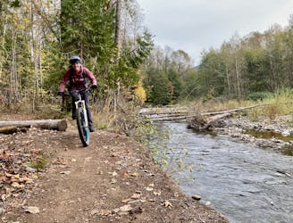
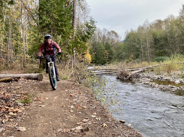
At the bottom of Dead Mountain, you can either pop out onto the pavement and roll back into town, or you can turn left and connect into the Salmon Creek Trail. Salmon Creek is the easiest trail in the region, so the good times keep rolling with mellow pedaling and beautiful views. There are a couple of tricky stream crossings and washouts in the last mile of this trail, but they can easily be walked.
Moderate
Mostly stable trail tread with some variability, with unavoidable obstacles 8in/20cm tall or less. Other obstacles such as rock gullies and steep sections may exist. Ideal for lower intermediate riders.

The trail contains some obstacles such as outcroppings and rock which could cause injury.
Away from help but easily accessed.
4.5 km away
An overgrown but rewarding trail!
Severe Mountain Biking
4.5 km away
The perfect beginner trail!
Easy Mountain Biking
6 km away
One of the best loop rides from downtown Oakridge.
Moderate Mountain Biking
7.6 km away

Score beautiful views of the North Fork of the Willamette River.
Difficult Mountain Biking
9 km away
A short, fast, flowy shuttle that ends directly on the outskirts of Oakridge.
Moderate Mountain Biking
10 routes · Mountain Biking

20 routes · Mountain Biking
6 routes · Mountain Biking
5 routes · Mountain Biking · Hiking · Trail Running