5 routes · Hiking
A mellow stroll through Congaree National Park’s enchanting forest of huge trees, reaching a viewpoint on the banks of the Congaree River.
Hiking Easy

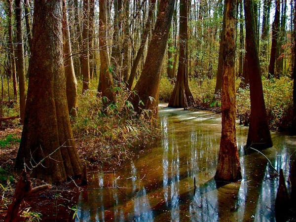
Bates Ferry Trail is at the eastern edge of Congaree National Park, separated from the visitor center and most other trails. It’s the easiest to get to, however, because of its location right along Highway 601. If you are just passing through the area, this trail is the perfect chance to get a taste of Congaree’s famous forest. The park is known for huge trees that are hundreds of years old. On Bates Ferry Trail, you’ll see some impressive trunks and cypress knees, plus wildflowers, flowering vines, birds, and butterflies. The trail ends at the Congaree River––the main water source for the forest and an important feature of South Carolina history.

The trail follows an old causeway that was constructed in the 1800s to reach the river, where a ferry then took passengers across. In those days, it was very tough to travel this swampy terrain, especially when flooded. Because it’s built to be elevated and flat, the Bates Ferry Trail is generally easy walking, but it can still become submerged and impassable after heavy rains.
All of the forest along this particular trail was logged in the past, so it has smaller trees and denser vegetation than some other parts of the park, but not all the big trees were cut. In fact, The largest bald cypress anywhere in the park is located here. It’s named the General Greene Tree, and can be found on a short side trail. Look for signs that lead to it. A number of other side paths branch off from the Bates Ferry Trail as well. Most are unmarked and unmaintained. If you are feeling adventurous, these provide opportunities to explore off the beaten path.
After just one mile on the old roadbed, you’ll come to a low bluff beside the Congaree River. Whatever ramp used to reach the water has eroded away, so there’s no longer an easy way down. You can choose to brave the slippery bank, or just stay up high and enjoy the view. As you turn around and walk back, look and listen carefully for subtle natural beauty that you may have missed at first. There is always more to see in this dense and diverse ecosystem.
Sources: https://www.nps.gov/cong/planyourvisit/trail-information.htm https://friendsofcongaree.org/location/bates-ferry-trail-guide/
Easy
Walking along a well-kept trail that’s mostly flat. No obstacles are present.

The path is on completely flat land and potential injury is limited to falling over.

Away from help but easily accessed.
5 routes · Hiking